Showing posts with label walking track/vehicular trail. Show all posts

Friday, 12 June 2026

Tidinbilla Nature Reserve: Johns Peak, Tidbinbilla Peak and Tidbinbilla Mountain

General Information

Grading:  hard
Distance:   14.5 kilometers
Total climb:   948 meters
Time taken:   6 hours 30 minutes
Moving time: 3 hours 30 minutes
Maps:   Tidbinbilla 8627-2S 1:25 000
Start point distance by road from Canberra GPO:   52.7 kilometers
Start point map grid reference: 55H FA 71480 74646
Destination map grid reference:  none
Dates walked: 12 June 2026
 

Route


Description

I have hiked these peaks several times in the past, but never the three of them together. This was made possible by the opening of the Mindjagari Track network in 2025 which (among other things) linked Tidbinbilla Peak and Tidbinbilla Mountain.

The walk starts at the Mountain Creek car park in the Tidbinbilla Nature Reserve. From the car park we followed the Camelback Fire Trail up to where it intersects with the track to Johns Peak (55H FA 72075 78543). We made Johns Peak in good time and went on to Tidbinbilla Peak and Tidbinbilla Mountain along the Mindjagari Track. The only new section for me was the Track between Tidbinbilla Peak and Tidbinbilla Mountain, which is not as easy as it seems on the map: rocky ground and a few substantial climbs. The views from all three peaks are superb, but Tidbinbilla Mountain is the only one to offer 360 degree views.


After lunch on the Mountain we headed towards the Snowy Corner Track and began our real descent back to the car park, stopping at a viewing chair on the way to take in a final view over the Tidbinbilla valley.

The walk down was quite steep, strenuous, and very slippery after recent rain. It's not a great distance - only 3.6 kilometers - but it took us 1.75 hours to get from the top of the Mountain back to the car park.

Friday, 27 February 2026

Canberra Nature Park: Mt Ainslie Base Circuit

General Information

Grading:  easy
Distance:   9 kilometers
Total climb:   222 meters
Time taken:   1 hour 55 minutes
Moving time: 1 hour 50 minutes
Maps:   Canberra 8727-3N 1:25 000
Start point distance by road from Canberra GPO:   5.6 kilometers
Start point map grid reference: 55H FA 96596 96439
Destination map grid reference:  none
Dates walked: 27 February 2026
 

Route


Description

The walk started at the Kellaway Street car park in Hackett. From there we followed tracks and trails in a counter-clockwise direction around the base of Mt Ainslie. A nice enough walk, but not much noteworthy around the route. Hence no pictures.


Tuesday, 19 August 2025

Canberra Nature Park: The Pinnacle and Kama

General Information

Grading:  easy
Distance:   12.2 kilometers
Total climb:   367 meters
Time taken:   2 hours 35 minutes
Moving time: 2 hours 12 minutes
Maps:   Canberra 8727-3N 1:25 000
Start point distance by road from Canberra GPO:   9.4 kilometers
Start point map grid reference: 55H FA 86284 96432
Destination map grid reference:  55H FA 83460 95004
Dates walked: 19 August 2025
 

Route


Description

This walk starts at the parking area off Springvale Drive near De Salis Street. From there I walked southeast and then southwest around the edge of The Pinnacle Reserve. At map reference 55H FA 85379 96011 I turned off down the track linking The Pinnacle and Kama Nature Reserves. Passing under William Hovell Drive through the underpass, I walked roughly southwest down as far as the Molonglo River.


 I did some further exploring around the river and a bit downstream...


 ...before heading back to the underpass and the beginning of the link trail. From there I turned left and completed a loop back to the starting point via The Pinnacle itself.

Wednesday, 13 November 2024

Canberra Nature Park: Red Hill, Davidson Trig and Mt Mugga Nature Reserve

General Information

Grading: easy
Distance:   12 kilometers
Total climb:   428 meters
Time taken:   2 hours 50 minutes
Maps:   Canberra 8627-3N 1:25 000
Start point distance by road from Canberra GPO:   9.3 kilometers
Start point map grid reference:  55H FA 91054 87473
Destination map grid reference:  Red Hill 55H FA 92384 88494
                                                    Davidson Hill 55H FA 92290 87556
End point:  same as start
 

Route


Description

This walk was identical to the one completed on 25 June 2019 (link).


Saturday, 24 August 2024

North Cotter Reserve and Mount McDonald

General Information

Grading:  medium
Distance:   9.5 kilometers
Total climb:   386 meters
Time taken:   2 hours 30 minutes
Maps:   Cotter Dam 8627-2N 1:25 000
Start point distance by road from Canberra GPO:   26 kilometers
Start point map grid reference:  55H FA 77061 90367
Destination map grid reference:  Mt. McDonald 55H FA 76550 91170
End point:  Same as start

Route


Description

This walk was similar to the one I completed on 19 October 2022, but it did not include the Stony Creek section.

Monday, 10 June 2024

Canberrra Nature Park: Barrer Hill from Coombs

General Information

Grading:  very easy
Distance:   6.5 kilometers
Total climb:   147 meters
Time taken:   1 hour 30 minutes
Maps:   Canberra 8727-3N 1:25 000
Start point distance by road from Canberra GPO:   12.7 kilometers
Start point map grid reference: 55H FA 86356 89591
Destination map grid reference:55H FA 86253 90981
End point:  same as start
 

Route


Description

We started this walk on Harold White Avenue across from Bedbrook Street in the suburb of Coombs. We walked west along Harold White Avenue  and then down to the Molonglo River, which we crossed via a causeway at map reference 55H FA 86093 89684. We then followed the trrail along the other side of the river until we came to the Life Support Sculpture (map reference 55H FA 85442 90855) and took in the river views from there. We then backtracked and looped around to the top of Barrer Hill, and returned via the trail through the pine forest.

Thursday, 30 May 2024

Tidbinbilla Nature Reserve: Johns Peak

General Information

Grading:  hard 
Distance:  14.3 kilometers 
Total climb:  708 meters 
Time taken:  3 hours 20 minutes 
Map:  Tidbinbilla 8627-2S, 1:25 000 
Start point distance by road from Canberra GPO:  52 kilometers 
Start point map grid reference:  55H FA 71471 74628 
Destination map grid reference:  55H FA 71378 77330 
End point:  same as start
 

Previous Similar Walks

6 June 2019, 21 June 2019, 16 July 2020

Route


Description

Another hike to Johns Peak from the Mountain Creek Carpark, following the official track. I had originally planned to continue on to Tidbinbilla Peak, but the weather conditions at the top of the range were awful: cold temperature, strong winds and heavy clouds.

Refer to previous walks for more details.


Tuesday, 28 May 2024

Ginninderry Conservation Corridor: Strathnairn to Shepherds Lookout - New Loop Route

General Information

Grading:  easy
Distance:   7 kilometers
Total climb:   150 meters
Time taken:   1 hour 15 minutes
Maps:   Umburra 8627-1S 1:25 000
Start point distance by road from Canberra GPO:   17 kilometers
Start point map grid reference:  55H FA 81450 99525
Destination map grid reference:   55H FA 79896 98445
End point:  Same as start
 

Previous Similar Walks

Ginninderry Conservation Corridor: 23 November 2021, 22 May 2024

Route


Description

This walk combines the old Strathnairn to Shepherds Lookout track and a new section of track roughly east of the original track. The walk starts at the Strathnairn to Shepherds Lookout trackhead which is accessed from The Link on McClymont Way Strathnairn.

At the beginning of the actual walking track I took the right hand fork which also leads to the Woodland/Nguurung Bila Loop. Where the track comes to an intersection with a small bridge on the right I went straight ahead (not over the bridge!), following the orange arrows. This led me to the Burin Lookout with its views towards the mountains.

Coming soon after to an intersection I turned right and followed an old vehicular trail for a while before a new section of walking track to the left. This led me through a more forested area of the walk with some deep, steep sided gullies.

Eventually the trail came to the old Walaroo Spur lookout, and from there to the original track. I continued on to Shepherds Lookout with its wonderful view up the Murrumbidgee (I particularly liked the sun glistening off the water).

I walked back via the original track.

Monday, 27 May 2024

Canberra Nature Park: Coombs to Scrivener Dam and Return

General Information

Grading:  very easy
Distance:   7.2 kilometers
Total climb:   88 meters
Time taken:   1 hour 30 minutes
Maps:   Canberra 8727-3N 1:25 000
Start point distance by road from Canberra GPO:   12.7 kilometers
Start point map grid reference: 55H FA 86356 89591
Destination map grid reference: 
End point:  same as start
 

Route


Description

We started this walk at the intersection of Harold White Avenue and Pearlman Street in the suburb of Coombs. From there we walked down to the Molonglo River and crossed to the other side, following the river under Tuggeranong Parkway until we reached another river crossing at map reference 55H FA 88106 90660. This was a good place for a photograph of the river with the last vestiges of the morning's fog.


On the other side of the river we continued on to Scrivener Damand crossed it. We then followed the fenceline of The National Zoo and Aquarium, which gave us some views seldom seen on local bushwalks.


We continued back along the river, returning to our starting point.

Thursday, 2 May 2024

Canberra Nature Park: The Pinnacle and Weetangera Cemetery

General Information

Grading:  easy
Distance:   7.3 kilometers
Total climb:   158 meters
Time taken:   1 hour 30 minutes
Maps:   Canberra 8727-3N 1:25 000
Start point distance by road from Canberra GPO:   9.4 kilometers
Start point map grid reference: 55H FA 86284 96432
Destination map grid reference:  Weetangera Cemetery 55H FA 84378 97697
End point:  same as start
 

Route


Description

This walk starts at the parking area off Springvale Drive near De Salis Street.

Entering The Pinnacle Reserve, I followed the Bicentennial National Trail to the right and then turned off towards The Pinnacle - I couldn't go the top because there was maintenance work happening. I then made may way along the back of the suburb of Hawker, took the underpass at William Hovell Drive and turned left to the Weetangera Cemetery. I returned back through Hawker and along the border of The Pinnacle Nature Reserve, with a brief detour off the track to a prominence at map reference 55H FA 85657 95618.

Saturday, 2 March 2024

Hume and Hovell Walking Track: Along Micalong Creek to Micalong Creek Camp Ground

General Information


Distance:   15.3 kilometers
Total climb:   363 meters
Time taken:   4 hours 26 minutes
Map:  Bobbys Plains 8627-3N 1:25 000
Start point distance by road from Canberra GPO:   90 kilometers (via Brindabella)
Start point map grid reference:  55H FA 39856 94716
Destination map grid reference:  55H FA 43189 98472
End point:  same as start

Route


Description

This walk starts at the Bossowa Campsite, about 1 kilometer north of Brindabella Road on Micalong Creek. We started the walk by crossing the footbridge over the creek and following the trail around to the north east. Before long we came to a ford with some stepping stones and went back to the original side of the creek. The crossing was not easy as the rocks were irregular and slippery in places.

From here we followed the Hume & Hovell Track signs. At first we were walking along a vehicular trail which paralleled Micalong Creek. Pine forest was on the right, with native bush and views of the creek on the left.

At map reference 55H FA 41486 96674 the rack narrows to a walking trail which winds through a narrow gully above the creek with some great views.


The trail crosses over the creek, normally by a footbridge which was not at its best when we were there:

Nevertheless, we were able to cross and continue following the trail signs to the Micalong Creek Camp Ground, which is right on a very nice part of the creek.

Unfortunately the camp ground itself was a bit disappointing, with structures graffitied and items of rubbish left around.

We returned to the starting point by much the same route, but took the more direct trail at the end.

Wednesday, 24 January 2024

Canberra Nature Park: The Pinnacle and Mt Painter

General Information

Grading:  easy
Distance:   9.2 kilometers
Total climb:   341 meters
Time taken:   3 hours
Maps:   Canberra 8727-3N 1:25 000
Start point distance by road from Canberra GPO:   9.4 kilometers
Start point map grid reference: 55H FA 86284 96432
Destination map grid reference:  Mt Painter - 55H FA 87754 95142
                                                     The Pinnacle - 55H FA 85674 96486
End point:  same as start
 

Route


Description

This walk starts at the parking area off Springvale Drive near De Salis Street.

Entering The Pinnacle Reserve, I followed the Bicentennial National Trail to the left and down to Coulter Drive. I walked down  Coulter Drive and then turned off onto the trail up to the summit of Mt Painter. Returning back to The Pinnacle Reserve the same way, I did a clockwise loop around the Reserve, stopping at The Pinnacle itself before heading back to the starting point.

Thursday, 6 April 2023

Kowen Forest: Glenburn Heritage Precinct

General Information

Grading:  easy
Distance:   11.9 kilometers
Total climb:   236 meters
Time taken:   2 hours 30 minutes
Maps:   Bungendore 8727-2N 1:25 000
Start point distance by road from Canberra GPO:   24.7 kilometers
Start point map grid reference: 55H GA 11271 87328
Destination map grid reference:  none
End point:  same as start
 

Route


Description

This walk started at a small car parking area before the gate on Charcoal Kiln Road, just off the Kings Highway about 200 meters past the ACT border. There is a map just inside the gate showing a number of walking options in the historic precinct, but I chose the Precinct Loop Trail and decided to do it counter-clockwise, although I have since done it in the other direction as well. The walk is pretty well signposted.

I started walking up Charcoal Kiln Road and after a bit over 3 kilometers came to the Glenburn Homestead area. There is a mown path off to the right which loops around the homestead passing by the shearing quarters and shearing shed, the Colverwell grave site and the homestead itself.


After getting back to Charcoal Kiln Road I continued past the Kowen school and the charcoal kiln sites. After the gate I turned south and followed River Road, which follows Glen Burn Creek to its junction with the Molonglo River. I continued along River Road until map reference 55H GA 08684 88952 where I turned to the right to view the Coppins Homestead ruins.


I then backtracked to map reference 55H GA 09133 89181where I turned off River Road and crossed Glen Burn Creek. At the top of the next rise I had a great view of Colliers Homestead ruins in the distance, and soon came to the ruin itself.


I continued to follow the signs to Mt Atkinson, and from there back to Charcoal Kiln Road and the car park.

Wednesday, 14 December 2022

Barren Gounds Nature Reserve: Cooks Nose and the Natural Stone Bridge

General Information

Grading: easy
Distance: 10 kilometers 
Total climb: 239 meters 
Time taken: 2 hours 50 minutes
Map: Kangaroo Valley 9028-4S 1:25 000 
Start point distance by road from Canberra GPO:  200 kilometers
Start point map grid reference:  56H KG 90433 60727
Destination:  Cooks Nose 56H KG 88801 58583
                      Natural Stone Bridge 56H KG 91044 59371
End Point:  Same as start
 

Route


Description 

 
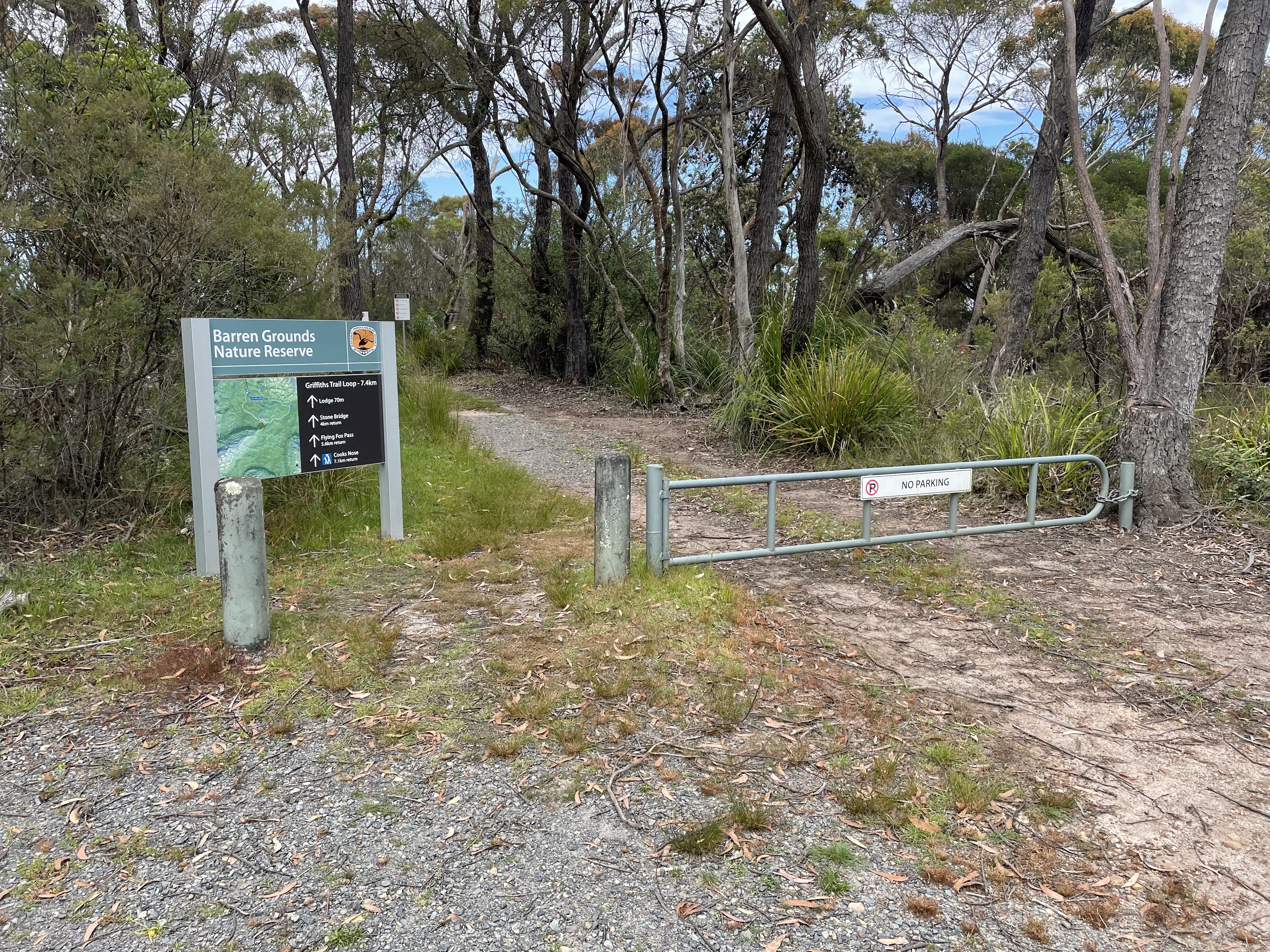
Barren Grounds Nature Reserve is to the south of Jamberoo Mountain Road, about 14 kilometers from the Illawarra Highway (at the Robertson Pie Shop).
 
This walk commenced at the Barren Grounds Picnic Area, about 1 kilometer to the right off Jamberoo Mountain Road. There are two trailheads at the Picnic Ground, but both are well signposted.


Naturally we followed the trail to Cooks Nose at the southern end of the Picnic Area. This took us initially through some flat, fairly open terrain with many varieties of wildflower still in bloom.


The trail starts to go up and down a bit after a while and is quite rocky.


Eventually we came to a walking track off to the right which took us to Cooks Nose, and some very good views into the Brogers Creek and Lamonds Creek gorges, and down towards Kangaroo Valley in the distance.

After taking in the views for a while we headed back the way we had come, but turned off at the Stone Bridge sign to have a look at the natural stone bridge about 1 kilometer away. The stone bridge itself is interesting without being spectacular, but the area around it (Lamonds Creek) is quite nice despite many mosquitos coming to feed on me.


After a break down by the Creek we retraced our steps back to our starting point.

Monday, 18 April 2022

Corin Forest: Smokers Trail to Orroral River

General Information

Grading : hard
Distance:  22 kilometers 
Total climb:  795 meters
Time taken:  5 hours 50 minutes
Map:  Corin Dam 8626-1N, 1:25 000 
Start point distance by road from Canberra GPO:  51.5 kilometers 
Start point map grid reference:  55H FA 73687 67792
Destination map grid reference:  55H FA 72960 61299
End point:  same as start

Route


Description

This walk began at the Square Rock car park just off Corin Road. We initially followed the walking trail towards Square Rock. At map reference 55H FA 72421 66150 there is a link track off to the left that takes you down to the Smokers Trail, and we followed this. When we reached Smokers Trail we turned right and followed it alongside a creek with a number of small waterfalls. As we neared the ridge above Orroral Valley there was plenty of evidence of damage from the 2020 bushfire.


We descended along Smokers Trail down to the Orroral River at the head of Orroral Valley. While the crossing is rather nondescript, the river itself is quite pretty.

Pausing here for some lunch, we then made our way back up Smokers Trail. Instead of walking back up the link trail to the Square Rock track, we continued along Smokers Trail until we came to a marker directing us back to the car park. This turned out to be a rather interesting walking track, quite narrow and treacherous in some places, but through some very pretty bushland.

This took us back to our starting point.