Showing posts with label Cairns. Show all posts

Thursday, 18 July 2019

Cairns Region: Cattana Wetlands Jabiru Lake Circuit

General Information

Grading: very easy
Distance:   1.5 kilometers
Total climb:   negligible
Time taken:   20 minutes
Start point distance by road from Cairns PO:   17 kilometers

Route

Cairns Regional Council

Description

This was a very short walk which we were able to fit in with a day's sightseeing around Cairns. It started from the Cattana Wetlands carpark off Dunne Road, Smithfield. With limited time we chose to do the loop around Jabiru Lake. The surface was flat and paved, making for easy walking and plenty of time to take in the wetlands and its birdlife.

Tuesday, 16 July 2019

Cairns Region: Earl Hill Summit Track

General Information

Grading:  easy
Distance:   3 kilometers
Total climb:   210 meters
Time taken:   1 hour
Start point distance by road from Cairns PO:   19 kilometers
End point:  same as start

Route

http://qtopo.dnrm.qld.gov.au

Description

This walk started from the carpark in Reed Road, Trinity Beach, just before the roundabout intersection with Roberts Drive. From here it is about a 350 metre walk to the start of the Earl Hill summit walking track in Roberts Drive.

The walking track is clear, well-maintained and well-used, although some sections are quite steep.

The track follows the ridge south southeast of the summit, where there are some views of Trinity Beach to the north...

...and back towards the coastline towards Cairns itself to the south.

I walked back to the car the same way.


Wednesday, 10 July 2019

Cairns Region: Mount Whitfield Conservation Park

General Information

Grading:  easy
Distance:   9 kilometers
Total climb:   350 meters (approximate)
Time taken:   2 hours
Start point distance by road from Canberra GPO:   2,517 kilometers (but only 4 kilometers 
                                                                                 from Cairns Post Office)
Start point:  Red Arrow Walking Track off Collins Avenue, Edge Hill
Destination:  Mount Whitfield (364 meters)
End point:  same as start

Route

Cairns Regional Council

Description

Having parked my car along Collins Avenue, not far from Sheridan Street, I started up the beautifully maintained bitumen Red Arrow Walking Track. Coming to the junction where the Red Arrow loops around, I took the right hand fork which led me through thick rainforest and at one point a bamboo thicket.

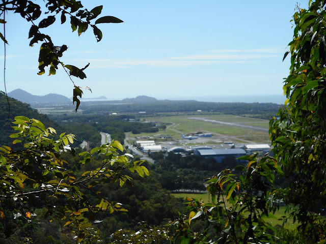
After some heavy climbing I came to a lookout which gave some views northeast towards Cairns Airport and the ocean.
Soon after this point I came to the junction of the Red Arrow and Blue Arrow tracks and followed the Blue Arrow, leaving smooth bitumen for a narrow dirt track crisscrossed with tangled roots providing an excellent tripping hazard.

Coming to a junction where the Blue Arrow loops around, I followed the left hand track and continued climbing through the rainforest until I came to the intersection of the Blue Arrow and Green Arrow tracks. I followed the Green Arrow a short distance up to Mt Whitfield, which I possibly would have missed had it not been for a sign telling me I had arrived.

There are no views from Mt Whitfield, but the star of this walk is more the rainforest than the elevation.

Running a bit short of timeI quickly retraced my steps back along the Green and Blue Arrows to the Red Arrow. I turned right at the Red Arrow to take me down the un-walked section back to the parked car.