Tuesday 29 September 2015

Canberra Centennial Trail: Mulligans Flat to Hall

General Information


Distance: 17 kilometers
Total climb: 462 meters
Time taken: 3 hours 35 minutes
Map:  Hall 8727-4S 1:25 000
Guide:  link
Start point distance by road from Canberra GPO:  17 kilometers
Start point map grid reference:  55H FB 96448 07768
Destination map grid reference:  55H FB 88578 06552
End Point:  same as destination


Route


http://maps.six.nsw.gov.au/

Description


This walk is through two stages of the Canberra Centennial Trail: part of the Watson to Northern Border Campsite stage and all of the Northern Border Campsite to Hall stage. It mainly follows the northern border of the Australian capital Territory (ACT) and New South Wales (NSW). While it is all along a formed trail, some care is needed as the trail is used by fast-moving mountain bikers who can sometimes come around blind corners at breakneck speed. We started the walk at Mulligans Flat Nature Reserve, just off Mulligans Flat Road northeast of the suburb of Forde. The first part of the walk is a climb through the Nature Reserve towards Oak Hill, which is unfortunately on private property on the NSW side of the border. From here the trail follows the ACT/NSW border through the Northern Border campsite, which has some facilities for the hiker, including toilets. About 7.5 kilometers into the walk, the northernmost tip of the ACT is reached and the trail heads southwest towards One Tree Hill, which is reached about 11.5 kilometers into the walk. We ascended One Tree Hill to take in the excellent views of canberra and its environs, which adds about 1 kilometer (and some climbing) on to the total walk. Backtracking from the summit of One Tree Hill, we continued to follow the Centenary Trail to the village of Hall.

This is a very pleasant walk through some nice rural bushland only a short distance from the city. The track is very dry and stony, however, and can be hard on the feet. There is no water along the trail apart from a rainwater tank at the Northern Border campsite, which I suppose could provide drinking water if you have some form of reliable water purification device. I prefer to take plenty of water with me. There are some nice rural and urban views along the trail. If you look carefully along the fence line that marks the ACT/NSW border, some of the original survey markers can still be seen.

Sunday 20 September 2015

Tomaree National Park: Fort Tomaree and Tomaree Head Summit

General Information


Distance: 2.9 kilometers
Total climb: 150 meters
Time taken: 1 hour
Map:  Port Stephens 9332-4S 1:25 000
Guide:  link
Start point distance by road from Canberra GPO:  490 kilometers
Start point:  
Destination:  
End Point:  Same as start


Route


http://maps.six.nsw.gov.au/

Description


Tomaree Head is the southern head of Port Stephens, north of Newcastle. The start for this walk is accessed from Shoal Bay Road just after the suburb of Shoal Bay. It is along a paved trail with, if I remember correctly, some ladders to be climbed in the steeper sections. The trail is well signposted, so no map or guide is really necessary. We decided to walk to the remains of Fort Tomaree first. This fort was part of the defences of Port Stephens and the Australian coastline during World War II.


We backtracked about 350 meters from the Fort remains to commence the final part of the climb to the Tomaree Head summit. Plenty of excellent views, but lots of people too.


Having taken in the views we headed back to the starting point back down the trail. A great short walk with some historical interest as well as fabulous views. 

Thursday 10 September 2015

Namadgi National Park: Orroral Heritage Walking Track

General Information


Distance: 12 kilometers
Total climb: 158 meters
Time taken: 3 hours
Map: Rendezvous Creek 8626-1S 1:25 000
Guide:  none
Start point distance by road from Canberra GPO:  61 kilometers
Start point map grid reference:  55H FA 77105 55439
Destination map grid reference:  55H FA 80017 51574
End Point:  Same as start


Route


http://maps.six.nsw.gov.au/

Description


This is a walk through grassland at the southeastern end of the Orroral Valley. It takes in Aboriginal, pioneer and modern sites in the Valley, which are well signposted with informative information boards. We started the walk at the site of the former Orroral Tracking Station and followed the track through grassland littered with grazing kangaroos.


Before long we reached passed old stockyards before arriving at the Orroral Homestead, built next to the ruins of an older homestead.


We continued walking through the valley, eventually crossing the Orroral River via a footbridge and continuing on beside the river to the Orroral campground.


We returned to the starting point by the same route. This is a very nice walk through open grassland with forested hills on either side. There is plenty to see and learn about the history and prehistory of the area.

Wednesday 2 September 2015

Namadgi National Park: Naas Valley to Horse Gully Hut

General Information


Distance: 19 kilometers
Total climb: 530 meters
Time taken: 4 hours 20 minutes
Map:  Colinton 8726-3N 1:25 000
Guide:  link
Start point distance by road from Canberra GPO:  80 kilometers
Start point map grid reference:  55H FA 81540 29140
Destination map grid reference:  55H FB 86633 33632
End Point:  Same as start


Route


http://maps.six.nsw.gov.au/

Description


This walk starts at the Mount Clear camping ground, just off Boboyan Road in the far south of the Australian Capital Territory. The walking trail follows management trails through the Naas Valley which are part of the Bicentennial National Trail. There are a number of points of interest along the track that are marked with numbered posts - the guide provides information on these, so it's a good idea to take it with you. Leaving the campground we walked firstly through fairly open terrain, passing the remains of the Mount Clear horse yards and with occasional glimpses of Naas Creek.


About 2 kilometers into the trail there is a bow in Naas Creek which means that it has to be crossed twice, or walked around. The water level was quite high when we were there so we decided to walk around the bow rather than ford the creek twice. This was quite heavy going through thick grass, and was a bit swampy in places. We were probably lucky not to encounter any snakes. The trail continues through more wooded terrain with a lot of climbing up and down. The track is very distinct though and easy to follow.


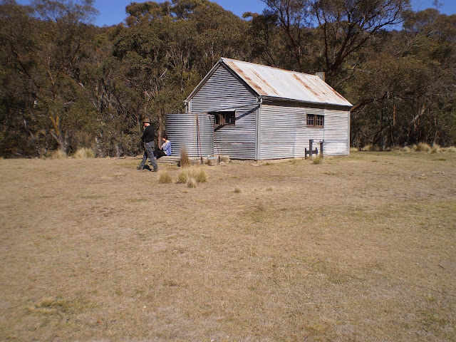
A bit over 7 kilometers into our walk we came across a side-track on the left that leads to Demandering Hut, about 200 meters away. We continued on along the track, finally reaching a grassy clearing and Horse Gully Hut which was built in the 1940's.


We had lunch in the hut, which contains some basic amenities typical of huts in Namadgi National Park.


We returned to the Mount Clear camping ground the way we had come, again diverting around the marshy bow in Naas Creek.


This is quite a long and demanding walk, but well worth it. Although we were walking on a hard and dusty management trail, the scenery was very nice and there were 20 items of interest along the way (marked by numbered posts and explained in the guide).