Showing posts with label easy grade. Show all posts

Friday, 22 May 2026

Canberra Nature Park: Bluett's Block and the Molonglo River

General Information

Grading:  easy
Distance:   9.4 kilometers
Total climb:   312 meters
Time taken:   2 hours
Moving time: 1 hour 50 minutes
Maps:   Canberra 8727-3N 1:25 000
Start point distance by road from Canberra GPO:   5.6 kilometers
Start point map grid reference: 55H FA 872661 91832
Destination map grid reference:  none
Dates walked: 22 May 2026
 

Route


Description

This walk starts at the entrance to Bluett's Block Reserve off Uriarra Road about 1.6 kilometers past the Coaldrake Avenue roundabout. There is a small car park here next to the gate.

Climbing over the gate I came to some power lines which I followed to the top of the rise before heading right into some very nice bush.

I made my way to a rise at 55H FA 82859 92276 and from there to Springybark Hill (55H FA 82774 92513).  Some great views all around from there.

I next followed the western edge of the Reserve (marked by a barbed wire fence) and back to the main road through it. I headed north along the road until I came to the Molonglo River.
 

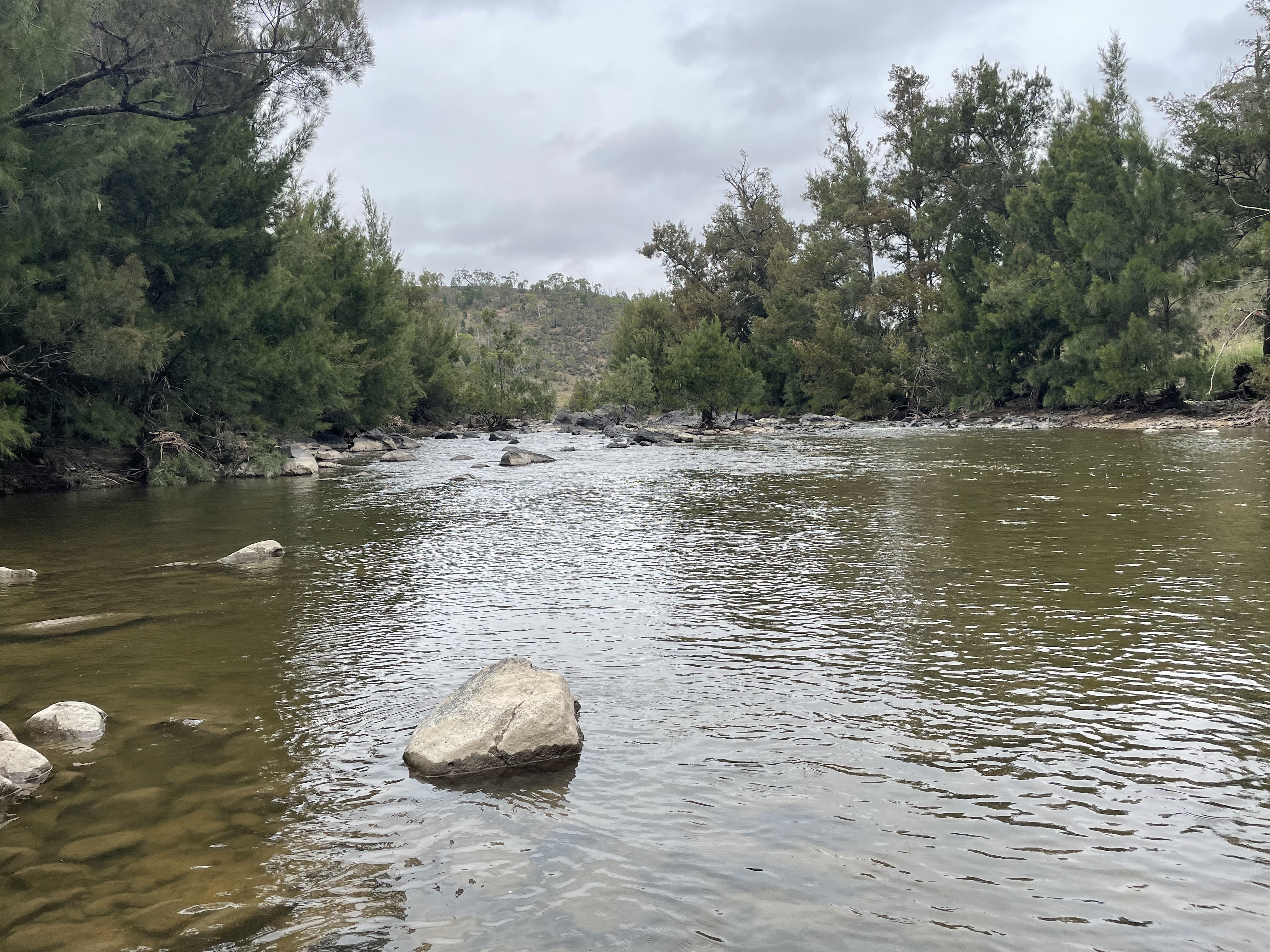
I followed the track beside the river, then heading for the shops at Denman Prospect where I could stop for a coffee. After that I walked up Holborow Avenue until I found a place where I could re-enter Blewett's Block Reserve (around 55H FA 83696 92693), a bit south of where I re-joined the road on the outward journey. I went bush at first, since I couldn't follow the road due to construction fences. Eventually, however, I was able to use the road again at around 55H FA 83499 92325 and continue along it to the starting point. This was not a particularly satisfying sector of the walk due to the very loud construction noises coming from just left of the road.

Friday, 27 February 2026

Canberra Nature Park: Mt Ainslie Base Circuit

General Information

Grading:  easy
Distance:   9 kilometers
Total climb:   222 meters
Time taken:   1 hour 55 minutes
Moving time: 1 hour 50 minutes
Maps:   Canberra 8727-3N 1:25 000
Start point distance by road from Canberra GPO:   5.6 kilometers
Start point map grid reference: 55H FA 96596 96439
Destination map grid reference:  none
Dates walked: 27 February 2026
 

Route


Description

The walk started at the Kellaway Street car park in Hackett. From there we followed tracks and trails in a counter-clockwise direction around the base of Mt Ainslie. A nice enough walk, but not much noteworthy around the route. Hence no pictures.


Friday, 23 January 2026

Castle Hill

General Information

Grading:  easy
Distance:   9.1 kilometers
Total climb:   407 meters
Time taken:   3 hours 11 minutes
Moving time: 2 hours 5 minutes
Maps:   Tuggeranong 8727-3S 1:25 000
Start point distance by road from Canberra GPO:   33.5 kilometers
Start point map grid reference: 55H FA 83721 73853
Destination map grid reference:  55H FA 84416 71684
Dates walked: 23 January 2026
 
Note: This walk was through private land and was done with the permission of the landowner. 
 

Route


Description

The walk started from Tidbinbilla Road about 5.7 kilometers from Point Hut Crossing and near some overhead power lines. We followed these power lines for the first part of the walk before deviating up the spur that leads to Castle Hill. Almost immediately there were views to the north, and Castle Hill itself became prominent to the south east. 


We continued along the ridge and up a rather barren-looking Castle Hill itself, where there were great views all around.


After some discussion at the top of Castle Hill we decided to continue down the south east spur and return via Booroomba Road. There is an (apparently) disused vehicular track down this spur; very steep and treacherous, but much better than walking through the thick scrub on that side of the Hill. We found Booroomba Road and followed it until we passed a cattle grid, at which point we left the road and found Paddy's River. 


From there we returned to the power lines and back to our starting point. 

Saturday, 3 January 2026

Blue Mountains: Leura Cascades to Echo Point

General Information

Grading:  easy
Distance:   6.4 kilometers
Total climb:   225 meters
Time taken:   2 hours 5 minutes
Moving time: 1 hour 40 minutes
Maps:   Katoomba 8930-1S 1:25 000
Start point distance by road from Canberra GPO:   328 kilometers
Start point map grid reference: 56H KH 52005 65718
Destination map grid reference:  56H KH 51020 64250
Dates walked: 3 January 2026
 

Route


Description

This was more of a tourist stroll than a bushwalk, but worth reporting nonetheless.

The walk started at the Leura Cascades car park off Cliff Drive, from which point we followed the well-maintained walking track towards Echo Point.


  There were occasional views back towards Leura and Sublime Point.

Eventually we made it to The Three Sisters and Echo Point, where the crowds were crazy but did not prevent us from taking a few pictures of the sights.


 We returned the same way to our starting point.

Friday, 21 November 2025

Canberra Nature Park: Tuggeranong Hill

General Information

Grading:  easy
Distance:   9.4 kilometers
Total climb:   346 meters
Time taken:   2 hours 10 minutes
Moving time: 2 hours
Maps:   Tuggeranong 8727-3S 1:25 000
Start point distance by road from Canberra GPO:   26.5 kilometers
Start point map grid reference: 55H FA 92169 74114
Destination map grid reference:  none
Dates walked: 21 November 2025
 

Route


Description

The walk started at Callister Crescent in Theodore. Inside the Reserve we followed a management trail to the northeast until we almost reached the Monaro Highway before turning around and heading back via the ridge we had just passed. There were some good views from the top of the hill.


Returning back to our starting point we did an anticlockwise loop around the base of Tuggeranong Hill.


Wednesday, 17 September 2025

Canberra Nature Park: Palmerville and Gold Creek

General Information

Grading:  easy
Distance:   14.6 kilometers
Total climb:   152 meters
Time taken:   2 hours 20 minutes
Moving time: 2 hours 15 minutes
Maps:   Hall 8727-4S 1:25 000
Start point distance by road from Canberra GPO:   10.3 kilometers
Start point map grid reference: 55H FA 87709 99827
Destination map grid reference:    Palmerville 55H FB 89814 01432
                                                       Gold Creek 55H FB 89626 03881
Dates walked: 17 September 2025
 

Route


Description

This walk started at the McDermott Place carpark on Lake Ginninderra, for no other reason than to make the walk as long as possible. From there I headed to Ginninderra Drive, which I followed to the bridge before turning north and following Ginninderra Creek to the Palmerville Heritage Park.


I took a stroll through the Heritage Park and then continued along Ginninderra Creek until the Barton Highway. From there I went through the Gold Creek village area and stopped at one of the excellent cafes there for a rest before heading back to the starting point by much the same route.

Tuesday, 19 August 2025

Canberra Nature Park: The Pinnacle and Kama

General Information

Grading:  easy
Distance:   12.2 kilometers
Total climb:   367 meters
Time taken:   2 hours 35 minutes
Moving time: 2 hours 12 minutes
Maps:   Canberra 8727-3N 1:25 000
Start point distance by road from Canberra GPO:   9.4 kilometers
Start point map grid reference: 55H FA 86284 96432
Destination map grid reference:  55H FA 83460 95004
Dates walked: 19 August 2025
 

Route


Description

This walk starts at the parking area off Springvale Drive near De Salis Street. From there I walked southeast and then southwest around the edge of The Pinnacle Reserve. At map reference 55H FA 85379 96011 I turned off down the track linking The Pinnacle and Kama Nature Reserves. Passing under William Hovell Drive through the underpass, I walked roughly southwest down as far as the Molonglo River.


 I did some further exploring around the river and a bit downstream...


 ...before heading back to the underpass and the beginning of the link trail. From there I turned left and completed a loop back to the starting point via The Pinnacle itself.

Saturday, 26 July 2025

Narrandera: Flora and Fauna Reserve

General Information

Grading:  easy
Distance:   6.7 kilometers
Total climb:   37 meters
Time taken:   1 hour 250 minutes
Maps:   Berembed Weir 8228-S 1:50 000
Start point distance by road from Canberra GPO:   341 kilometers
 

Route


Description

This walk commenced on Melbourne Street East where there is a footbridge over the canal. Crossing the footbridge I wandered down Oakbank Street to the Flora and Fauna Reserve entry. From there I headed south to a beach on the Murrumbidgee River.


 Following the river I walked through some nice forest and river views to a second beach.


From the second beach I headed north, watching the tree canopy for koalas (supposedly quite numerous there) but without luck. So I continued to the edge of Lake Talbot before heading back to the reserve entry.


Thursday, 29 May 2025

Uriarra: Tongs Hole and Downstream Molonglo River

General Information

Grading:  easy
Distance:   2.6 kilometers
Total climb:   180 meters
Time taken:   1 hour 10 minutes
Maps:   Umburra 8627-1S 1:25 000
Start point distance by road from Canberra GPO:   20 kilometers
Start point map grid reference:  55H FA 79466 97509
Destination map grid reference:  55H FA 79510 97031
End point:  Same as start
 

Route


Description

This walk starts on Stockdill Drive, just before the gates into the Lower Molonglo Water Quality Control Centre. We first followed the walking track down to Tong's Hole, which is quite a nice spot on the Molonglo.


From there we continued off-trail down the Molonglo, hoping to get as far as the Molonglo plank bridge. Unfortunately, however, we came across a rather robust outfall from the Water Quality Control Centre which we could not cross. Crossing to the other side of the Molonglo River to pass this by was also not an option, so we had no choice other than to turn back. We took a higher route back to our starting point, which gave us some compensating views down the river and westwards.


Overall, the walk was a bit of a disappointment. 


Thursday, 30 January 2025

Stony Creek Nature Reserve: Stony Creek to Murrumbidgee River

General Information

Grading:  easy
Distance:   8.5 kilometers
Total climb:   297 meters
Time taken:   2 hours 35 minutes
Maps:   Canberra 8727-3N 1:25 000; Cotter Dam 8627-2N 1:25 000
Start point distance by road from Canberra GPO:   16.5 kilometers
Start point map grid reference:  55H FA 82107 92200
Destination map grid reference:     55H FA 79070 91611
End point:  Same as start
 

Route


Description

This walk started in Stromlo Forest just off Uriarra Road about 2.5km from the Coaldrake Avenue roundabout (see map reference above). We followed Coopers Fire Trail for about 2km until we reached some power lines. There is a fence here that divides Stromlo Forest from Stony Creek Nature Reserve, and a convenient wooden stile to cross over.

Entering Stony Creek Nature Reserve we made our way through open grassland towards Stony Creek itself.


Following the southern side of the Creek its sides became steeper until it ran through a rather nice rocky gorge.


We had vague ideas about following the Creek through the gorge, but the steep descent and obvious blackberry infestations turned us off the idea. We later found that there was also a waterfall (at that time dry) which we would have had to climb down.


Eventually we came to a fence which we were able to cross under where it passes over the Creek, and it was a short distance from there to a very peaceful stretch of the Murrumbidgee.


Making our way back to the fence, we climbed out of the Creek bed and headed towards the southern border of this part of the Reserve. We then followed the border fence, with some more views towards the Murrumbidgee, Stony Creek and beyond.


Making our way back to the stile we went back up Coopers Fire Trail, but took a detour up TSR Fire Trail (just for a bit of variety) and back to our starting point.

Thursday, 2 January 2025

Ginninderry Conservation Corridor: New Track to the Murrumbidgee

General Information

Grading:  easy
Distance:   8.9 kilometers
Total climb:   264 meters
Time taken:   2 hours 15 minutes
Maps:   Umburra 8627-1S 1:25 000
Ginninderry walking tracks information: https://www.ginninderry.org/corridor-walking-tracks
Start point distance by road from Canberra GPO:   17 kilometers
Start point map grid reference:  55H FA 81450 99525
Destination map grid reference:   None
End point:  Same as start
 

Previous Similar Walks

23 November 2021, 22 May 2024, 28 May 2024, 16 June 2024

Route


Description

A new section of the Ginninderry Conservation Corridor walking track has recently been opened northwest of the swing bridges and down to the Murrumbidgee River. We decided to check this out.

Starting at The Link on McClymont Way we followed the pink trail up to Woodland Lookout and then down to the other side of the swing bridges where the new section of track begins (shown in dark blue on the Ginninderry walking trail map). We followed this up to Jahli's Lookout and then down to the river, where a nice swimming area has been designated.


We followed the blue track back to the pink track and then back to The Link by the usual route.


Tuesday, 28 May 2024

Ginninderry Conservation Corridor: Strathnairn to Shepherds Lookout - New Loop Route

General Information

Grading:  easy
Distance:   7 kilometers
Total climb:   150 meters
Time taken:   1 hour 15 minutes
Maps:   Umburra 8627-1S 1:25 000
Start point distance by road from Canberra GPO:   17 kilometers
Start point map grid reference:  55H FA 81450 99525
Destination map grid reference:   55H FA 79896 98445
End point:  Same as start
 

Previous Similar Walks

Ginninderry Conservation Corridor: 23 November 2021, 22 May 2024

Route


Description

This walk combines the old Strathnairn to Shepherds Lookout track and a new section of track roughly east of the original track. The walk starts at the Strathnairn to Shepherds Lookout trackhead which is accessed from The Link on McClymont Way Strathnairn.

At the beginning of the actual walking track I took the right hand fork which also leads to the Woodland/Nguurung Bila Loop. Where the track comes to an intersection with a small bridge on the right I went straight ahead (not over the bridge!), following the orange arrows. This led me to the Burin Lookout with its views towards the mountains.

Coming soon after to an intersection I turned right and followed an old vehicular trail for a while before a new section of walking track to the left. This led me through a more forested area of the walk with some deep, steep sided gullies.

Eventually the trail came to the old Walaroo Spur lookout, and from there to the original track. I continued on to Shepherds Lookout with its wonderful view up the Murrumbidgee (I particularly liked the sun glistening off the water).

I walked back via the original track.