General Information
Grading: mediumDistance: 8.9 kilometers
Total climb: 343 meters
Time taken: 3 hours 45 minutes
Map: Chatsbury 8828-1N 1:25 000
Start point distance by road from Canberra GPO: 123 kilometers
Start point map grid reference: 55H GB 69327 69324
Destination map grid reference: no specific destination
End point: same as start
Grading: medium
Route


Description
The Tarlo River National Park is difficult to access, with only one public road (Towrang Road) passing through a small part of the Park's south eastern extremity. A good starting point for walking in Tarlo River National Park north or south of Towrang Road is where it meets the Quarry Trail, only a few hundred metres inside the Park. This is where we started.
We decided to explore the area south of Towrang Road first, and made our way along Towrang Road for about 350 metres before heading into the bush. It wasn't long before we came across the first of the Permian conglomerate outcrops which are a feature of this area.
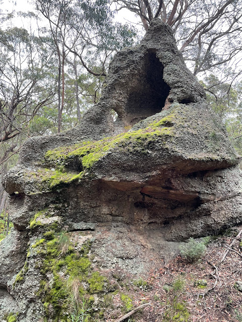
 These can be found around the numerous steep, but easily accessible gullies that pervade the area. The bottoms of most gullies are covered in thick ferns, and care needs to be taken when walking through it as it obscures fallen trees and other hazards.

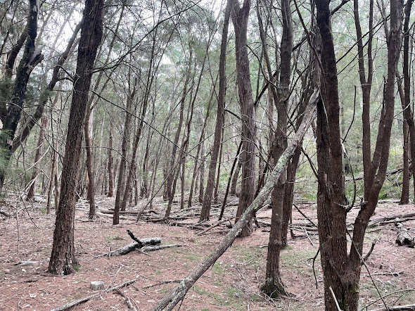
We headed generally south, going down into one gully and back again up the ridge before the next gully. The ridges were dry forest and the walking around them was very easy.
 Reaching as far south as we wanted to go, and wanting to leave some time to explore north of the road, we turned around and navigated to the Yururga Trail which we followed back to Towrang Road and our starting point. Stopping for lunch here, we then went into the northern section and had a bit of a look around. It was also a series of ridges and gullies, but less interesting than the southern section.
 After exploring for only a relatively short distance we decided to return to our starting point, although by a different route.
It might be useful in the future to spend a day walking north of Towrang Road to see how far we could get into the main area of the Park.
The Tarlo River National Park is difficult to access, with only one public road (Towrang Road) passing through a small part of the Park's south eastern extremity. A good starting point for walking in Tarlo River National Park north or south of Towrang Road is where it meets the Quarry Trail, only a few hundred metres inside the Park. This is where we started.
We decided to explore the area south of Towrang Road first, and made our way along Towrang Road for about 350 metres before heading into the bush. It wasn't long before we came across the first of the Permian conglomerate outcrops which are a feature of this area.


We headed generally south, going down into one gully and back again up the ridge before the next gully. The ridges were dry forest and the walking around them was very easy.


It might be useful in the future to spend a day walking north of Towrang Road to see how far we could get into the main area of the Park.


