Showing posts with label walking track/bush bashing/vehicular trail. Show all posts

Wednesday, 5 March 2025

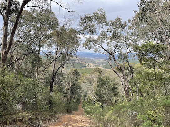
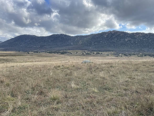
Namadgi National Park: Booroomba Rocks, Blue Gum Creek and Bushfold Flats

General Information

 
Grading:  hard 
Distance: 14.9 kilometers 
Total climb: 606 meters 
Time taken: 7 hours 45 minutes
Maps: Corin Dam 8626-1N 1:25 000, Williamsdale 8726-4N 1:25 000
Start point distance by road from Canberra GPO:  56 kilometers 
Start/end point map grid reference:  55H FA 80550 62138 
End Point:  Same as start
 

Route


Description

This walk was led by the Brindabella Bushwalking Club. I joined the walk as a guest.

The walk commenced at the Booroomba Rocks carpark and we quickly walked up the track from there to Booroomba Rocks itself. From there we could look down Blue Gum Creek and the route we were to follow.


After taking in the views we went off-track along the ridge to the northeast and descended to the unnamed creek at around map reference 55H FA 81508 63972. This was quite a steep and rocky section of the walk.


Finishing our descent we proceeded in a roughly northerly direction down to Blue Gum Creek, where we could look back at Booroomba Rocks from below.


 We stopped along the creek for lunch.


We followed Blue Gum Creek to the northeast, crossing the creek many times and rock-hopping to find the best path. After walking about 2.5 kilometers along the creek we came to a management trail that follows Georges Creek to the south. We followed this to Bushfold Flats, where we took the Australian Alps Walking Track back to our starting point.

Wednesday, 11 September 2024

Uriarra: Two Sticks Hill, Sherwood Daffodils and Dowling Trig

General Information

Grading:  medium
Distance:   10.9 kilometers
Total climb:   544 meters
Time taken:   4 hours
Maps:   Cotter Dam 8627-2N 1:25 000
Start point distance by road from Canberra GPO:   32 kilometers
Start point map grid reference:  55H FA 74137 95543
Destination map grid reference:     Two Sticks Hill    55H FA 71374 95813  
                                                        Sherwood Daffodils   55H FA 72104 95061
                                                        Dowling Trig   55H FA 73523 95090
End point:  Same as start
 

Route


Description

As usual, this walk started at the small parking area off Mountain Creek Road. We followed the track up to the top of the ridge, and just past the fence we headed off to the minor track on the right, travelling north at first and then turning west. Where the track turned south again we continued west, following a  trail through some nice native forest.

Eventually we came to the road on the east side of Two Sticks Hill, and turning right we followed the road up to the ridge. This was very steep and required a few short rest stops. The pictures don't do justice to the steepness of this trail.

 
At the top of the ridge we followed a clear walking trail, past the NSW/ACT border marker to the summit of Two Sticks Hill. From the summit the walking trail continues to the south, but eventually turns 180 degrees back to the north east. This caused us some confusion, and we debated continuing south through the steep and thick bush before deciding to follow the trail and see where it took us. As luck would have it, the trail actually goes back to the same road we used to climb up the hill at map reference 55H FA 71665 95625. We followed the track south to the Sherwood daffodils.

After a break among the daffodils we cut across the creek and followed an animal track to link up with the initially steep trail to Dowling Trig. Some nice views from this trail.


From the summit we went bush down the northern side of the hill. This was reasonably steep, but easy walking. Getting back to Sherwood Road by this route, we walked back to the starting point.

Thursday, 4 April 2024

Namadgi National Park: Rendezvous Creek, Middle Creek and Yankee Hat

General Information

Grading : hard
Distance:  14.7 kilometers 
Total climb:  359 meters
Time taken:  5 hours 23 minutes
Map:  Rendezvous Creek 8626-1S, 1:25 000 
Start point distance by road from Canberra GPO:  63 kilometers 
Start point map grid reference:  55H FA 80599 44237
Destination map grid reference:  no particular destination
End point:  same as start

Route


Description

This walk began at the Rendezvous Creek car park off Boboyan Road. We initially thought we might head towards Middle Creek and see how far up the creek we could penetrate, but really we wanted the walk to be flexible.

We started out by following the walking trail over the bridge to the other side of Rendezvous Creek and up to the rest area. From here we took a pretty much straight line towards the mountain gap where we wanted to join Middle Creek. Some good views along the way of the Rendezvous Creek valley to the north and Yankee Hat to the south west.


After walking through grassland for a while we entered some forest, which was moderately difficult to get through, eventually making our way to the northern side of Middle Creek.

The banks of the creek were quite high, nearly vertical, and too wide to jump. We therefore continued upstream until we found a convenient fallen tree trunk across the creek. Having crossed over we continued walking upstream. It became increasingly difficult to get through the thick undergrowth, so we didn't get too far before deciding to stop for morning tea. At this point we took the courageous decision to leave Middle Creek and see how far we could ascend Yankee Hat North up its northern spur. This proved to be very difficult, with a very steep slope, rock outcrops and thick undergrowth to navigate. Just shy of the 1200 meter contour we found a rock outcrop where we could take in both lunch and the view, which included Mt Kelly, Mt Burbidge and Mt Namadgi.

Although the peak of Yankee Hat North appeared tantalisingly close, we decided against going any further up - it was too steep, too rocky, too overgrown, and we were too tired - and started to go down again by much the same route.

We stayed on the southern side of Middle Creek, intending to cross at the concrete ford on Middle Creek Track at map reference 55H FA 77939 42941. While we could cross the ford easily enough, we were unable to get across the swampy ground on the other side. We therefore had to continue along Middle Creek until we found a spot we could jump across. On the northern side of Middle Creek we made our way to the Rendezvous Creek Trail, which we followed for a while before going back to the start point via the walking track we had followed before.

Tuesday, 13 December 2022

Gibbergunyah Reserve

General Information

Grading: easy
Distance: 6.9 kilometers 
Total climb: 307 meters 
Time taken: 2 hours 30 minutes
Map: Mittagong 8929-2S 1:25 000 
Start point distance by road from Canberra GPO:  175 kilometers
Start point map grid reference:  56H KG 62016 85533
Destination:  none
End Point:  Same as start
 

Route


Description 

Gibbergunyah is a small reserve that sits between Mittagong and Bowral. It can be accessed from either town, but we started our walk from the Mittagong side. The access point is a locked gate on Howards Way, about 4 kilometers west of the centre of Mittagong. There is a sign here with a map of the walking tracks in the Reserve, and it's a good idea to take a picture of it before setting out. It should be noted that there is traffic noise from the nearby Hume Motorway on the Mittagong side of the Reserve, so this really isn't a walk for people who like the quiet sounds of the bush.


We started up the walking track to the right of the locked gate (shown in yellow on the guide map) and gradually climbed through forest until it met the Gang Gang Track. There were still plenty of wildflowers about, even though it was (notionally) Summer.


We followed the Gang Gang track to the right until we came to a walking trail on the right leading up to Ninety Acre Hill lookout, which has limited views to the northwest.


Returning to  Gang Gang Track, we followed it to the end and turned left onto Goanna Track, which we followed around until it turned sharply left. Here we left  Goanna Track and followed a walking trail down into a rainforest gully.


Unfortunately we found the trail a bit difficult to follow and soon lost it altogether. We were able to bush bash our way out of the gully and back to the Gang Gang Track, which we followed back to our starting point.

Wednesday, 19 October 2022

Cotter Area: Stony Creek Nature Reserve, Uriarra Forest and Mt McDonald

General Information


Grading:  medium
Distance:   13.8 kilometers
Total climb:   473 meters
Time taken:   3 hours 30 minutes
Maps:   Cotter Dam 8627-2N 1:25 000
Start point distance by road from Canberra GPO:   26 kilometers
Start point map grid reference:  55H FA 77061 90367
Destination map grid reference:   Cotter Campground 55H FA 77183 89391
                                                      Mt. McDonald 55H FA 76550 91170
End point:  Same as start

Route


Description


This walk began at the small car park just off Brindabella Road about 2 kilometers north of Cotter Road. From the car park I headed through the bush and across Brindabella Road to find the gate into Stony Creek Nature Reserve (map reference: 55H FA 77214 89929). Through the gate I followed a fairly indistinct track down to Grasstree Lookout, which has a bench from which to enjoy the view.


After the lookout the trail starts to zigzag down the side of the hill to the Murrumbidgee River. At first it passes through fairly open forest (with at one point a fantastic view of the Cotter Pumping Station and bridge over the Murrumbidgee) and then through fairly thick scrub at the bottom.


I followed the trail right to the bridge over the Murrumbidgee and then turned around and headed back. At map reference 55H FA 77192 89740, which is right at the first acute bend of the main trail, I followed a trail off to the side which I thought could be a trail along the bank of the river, but the trail was soon lost in a grassy opening and I returned to the main trail. I then climbed all the way back up to the car park the way I had come. This trail is quite steep in places, but is in excellent condition.

Getting back to my starting point at the car park I headed off again, this time through the locked gate at the car park down Lookout Road towards Cotter Dam. I then followed Priors Road as close as I could get to the Dam.

Continuing along Priors Road there were some nice views and reflections off the catchment.

I turned off Priors Road on to to Crusher Road and followed for some distance, taking a slight detour at one point to climb to a high point at map reference 55H FA 75733 91406, with views to the south.

Returning to Crusher Road I followed it through to the Uriarra Village Fire Trail which I then followed down to some power lines which cut through the pine forest. This is pictured below from the eastern side:

The track following the power lines was extremely wet, muddy and slippery, but it eventually comes out on Crusher Road again. From there I headed up the trail to the summit of Mt McDonald, which has a decent view towards Canberra.


From the summit I headed down Mt McDonald Road. I took a brief detour to the Cotter Dam Lookout, and then took the Lookout walking track back to the car park. The Lookout walking track was quite badly eroded along much of its length and I had to take care not to fall over stepping on loose rocks.

I'll finish with a couple of warnings about the Cotter Dam/Mt McDonald part of this walk. First, there is little shade to be found, so it may not be a pleasant walk in high summer. Second, blackberry bushes are all over the place, so cutting through the bush can be problematic.

Thursday, 25 August 2022

Gibraltar Pines: Punch Bowl Creek

General Information

Grading : medium
Distance:  9.8 kilometers 
Total climb:  417 meters
Time taken:  3 hours 30 minutes
Map:  Corin Dam 8626-1N, 1:25 000 
Start point distance by road from Canberra GPO:  49 kilometers 
Start point map grid reference:  55H FA 74894 68592
Destination map grid reference:  n/a
End point:  same as start

Route


Description

This walk began at the Smokers Trail car park off Corin Road. We walked up to the top of the hill, then turned slightly right and cut through the bush to another management trail which we followed round to the start of the walking track along Punch Bowl Creek (map reference 55H FA 75649 68431).

We followed the walking track past the two waterfalls on Punch Bowl Creek...


...and then continued down to an old gate before turning left and crossing Punch Bowl Creek at map reference 55H FA 76680 68759. From here we hit exploration mode, following an old and rough track paralleling the north side of the creek. We followed this for a few kilometers just to see where it went. We were hopeful that it might climb up the ridge on our left, but it soon became apparent that it most likely just went to the Booroomba Homestead (as it turned out we were right about this) and decided to turn back.

We followed mostly the same route back to our starting point, although we re-crossed Punch Bowl Creek a bit further downstream than on the outward journey.

Thursday, 14 July 2022

Rob Roy Nature Reserve: Some Waterfalls, the Black and White Mine and Monks Hill

General Information

Grading : medium
Distance:  9.4 kilometers 
Total climb:  521 meters
Time taken:  3 hours 50 minutes
Map:  Tuggeranong 8727-3S, 1:25 000 
Start point distance by road from Canberra GPO:  29 kilometers 
Start point map grid reference:  55H FA 91194 72673
Destination map grid reference:  Waterfalls 55H FA 91349 70137 (approximate)
                                                     Mine 55H FA 91016 71165
                                                     Monks 55H FA 91216 71267
End point:  same as start

Route


Description

This walk began at the car park just off Orange Tree Crescent in Banks. Through the gate we started walking up a steep sealed track which turns into a more level gravel track at the top of this first ascent. About 2 kilometers into the walk the track divides, with the track on the right heading towards Monks Hill and the left track heading towards Mount Rob Roy. We went up towards Monks Hill for as short distance, and then went bush following a fence line south until we came to a creek in a deep gully with some small waterfalls.


We then headed back along the same fence line for a while before heading west towards the Black and White Mine.

After inspecting the mine we headed up to Monks Hill to take in some of the views before retracing our route back to the starting point.


Tuesday, 15 June 2021

Tidbinbilla Nature Reserve: Devils Gap and Gibraltar Falls

General Information

Grading: hard
Distance: 11.9  kilometers 
Total climb: 658 meters 
Time taken: 4 hours 15 minutes 
Map: Tidbinbilla 8627-2S 1:25 000 
Start point distance by road from Canberra GPO:  46 kilometers
Start point map grid reference:  55H FA 74405 73675
Destination:  55H FA 75503 71261
End Point:  Same as start
 

Route


Description

This walk started at the Devils Gap carpark on the Tidbinbilla Reserve ring road. I first followed the Devils Gap fire trail to Devils Gap and then turned right on to a well-marked walking trail.


 This walking trail at first goes through some very nice wooded grassland.

After a short time the track starts to descend down the other side of Devils Gap via a large number of steps before getting back to a fire trail not far from Corin Road. Reaching Corin Road I turned left along an old fire trail (these days little more than a walking track) the parallels Corin Road and comes back to it just across from the Woods Reserve access road. I went down to Woods Reserve and at the end of the campground there is a gap in the fence which is the start of the formal trail up to Gibraltar Falls.

I followed the formal trail up to the eastern side of the top of the falls, although the last section was closed for some reason or other (as was the viewing platform at the other side of the falls). Nevertheless I was able to get to a rock shelf just off the trail with views back towards The Pyramid and of the top of the falls themselves.

Returning back down the trail, when I got back to Gibraltar Creek near the campground I decided to head up the creek to see if I could get a view of the bottom of the falls, encouraged by what looked like a decent walking trail. It soon became apparent, however, that the trail was no such thing and I had to scramble over and around large rocks with the steep sides of the gorge limiting my choices.

Although it was physically exhausting I continued my scramble, even after an ill-advised jump from one rock to another very nearly compromised my left ankle, and I finally made it to the base of the falls.

Rather than scramble back along the creek the way I had come I decided to climb back up to the walking trail I had gone up and down earlier. This also proved to be quite difficult - very steep and covered with rocks and post-bushfire regrowth. I followed the walking track back to Woods Reserve and gave myself a well-earned lunch break.

Getting back to Corin Road I headed towards a management trail across the road and to the left. This trail doesn't seem to be used much these days and was quite rough and rocky. And also steep.

Eventually the trail meets up with the Devils Gap fire trail and I followed this back to the car.