Showing posts with label Hume and Hovell. Show all posts

Thursday, 1 August 2024

Hume and Hovell Walking Track: Mt Wee Jasper

General Information

Grading:  hard 
Distance:  15.6 kilometers 
Total climb:  1008 meters 
Time taken:  5 hours
Map:  Couragago 8627-4S, 1:25 000 
Start point distance by road from Canberra GPO:  88 kilometers 
Start point map grid reference:  55H FB 52524 10232
Destination map grid reference:  55H FB 48996 07860
End point:  same as start
 

Previous Similar Walks

26 February 2015

Route


Description

We started this walk from the Fitzpatrick Trackhead, off Wee Jasper Road about 4 kilometers south of Wee Jasper. The walk can be shortened by about 2.6 kilometers by starting at a point about 2.2 kilometers further along Wee Jasper Road from Fitzpatrick Trackhead (map reference 55H FB 51293 11000).

The track up to Mt Wee Jasper is pretty much a relentless uphill climb, but the track is in great condition and is well-marked all the way. The first section parallels Wee Jasper Road for about 1.3 kilometers before turning south through farm paddocks to the Wee Jasper State Forest.

Once in the State Forest the track meanders through numerous gullies and up spurs to the summit of the mountain. We found a bit of residual snow above 1000 meters before we reached the summit, which is 1122 meters.


Not much of a view from the summit, but back down the track a bit there are some views of the western side of the Brindabellas.


We went back down the track the way we'd come until we found a sunny spot for lunch with views to the north.


We then returned to the starting point.

Saturday, 2 March 2024

Hume and Hovell Walking Track: Along Micalong Creek to Micalong Creek Camp Ground

General Information


Distance:   15.3 kilometers
Total climb:   363 meters
Time taken:   4 hours 26 minutes
Map:  Bobbys Plains 8627-3N 1:25 000
Start point distance by road from Canberra GPO:   90 kilometers (via Brindabella)
Start point map grid reference:  55H FA 39856 94716
Destination map grid reference:  55H FA 43189 98472
End point:  same as start

Route


Description

This walk starts at the Bossowa Campsite, about 1 kilometer north of Brindabella Road on Micalong Creek. We started the walk by crossing the footbridge over the creek and following the trail around to the north east. Before long we came to a ford with some stepping stones and went back to the original side of the creek. The crossing was not easy as the rocks were irregular and slippery in places.

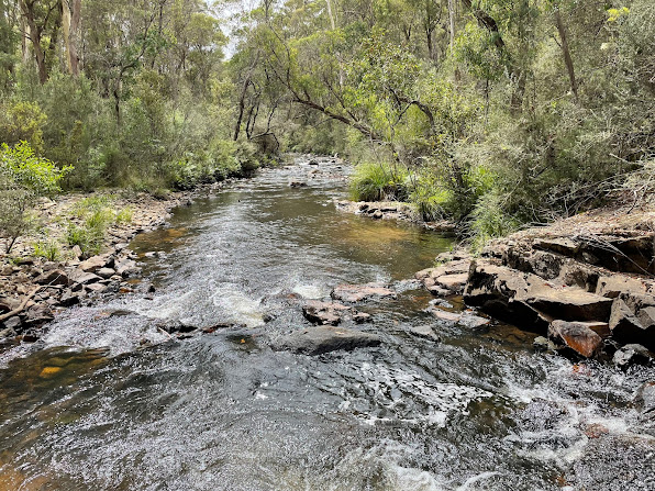
From here we followed the Hume & Hovell Track signs. At first we were walking along a vehicular trail which paralleled Micalong Creek. Pine forest was on the right, with native bush and views of the creek on the left.

At map reference 55H FA 41486 96674 the rack narrows to a walking trail which winds through a narrow gully above the creek with some great views.


The trail crosses over the creek, normally by a footbridge which was not at its best when we were there:

Nevertheless, we were able to cross and continue following the trail signs to the Micalong Creek Camp Ground, which is right on a very nice part of the creek.

Unfortunately the camp ground itself was a bit disappointing, with structures graffitied and items of rubbish left around.

We returned to the starting point by much the same route, but took the more direct trail at the end.

Tuesday, 15 May 2018

Hume and Hovell Walking Track: Micalong Swamp Flora Reserve

General Information


Distance:   14.2 kilometers
Total climb:   110 meters
Time taken:   2 hours 15 minutes
Map:  Bobbys Plains 8627-3N 1:25 000
Guide:  Graeme Barrow, 30 Family Bushwalks in and around Canberra (2002), pp.35-37.
Start point distance by road from Canberra GPO:   90 kilometers (via Brindabella)
Start point map grid reference:  55H FA 39676 937606
Destination map grid reference:  55H FA 37790 88299
End point:  same as start

Note: Much of this walk follows a section of the Hume & Hovell Walking Track.

Route


http://maps.six.nsw.gov.au/

Description

I began this walk on Micalong Road near where it intersects with Brindabella Road, about 28 kilometers west of Brindabella. I followed Micalong Road south along the east side of the Swamp to an intersection at map reference 55H FA 39482 92757 (it's possible to shorten the walk by about 2 kilometers by driving to this point instead of walking). I then followed the side track to the right which led me to a boardwalk crossing to the other side of the Swamp.


On the other side of the Swamp I continued south along management trails which were muddy and sometimes covered by large puddles.


The views across the Swamp were very pleasant though. At one point there was even some residual snow from falls the week before.


The trail eventually led to another boardwalk crossing, this time of Chinamans Creek, a tributary of Micalong Creek.


Continuing on to the southern end of the Swamp I turned north to make my way back to the car.

Thursday, 26 February 2015

Hume and Hovell Walking Track: Mount Wee Jasper

General Information


Distance: 15.6 kilometers
Total climb: 700 meters elevation gain, total climb may be as much as 900 meters
Time taken: 5 hours
Map:  Couragago 8627-4S 1:25 000
Guide:  link
Start point distance by road from Canberra GPO:  88 kilometers
Start point map grid reference:  55H FB 52524 10232
Destination map grid reference:  55H FB 48996 07860
End point:  same as start


Route


http://maps.six.nsw.gov.au/

Description


This hike is along a part of the Hume and Hovell Walking Track, which runs from Yass to Albury-Wodonga, a distance of 440 kilometers. The starting point for our hike was the Fitzpatrick Trackhead, off Wee Jasper Road about 4 kilometers south of the town of Wee Jasper. From there we hiked up to the nearby caves for a look.


We then returned to the walking trail and heading roughly northwest parallel to Wee Jasper Creek. At map grid reference 55H FB 51286 10999 there is a stile to be crossed, at which point the track heads sharply south starting the main climb to the peak of Mount Wee Jasper. There are some nice views back over pine forests as you gain elevation.


At map grid reference 55H FB 50655 10377 (about 3 kilometers into the walk) we had to turn off the wide track we had been following on to a narrow walking trail.


Although the map shows the trail crossing several watercourses, when we went at the height of summer there was only one that had any obvious water in it (map grid reference 55H FB 49968 08439), and that was fairly unimpressive. We drank the water without any ill effects, though maybe we were just lucky.


Soon after we began the final ascent to Mount Wee Jasper.


The summit was fairly densely forested and there were clear views only towards Brindabella national Park to the east.


Having had lunch at the summit, we returned the way that we had come. Even though this was mostly downhill, the heat of late February along with the dearth of water made this return trip quite stressful. I suspect that it would be best to avoid this hike in the heat of summer. The extent of climbing required makes this a long and tiring walk. There is little water to be found along the way so it is necessary to carry at least 2-3 litres.