Showing posts with label Uriarra. Show all posts

Wednesday, 11 September 2024

Uriarra: Two Sticks Hill, Sherwood Daffodils and Dowling Trig

General Information

Grading:  medium
Distance:   10.9 kilometers
Total climb:   544 meters
Time taken:   4 hours
Maps:   Cotter Dam 8627-2N 1:25 000
Start point distance by road from Canberra GPO:   32 kilometers
Start point map grid reference:  55H FA 74137 95543
Destination map grid reference:     Two Sticks Hill    55H FA 71374 95813  
                                                        Sherwood Daffodils   55H FA 72104 95061
                                                        Dowling Trig   55H FA 73523 95090
End point:  Same as start
 

Route


Description

As usual, this walk started at the small parking area off Mountain Creek Road. We followed the track up to the top of the ridge, and just past the fence we headed off to the minor track on the right, travelling north at first and then turning west. Where the track turned south again we continued west, following a  trail through some nice native forest.

Eventually we came to the road on the east side of Two Sticks Hill, and turning right we followed the road up to the ridge. This was very steep and required a few short rest stops. The pictures don't do justice to the steepness of this trail.

 
At the top of the ridge we followed a clear walking trail, past the NSW/ACT border marker to the summit of Two Sticks Hill. From the summit the walking trail continues to the south, but eventually turns 180 degrees back to the north east. This caused us some confusion, and we debated continuing south through the steep and thick bush before deciding to follow the trail and see where it took us. As luck would have it, the trail actually goes back to the same road we used to climb up the hill at map reference 55H FA 71665 95625. We followed the track south to the Sherwood daffodils.

After a break among the daffodils we cut across the creek and followed an animal track to link up with the initially steep trail to Dowling Trig. Some nice views from this trail.


From the summit we went bush down the northern side of the hill. This was reasonably steep, but easy walking. Getting back to Sherwood Road by this route, we walked back to the starting point.

Sunday, 16 June 2024

Ginninderry Conservation Corridor: Uriarra Crossing, Shepherds Lookout and the Swing Bridges

General Information

Grading:  medium
Distance:   19.1 kilometers
Total climb:   565 meters
Time taken:   3 hours 30 minutes (walking very fast)
Maps:   Umburra 8627-1S 1:25 000
Start point distance by road from Canberra GPO:   17 kilometers
Start point map grid reference:  55H FA 81450 99525
Destination map grid reference:   None
End point:  Same as start
 

Previous Similar Walks

Ginninderry Conservation Corridor: 23 November 2021, 22 May 2024, 28 May 2024
Uriarra Crossing:
11 October 2014, 9 August 2015, 18 June 2020

Route


Description

After a few weeks of very ordinary weather I took advantage of a perfect Winter's Sunday to hike all of the walking tracks from The Link at Strathnairn: the Uriarra Loop, the Shepherd's Lookout loop and the Woodland/Nguurung Bila loop.

Starting at The Link in McClymont Way Strathnairn I walked the (relatively) old track towards Shepherds Lookout, but deviated to the Uriarra Loop and then back up to Shepherds Lookout itself. Leaving the Lookout I made my way to Wallaroo Spur and followed the new track back to where the Woodland/Nguurung Bila track (pink and blue arrows) starts. I followed the Woodland track (pink arrows) first and then returned via the Nguurung Bila track. Nice views towards Pig Hill...

...and back up at Shepherds Lookout.


Saturday, 13 April 2024

Uriarra: Sherwood in Autumn

General Information

Grading:  easy
Distance:   8.2 kilometers
Total climb:   245 meters
Time taken:   2 hours 20 minutes
Maps:   Cotter Dam 8627-2N 1:25 000
Start point distance by road from Canberra GPO:   32 kilometers
Start point map grid reference:  55H FA 74137 95543
Destination map grid reference:   55H FA 72104 95061
End point:  Same as start

Route


Description

I had visited the Sherwood daffodils in October several times in the past, but had always thought it might be nice to visit while the trees were still leafy, and perhaps starting to turn to their autumn colours.

We started the walk at the small parking area off Mountain Creek Road, and having walked up the first hill, we followed the loop in a clockwise direction to the Sherwood Homestead site. There were some autumn colours in the trees along the way, but not much.

 The homestead site looks very different in autumn, and is best described in photos:


We were surprised to find that there were still some irises(?) in bloom under the tree canopy.

We had two young children (aged 5 and 2) on the walk, both of whom are big fans of The Gruffalo. They had a great time strolling through "the deep dark wood" and looking for the fox's underground house, the owl's treetop house and the snake's log pile house. Not only did they find all of these, they even found a nut for the mouse.

We walked back through the pine forest to the carpark.

Thursday, 21 September 2023

Uriarra: Blue Range

General Information

 
Grading: hard
Distance:   18.2 kilometers
Total climb:   737 meters
Time taken:   4 hours 25 minutes
Maps:   Cotter Dam 8627-2N 1:25 000
Start point distance by road from Canberra GPO:   37 kilometers
Start point map grid reference:  55H FA 70471 92950
Destination map grid reference:   no specific destination
End point:  Same as start

Route


Description

This walk started at the locked gate before the Blue Range Hut Camping Ground. We started by heading north, intending to visit the Sherwood daffodils, but after we turned off to the right we found that the Sherwood area was closed due to feral animal culls and we had to retrace our steps to One Stick Road. We then started climbing up towards Blue Range, at first to the west and then veering round more to the north-east, following whichever trail looked to be promising. Crossing the ACT/NSW border we found ourselves eventually on Genges Trail, which meanders along Blue Ridge. We followed Genges Trail for some distance until it ended at Blue Range Road, which we then followed back down the range. There were some great views to the east along the way from both Genges Trail and Blue Range Road.


We then followed whatever trails seemed to take us in the right direction until we came back to our starting point.
 

Tuesday, 12 September 2023

Uriarra: Two Sticks Hill and Lower Blue Ridge

General Information

Grading: hard
Distance:   16.5 kilometers
Total climb:   717 meters
Time taken:   3 hour 50 minutes
Maps:   Cotter Dam 8627-2N 1:25 000
Start point distance by road from Canberra GPO:   32 kilometers
Start point map grid reference:  55H FA 74137 95543
Destination map grid reference:   55H FA 71375 95817
End point:  Same as start

Route


Description

This walk started at a small carpark just off Mountain Creek Road 1.5 kilometers north of Uriarra Road, my usual starting point for the Sherwood Daffodils walk. Proceeding through the gate at the carpark I climbed to the top of the ridge. Passing the dam and the fence I turned off on to the rougher track to the right through the trees:


This track took me to the power lines and gave some good views to the south and east.


Past the power lines the trail follows the border of the pine plantation and becomes less distinct. Recently fallen pine trees cover the trail in a number of places. After a short distance the trail turns sharply to the west and I gradually made my way back to Sherwood Road, which I followed past the turnoff to the daffodils and over the locked gate. Keeping to the right I followed the track on the western side of Two Sticks Hill, looking for a place to climb to the summit. At map reference 55H FA 71059 96088 I found this place, which looked promising enough to try:


It was a very steep climb, but it did take me up to the NSW/ACT border marker, and past that to the rather unimpressive summit of Two Sticks Hill.


I descended the same way, which was quite tricky and treacherous given the gradient and loose surface. Back at the main track I continued north to a locked gate where I turned left up a very rough and steep trail, where I had a rare sighting of a lyrebird. This trail turned around to the south, following the base of Blue Ridge. At first the track was rough, steep and slippery, but soon became a well-maintained management trail. This trail proved to be one of the highlights of the walk: beautiful native bush and all I could hear was birds and my own footsteps. It helped that by this time the sun had come out.


I continued south along this trail until I came to map reference 55H FA 70149 94632, where I turned left and followed that trail to One Stick Road and West Knob Road, which took me back to Sherwood Road and my starting point at the carpark.


Wednesday, 19 October 2022

Cotter Area: Stony Creek Nature Reserve, Uriarra Forest and Mt McDonald

General Information


Grading:  medium
Distance:   13.8 kilometers
Total climb:   473 meters
Time taken:   3 hours 30 minutes
Maps:   Cotter Dam 8627-2N 1:25 000
Start point distance by road from Canberra GPO:   26 kilometers
Start point map grid reference:  55H FA 77061 90367
Destination map grid reference:   Cotter Campground 55H FA 77183 89391
                                                      Mt. McDonald 55H FA 76550 91170
End point:  Same as start

Route


Description


This walk began at the small car park just off Brindabella Road about 2 kilometers north of Cotter Road. From the car park I headed through the bush and across Brindabella Road to find the gate into Stony Creek Nature Reserve (map reference: 55H FA 77214 89929). Through the gate I followed a fairly indistinct track down to Grasstree Lookout, which has a bench from which to enjoy the view.


After the lookout the trail starts to zigzag down the side of the hill to the Murrumbidgee River. At first it passes through fairly open forest (with at one point a fantastic view of the Cotter Pumping Station and bridge over the Murrumbidgee) and then through fairly thick scrub at the bottom.


I followed the trail right to the bridge over the Murrumbidgee and then turned around and headed back. At map reference 55H FA 77192 89740, which is right at the first acute bend of the main trail, I followed a trail off to the side which I thought could be a trail along the bank of the river, but the trail was soon lost in a grassy opening and I returned to the main trail. I then climbed all the way back up to the car park the way I had come. This trail is quite steep in places, but is in excellent condition.

Getting back to my starting point at the car park I headed off again, this time through the locked gate at the car park down Lookout Road towards Cotter Dam. I then followed Priors Road as close as I could get to the Dam.

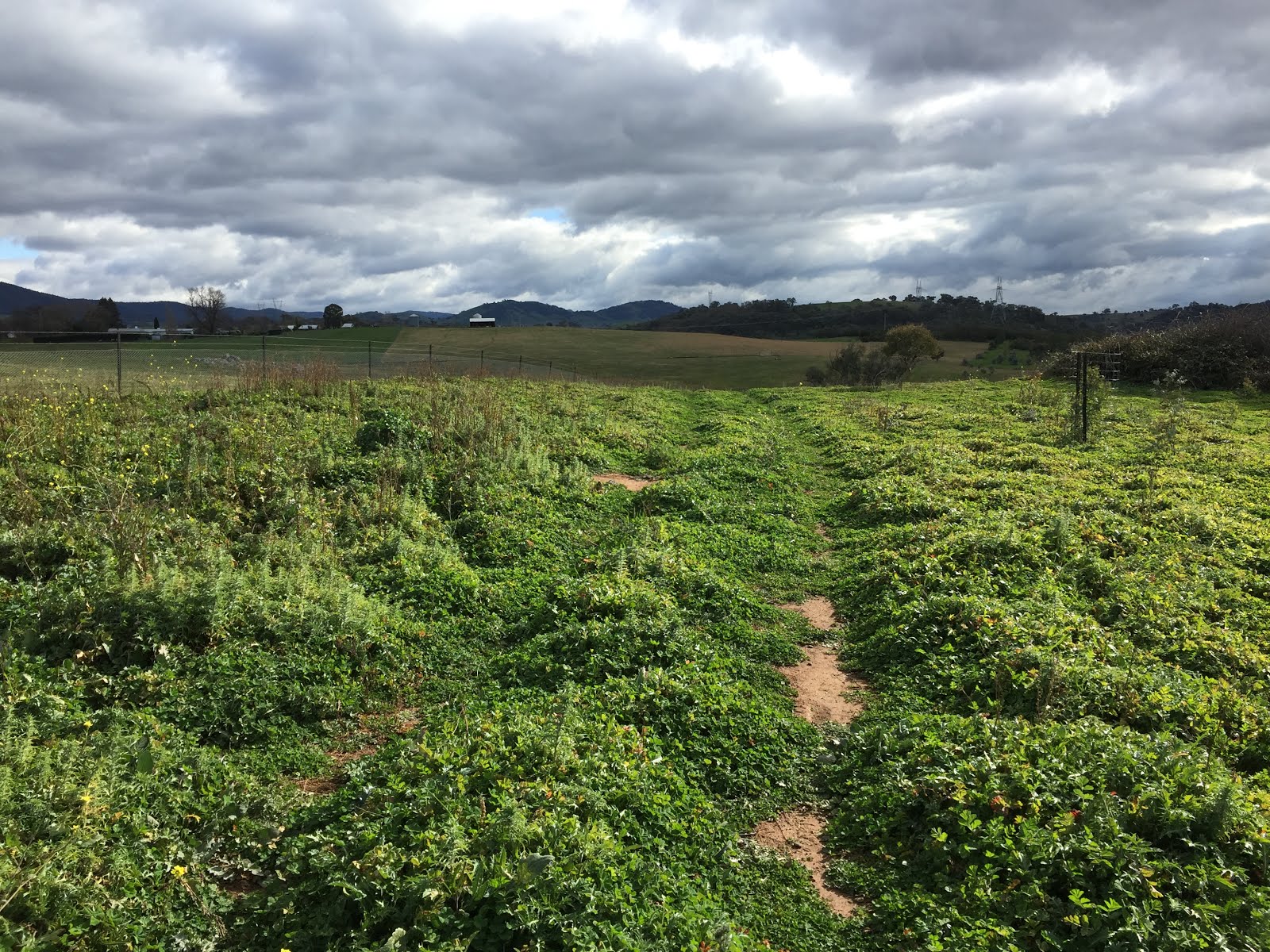
Continuing along Priors Road there were some nice views and reflections off the catchment.

I turned off Priors Road on to to Crusher Road and followed for some distance, taking a slight detour at one point to climb to a high point at map reference 55H FA 75733 91406, with views to the south.

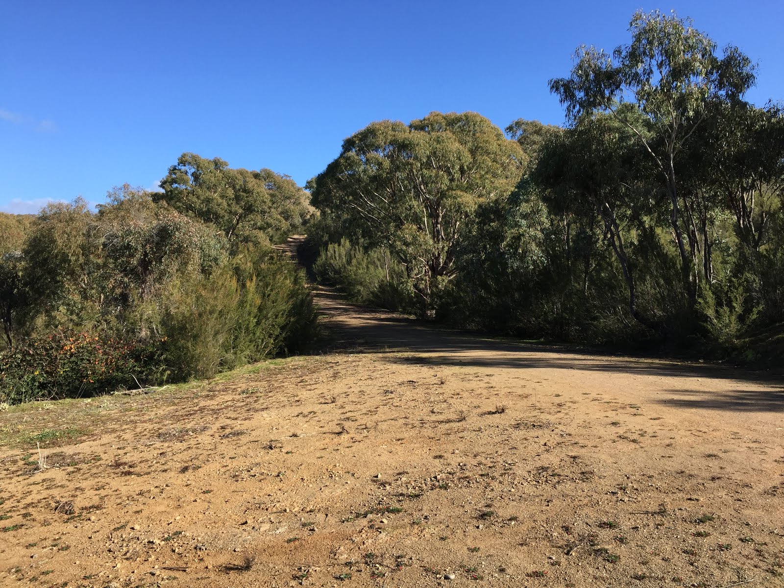
Returning to Crusher Road I followed it through to the Uriarra Village Fire Trail which I then followed down to some power lines which cut through the pine forest. This is pictured below from the eastern side:

The track following the power lines was extremely wet, muddy and slippery, but it eventually comes out on Crusher Road again. From there I headed up the trail to the summit of Mt McDonald, which has a decent view towards Canberra.


From the summit I headed down Mt McDonald Road. I took a brief detour to the Cotter Dam Lookout, and then took the Lookout walking track back to the car park. The Lookout walking track was quite badly eroded along much of its length and I had to take care not to fall over stepping on loose rocks.

I'll finish with a couple of warnings about the Cotter Dam/Mt McDonald part of this walk. First, there is little shade to be found, so it may not be a pleasant walk in high summer. Second, blackberry bushes are all over the place, so cutting through the bush can be problematic.

Tuesday, 8 September 2020

Uriarra: Sherwood Daffodils (2)

General Information

Grading:  easy
Distance:   8.6 kilometers
Total climb:   249 meters
Time taken:   3 hours 10 minutes (including a long break at the daffodils)
Maps:   Cotter Dam 8627-2N 1:25 000
Start point distance by road from Canberra GPO:   32 kilometers
Start point map grid reference:  55H FA 74137 95543
Destination map grid reference:   55H FA 72104 95061
End point:  Same as start

Route


http://maps.six.nsw.gov.au/

Description

This walk was similar to the one undertaken on 10 September 2019 (link), at least in terms of starting point and destination. The difference was that about 1.6 kilometres into the walk we turned north into the pine forest to loop around towards Two Sticks Hill before heading south towards the daffodils site. We returned the same way we had taken last year.

Thursday, 25 June 2020

Canberra Nature Park: Woodstock Nature Reserve

General Information

Grading:  medium 
Distance:  8.5 kilometers 
Total climb:  250 meters 
Time taken:  2 hours 
Map:  Umburra 8727-1S 1:25 000 
Start point distance by road from Canberra GPO:  26 kilometers 
Start point map grid reference:  55H FA 77534 98832 
Destination map grid reference: ACT/NSW border - 55H FB 78466 00899 
End Point:  Same as start

Route

http://maps.six.nsw.gov.au/

Description

Having had a bit of a look at Woodstock Nature Reserve the previous week (link), I decided to go back there and explore it to the point where the Murrumbidgee River reaches the NSW border. In the end we didn't go quite that far, but still were able to explore a large part of the Reserve.

The starting point for the walk was the carpark off Fairlight Road about 900 metres north of Uriarra Crossing. We walked down the management trail in an easterly direction, following the river until it bends in a more northerly direction under the steep rocks below Shepherds Lookout on the far side of the river.

Not far from the point the management trail terminates, although there is a faint track continuing along the river to the north. Unfortunately there are some rather nasty bushes growing next to the track that at this time of the year were shedding their seeds on clothing as we passed. I named these porcupine bushes for obvious reasons:

The spines proved very difficult to completely remove from wool knit clothes and I ended up trashing that particular jumper when I got home.

The annoyance of the spines was partly relieved by another glimpse of the two wedge-tailed eagles that I had seem on my two previous walks. We were able to get quite close to a tree that one of them was perching on, but still too far away to get a decent picture:


About 750 metres from the NSW border we reached the management trail that would take us back to our starting point by a mostly different route. We decided that there was little to be gained from going any further along the river to the border as we originally intended, so started our return journey. It was a moderately steep climb from the river up to a point near the Woodstock property where there were some good views in most directions.

At around map reference 55H FA 78888 98875 the track forks, although the right hand track is very faint and partly overgrown. Nevertheless, we were able to follow this track back down to the main management trail at the river. From there it was an easy walk back up to the carpark.

Thursday, 18 June 2020

Canberra Nature Park: Uriarra Loop and Woodstock Nature Reserve

General Information

 
Grading:  medium 
Distance:  12.4 kilometers 
Total climb:  400 meters 
Time taken:  2 hours 20 minutes 
Map:  Umburra 8727-1S 1:25 000 
Start point distance by road from Canberra GPO:  19 kilometers 
Start point map grid reference:  55H FA 809211 97979 
Destination map grid reference: Uriarra Crossing - 55H FA 77646 98169 
End Point:  Same as start


Previous Similar Walks

Uriarra Crossing: 11 October 2014, 9 August 2015

Route

 
http://maps.six.nsw.gov.au/

Description

I had done most of this walk - from the Shepherds Lookout carpark to Uriarra Crossing and back - a number of times previously (see link), but this time I took the opportunity to have a brief look at the Woodstock Nature Reserve.

Crossing to the western side of the Murrumbidgee at Uriarra Crossing I walked up Fairlight Road about 900 meters to the carpark at the entry to Woodstock Nature Reserve. From there I followed the track about 400 meters to an open area on the right, where I had some nice views back along the track and south along the Murrumbidgee towards the distant ranges. 

From this open area I randomly decided to head bush back down towards the river and loop back to Uriarra Crossing. The bush was fairly light, with only the occasional blackberry to cause discomfort, but near the river itself I found it all a bit muddy and decided to head back up the hill. Eventually I found the boundary fence for the private property marked as "Phencari" on the map and followed it back to the Woodstock Nature Reserve entrance, and from there back (mostly) the way I had come.