General Information
Distance: 15.3 kilometers
Total climb: 363 meters
Time taken: 4 hours 26 minutes
Map: Bobbys Plains 8627-3N 1:25 000
Start point distance by road from Canberra GPO: 90 kilometers (via Brindabella)
Start point map grid reference: 55H FA 39856 94716
Destination map grid reference: 55H FA 43189 98472
End point: same as start
Distance: 15.3 kilometers
Route

Description
This walk starts at the Bossowa Campsite, about 1 kilometer north of Brindabella Road on Micalong Creek. We started the walk by crossing the footbridge over the creek and following the trail around to the north east. Before long we came to a ford with some stepping stones and went back to the original side of the creek. The crossing was not easy as the rocks were irregular and slippery in places.
 From here we followed the Hume & Hovell Track signs. At first we were walking along a vehicular trail which paralleled Micalong Creek. Pine forest was on the right, with native bush and views of the creek on the left.
At map reference 55H FA 41486 96674 the rack narrows to a walking trail which winds through a narrow gully above the creek with some great views.


The trail crosses over the creek, normally by a footbridge which was not at its best when we were there:

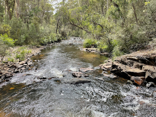
Nevertheless, we were able to cross and continue following the trail signs to the Micalong Creek Camp Ground, which is right on a very nice part of the creek.
Unfortunately the camp ground itself was a bit disappointing, with structures graffitied and items of rubbish left around.
We returned to the starting point by much the same route, but took the more direct trail at the end.
This walk starts at the Bossowa Campsite, about 1 kilometer north of Brindabella Road on Micalong Creek. We started the walk by crossing the footbridge over the creek and following the trail around to the north east. Before long we came to a ford with some stepping stones and went back to the original side of the creek. The crossing was not easy as the rocks were irregular and slippery in places.


At map reference 55H FA 41486 96674 the rack narrows to a walking trail which winds through a narrow gully above the creek with some great views.


The trail crosses over the creek, normally by a footbridge which was not at its best when we were there:

Nevertheless, we were able to cross and continue following the trail signs to the Micalong Creek Camp Ground, which is right on a very nice part of the creek.

Unfortunately the camp ground itself was a bit disappointing, with structures graffitied and items of rubbish left around.
We returned to the starting point by much the same route, but took the more direct trail at the end.
No comments:
Post a Comment