Tuesday 30 July 2019

Stromlo Forest: Brown Hill

General Information

Grading:  easy
Distance:   10.8 kilometers
Total climb:   266 meters
Time taken:   2 hours  25 minutes
Maps:   Canberra 8727-3N 1:25 000
             Cotter Dam 8627-2N 1:25 000
Start point distance by road from Canberra GPO:   17 kilometers
Start point map grid reference:  Canberra 55H FA 82106 92209
Destination map grid reference:  Cotter Dam 55H FA 80526 88953
End point:  same as start

This was the second time I had done this walk, the first being on 16 October 2018.

Route

http://maps.six.nsw.gov.au/

Description

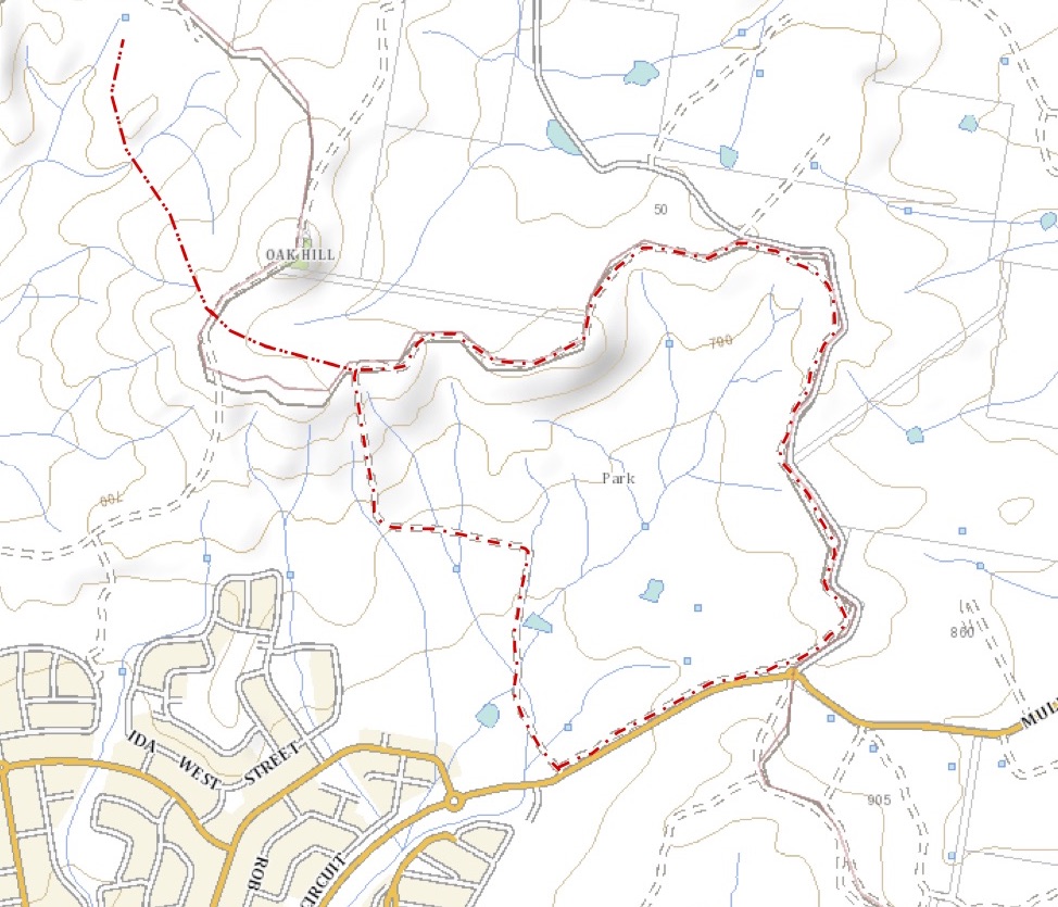
This walk commenced at a small parking area at the western edge of Stromlo Forest just off Uriarra Road. We followed the unnamed management trail to the southwest and then south, generally keeping to the right when we came to a fork in the trail. The walking is pretty gentle, with a few creek crossings and a generally open aspect. I had my first sighting of the snake season, with a red-bellied black snake watching me alertly from the side of the track. There were also some particularly nice views over toward Cotter Dam along the trail.


Reaching Brown Hill we followed the trail east and then turned off onto the rough track to the summit. There are excellent 360 degree views from there.


Rather than returning the same way, we continued down the hill in an easterly direction before taking another trail to the north.

Thursday 18 July 2019

Cairns Region: Cattana Wetlands Jabiru Lake Circuit

General Information

Grading: very easy
Distance:   1.5 kilometers
Total climb:   negligible
Time taken:   20 minutes
Start point distance by road from Cairns PO:   17 kilometers

Route

Cairns Regional Council

Description

This was a very short walk which we were able to fit in with a day's sightseeing around Cairns. It started from the Cattana Wetlands carpark off Dunne Road, Smithfield. With limited time we chose to do the loop around Jabiru Lake. The surface was flat and paved, making for easy walking and plenty of time to take in the wetlands and its birdlife.

Tuesday 16 July 2019

Cairns Region: Earl Hill Summit Track

General Information

Grading:  easy
Distance:   3 kilometers
Total climb:   210 meters
Time taken:   1 hour
Start point distance by road from Cairns PO:   19 kilometers
End point:  same as start

Route

http://qtopo.dnrm.qld.gov.au

Description

This walk started from the carpark in Reed Road, Trinity Beach, just before the roundabout intersection with Roberts Drive. From here it is about a 350 metre walk to the start of the Earl Hill summit walking track in Roberts Drive.

The walking track is clear, well-maintained and well-used, although some sections are quite steep.

The track follows the ridge south southeast of the summit, where there are some views of Trinity Beach to the north...

...and back towards the coastline towards Cairns itself to the south.

I walked back to the car the same way.


Wednesday 10 July 2019

Cairns Region: Mount Whitfield Conservation Park

General Information

Grading:  easy
Distance:   9 kilometers
Total climb:   350 meters (approximate)
Time taken:   2 hours
Start point distance by road from Canberra GPO:   2,517 kilometers (but only 4 kilometers 
                                                                                 from Cairns Post Office)
Start point:  Red Arrow Walking Track off Collins Avenue, Edge Hill
Destination:  Mount Whitfield (364 meters)
End point:  same as start

Route

Cairns Regional Council

Description

Having parked my car along Collins Avenue, not far from Sheridan Street, I started up the beautifully maintained bitumen Red Arrow Walking Track. Coming to the junction where the Red Arrow loops around, I took the right hand fork which led me through thick rainforest and at one point a bamboo thicket.

After some heavy climbing I came to a lookout which gave some views northeast towards Cairns Airport and the ocean.

Soon after this point I came to the junction of the Red Arrow and Blue Arrow tracks and followed the Blue Arrow, leaving smooth bitumen for a narrow dirt track crisscrossed with tangled roots providing an excellent tripping hazard.

Coming to a junction where the Blue Arrow loops around, I followed the left hand track and continued climbing through the rainforest until I came to the intersection of the Blue Arrow and Green Arrow tracks. I followed the Green Arrow a short distance up to Mt Whitfield, which I possibly would have missed had it not been for a sign telling me I had arrived.

There are no views from Mt Whitfield, but the star of this walk is more the rainforest than the elevation.

Running a bit short of timeI quickly retraced my steps back along the Green and Blue Arrows to the Red Arrow. I turned right at the Red Arrow to take me down the un-walked section back to the parked car.

Friday 5 July 2019

Tidbinbilla Nature Reserve: Camels Hump from Pierces Creek Forest

General Information

Grading:  medium
Distance:   17 kilometers
Total climb:   856 meters
Time taken:   4 hours 40 minutes
Maps:   Cotter Dam 8627-2N 1:25 000; Tidbinbilla 8627-2S
Start point distance by road from Canberra GPO:   32 kilometers
Start point map grid reference:  55H FA 73846 83772
Destination map grid reference:  55H FA 72009 79081
End point:  same as start

Route

http://maps.six.nsw.gov.au/

Description

The start point for this walk is a locked gate in the Tidbinbilla Range Road at map reference 55H FA 73846 83772.  Passing through the gate we followed Tidbinbilla Range Road steadily upwards, including some quite steep sections. Our first stop was at the top of the range where there is a water tank and a view of Canberra in the distance out to the northeast.

Not much further on was Black Spring Mountain, which was hardly noticeable and didn't provide any views. Continuing along the road we came to a side track that took us up to the top of Pierce Hill, which did have some views and a sheltered spot to have some morning tea.

To save some time, we went bush from Pierce Hill directly south to pick up the Tidbinbilla Range Road once more. Eventually we came to the Camels Hump walking trail and ascended Camels Hump. By this time encroaching drizzle made photography unsatisfying.

We retraced our steps to get back to the starting point. The only particularly interesting part of the return journey was two emus who came on to the road just south of Pierce Hill and walked along in front of us for a while before they took fright and ran back into the bush.

Tuesday 2 July 2019

Canberra Nature Park: Northern Border Campsite

General Information

Grading:  easy
Distance:   8 kilometers
Total climb:   219 meters
Time taken:   1 hour 40 minutes
Maps:   Hall 8727-4S 1:25 000
Start point distance by road from Canberra GPO:   18 kilometers
Start point map grid reference:  55H FB 96397 07741
Destination map grid reference:   55H FB 95520 09515
End point:  Same as start

Route

http://maps.six.nsw.gov.au/

Description

This was essentially the same walk completed on 23 April 2019 (link), except that it went a bit further along a walking track past Oak Hill to the campground.