Thursday 31 December 2015

Budawang Wilderness: Pigeon House Mountain

General Information


Distance: 5.3 kilometers return
Total climb: 485 meters
Time taken: 2 hours 30 minutes
Map:  Milton 8927-2N 1:25 000
Guide:  link
Start point distance by road from Canberra GPO:  202 kilometers
Start point map grid reference:  56H KF 50666 82793
Destination map grid reference:  56H KF 51467 84801
End point: same as start


Route


http://maps.six.nsw.gov.au/

Description


Pigeon House Mountain is a distinctively-shaped peak visible from many parts of the South Coast around Ulladulla.


The starting point for the hike was the picnic area at the end of Pigeon House Road. To get there from Ulladulla we drove south on the Princes Highway to Wheelbarrow Road where we turned right. We followed Wheelbarrow road to Woodburn Road, where we turned left and continued to Clyde Ridge Road where we turned right. Clyde Ridge Road eventually meets Yadboro Road where we turned right. About 4.3 kilometers along Yadboro Road is Pigeon House Road. The Pigeon House walking track is very clear and well maintained, and on the day that we did the walk there were a large number of walkers along it, including young children. The first kilometer of the track is very steep though. Once this first climb has been made, however, there is a peak on the ridge at 454 meters elevation which gives the first good views of the surrounding area.


Continuing on from there we continued to climb more gradually up the track following the ridge. At about 2 kilometers into the walk the steep climb up the southeast ridge of Pigeon House commences, and after about 500 meters the track comes to the cliffs that surround the summit. Ladders provide a safe and simple way of getting to the summit, though there are also some narrow sections of track.


Finally we came to the safety-fenced lookout at the summit where the views over the coast and the Budawang Wilderness are exceptional.


After taking some time with the views we headed back to the picnic area the way we had come. This is a great short walk on a very good track.

Monday 28 December 2015

Kosciuszko National Park: Kiandra Heritage Trail and Tabletop Track

General Information


Kiandra Heritage Trail
   Distance: 2 kilometers return
   Total climb: negligible
   Time taken: 30 minutes
   Map:  Ravine 8526-2N 1:25 000
   Guide:  Derrick Stone Walks, Tracks & Trails of New South Wales (2012), pp.180-181.
   Start point distance by road from Canberra GPO:  150 kilometers   
   Start point map grid reference:  55H FA 34892 28774
   Destination:  loop trail
   End point:  same as start

Tabletop Trail (part)
   Distance: 13 kilometers return
   Total climb: 232 meters
   Time taken: 2 hours 15 minutes
   Map:  Cabramurra 8526-2S 1:25 000
   Guide:  Derrick Stone Walks, Tracks & Trails of New South Wales (2012), pp.182-183.
   Start point distance by road from Canberra GPO:  206 kilometers
   Start point Map grid reference:  55H FA 34798 28358
   Destination:  none - walk was exploratory
   End point:  same as start


Route


http://maps.six.nsw.gov.au/

Description


I have an ancestor who was mining gold at Kiandra during the brief gold rush of 1859-61, so I wanted to see the site. I started at the restored courthouse and followed the trail through a rather bleak and windswept valley.


Old mining remains can be seen, as well as the ruins of Yan's Store and the restored Matthew's Cottage.


Information boards are regularly placed around the trail, and it is well worth taking the time to read them.


With the trail only 2 kilometers in length, I had plenty of time and energy for some additional walking and decided to check out part of the Tabletop Trail to see if it was worth the two-day hike in Derrick Stone's book. Starting near Pollocks Gully, I walked up the side of Dunn's Hill and looked back towards Kiandra.


The track passes mostly through open grassland with occasional stands of trees and distant mountains.


I followed the trail south about 5.5 kilometers and decided that I should return to get back to Cooma in time. Unfortunately I took a wrong turning down the Mt Selwyn nordic ski trail, and while this added about 2 kilometers to the walk, it provided some nice views.


The Kiandra Heritage Trail is worth taking some time over, though it is remote and has few facilities (there is a toilet at the Court House, however). The Tabletop Trail was sufficiently interesting to get me back there to do the Tabletop and Four Mile Trails as a two-day hike the following month. 

Monday 14 December 2015

Namadgi National Park: Square Rock

General Information


Distance:  11.2 kilometers
Total climb:  305 meters
Time taken:  3 hours 37 minutes
Map:  Corin Dam 8626-1N 1:25 000
Guide:  link
Start point distance by road from Canberra GPO:  52 kilometers
Start point map grid reference:  55H FA 73134 67548
Destination map grid reference:  55H FA 71122 65800
End Point:  same as start

This is the most recent time I have undertaken this walk. Previous walks were on 5 July 2015 and 13 May 2014.

Route


http://maps.six.nsw.gov.au/


Description


The Square Rock walking track begins at the Square Rock carpark on Corin Road, about 1 kilometer past the Corin Forest recreation area. The start of the track is well marked and at first parallels the Corin Road for about 1 kilometer through fairly open forest. The climb up to Square Rock starts then, and by about the 3.5 kilometer mark about 200 meters in elevation has been gained. Just short of the 4 kilometer mark there is a side track off to the left that leads to a point near the 1444 meter peak at map reference FA713650 (this track is marked accurately on the map). It is well worth taking this side track, as it leads to a lookout with very good views down towards the Orroral Valley.


Returning to the main track, it is only about one kilometer to Square Rock, which is easily climbed via a short ladder.


From Square Rock there are good views to the west, north and east.


Return to the carpark is by the same track. This is a nice and easy walk of a moderate distance with some good views along the way. It is easily accessible on sealed roads.
Monday 7 December 2015

Tidbinbilla Nature Reserve: Billy Billy Rocks - North/South Route

General Information


Distance:  5.4 kilometers
Total climb:  347 meters
Time taken:  7 hours
Map:  Corin Dam 8626-1N; 1:25: 000
Guide:  Graeme Barrow, Namadgi & Tidbinbilla Classics: Tough Bushwalks in Canberra's 
                                        High Country (2000), pp. 25-27.
Start point distance by road from Canberra GPO:  52 kilometers
Start point map grid reference: 55H FA 73102 67537
Destination map grid reference:  55H FA 71942 69153
End point:  same as start


Route


http://maps.six.nsw.gov.au/

Description


Billy Billy Rocks is a rocky peak in the south of the Tidbinbilla Nature Reserve. There are two main routes off Corin Road to get to the Rocks, one approaching from the east and the other from the south. On this occasion we decided to do the north-south route. This starts at Square Rock carpark, which is just a bit after the Corin Forest recreation area. Crossing Corin Road from the carpark we initially headed north and then west, avoiding the boggy ground around Gibraltar Creek. The climb was only moderate in the early stages of the hike, but it became steeper as we veered northwest up the hill at map reference FA721686 where there is a Bogong cave. As well as the steepness of the climb, we were faced with thick scrub and lots of fallen trees, a legacy of the 2003 bushfires. Due to these factors, it took us over 2 hours to hike our first 2 kilometers. Arriving at the peak at FA721686 we searched for the Bogong cave but without success. There were some interesting rock formations here though.


We then hiked due north towards Billy Billy Rocks. This meant we had to descend through the continuing dense scrub and fallen trees down to Billy Billy Creek and then climb up the other side. This took us another hour or so. Perhaps we would have been better off following the contours around to the west and then veering east to approach the Rocks. We spent some time exploring the Rocks, but were unable to find the stone cairns that would lead us to the best views over Namadgi and Tidbinbilla. We did get a few glimpses through the rocks and trees though.


Running short on time we decided to head back - not a pleasant thought given the terrain we had walked through to get to the Rocks. For some crazy reason we walked back to the peak at FA721686, which we should have just walked around to the east, saving us another climb. We then headed roughly straight southeast to get back to the car. This took us through the boggy ground around Gibraltar Creek, where I managed to stand on a red-bellied black snake which thankfully slithered off away from me.

Graeme Barrow rated this walk as "Hard" back in 2000, but given the post-bushfire regrowth and fallen trees it has become even more difficult. Barrow said that the walk should take 4.5 hours, but we took 7 wearying hours. My co-hikers and I decided that next time we would use the west-east route, where we had heard that there is at least a track of some description.

Tuesday 24 November 2015

Brindabella National Park: Coree Falls

General Information


Distance:  1.5 kilometers
Total climb:  128 meters
Time taken:  3 hours
Map:  Cotter Dam 8627-2N; 1:25: 000
Guide:  Graeme Barrow, Namadgi & Tidbinbilla Classics: Tough Bushwalks in Canberra's 
                                        High Country (2000), pp. 9-12.
Start point distance by road from Canberra GPO:  47 kilometers
Start point map grid reference:  55H FA 66085 92934
Destination map grid reference:  55H FA 66349 93350
End point:  same as start


Route


http://maps.six.nsw.gov.au/

Descriptionj


We started our walk at a point on Pabral Road. To get there we drove down Brindabella Road to Curries Road, which is on the right a little after Brindabella Road turns to gravel. We then followed Curries road until it meets Pabral Road (just after crossing Condor Creek), and followed Pabral Road for about 4.5 kilometers. At our hiking start point the road divides around some tall gum trees, and we parked the car here. We headed into the moderately dense scrub in a generally north-northeast direction using a GPS to navigate to the falls. As we came closer to Coree Creek we heard the sound of falling water and headed towards this, eventually coming to the modest upper falls.


Crossing the Creek here, we headed downstream for a short distance to the top of the main falls.


From here we climbed down to the pool at the bottom of the falls.


Crossing Coree Creek again here, we started our climb straight up out of the gully. This was very steep and treacherous, requiring us to find handholds as well as footholds on much of the climb. We were exhausted by the time we reached the top and had to rest a while before we navigated back through the scrub to Pabral Road. Although short in distance, this was a difficult walk. The falls, however, are worth the effort. 

Thursday 15 October 2015

Kowen Pine Forest: Mount Reedy

General Information


Distance: 11.2 kilometers
Total climb: 445 meters
Time taken: 4 hours
Maps:  Canberra 8627-3N 1:25 000; Bungendore 8727-2N 1:25 000
Guide:  link
Start point distance by road from Canberra GPO:  19 kilometers
Start point map grid reference:  55H GA 04479 88164 [Canberra]
Destination map grid reference:  55H GA 05428 90559 [Bungendore]
End point:  same as start


Route


Commentary


This walk started at the Molonglo Gorge picnic area, which is off the Sutton Road approximately 5 kilometers north of Queanbeyan. The 3 kilometer walking trail trough Molonglo Gorge begins here. It is well-marked at the start and very clear along its entire length.


We proceeded east along the walking trail on the north side of the Gorge, with the Canberra-Goulburn railway line across on the other side of the river. The trail starts close to river level, but climbs up the side of the Gorge, giving some good views of the river down below.


At the end of the Molonglo Gorge walking trail is Blue Tiles picnic area, where we stopped for a snack. Apparently there is good swimming here in warmer weather. From Blue Tiles we headed north into the Kowen Pine Forest along wide and clear management trails.
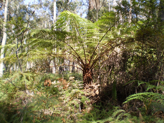


Veering northwest, we picked our way through the 5 kilometers to Mount Reedy (763 meters) on the edge of Kowen Forest. There were some views towards Canberra and Queanbeyan both from the higher management trails and the summit of Mount Reedy.


Leaving the summit we headed southwest along a management trail, but after about 1 kilometer the trail ended unexpectedly - not as it is marked on the map. We were then obliged to cut through the bush into a gully with a creek at the bottom. This was a bit of a scramble and quite a climb back out of the gully, but turned out to be quite picturesque.


At the top of the gully we met up with Kowen Road which we followed to the west before turning south into the road back to the Molonglo Gorge picnic area.


Assessment


Molonglo Gorge is a great short walk in its own right, but it was even better to go on to Mount Reedy than to just backtrack the way we had come. Navigating through the pine forest requires a map with the management trails marked, or wrong turns could easily be taken.

Tuesday 6 October 2015

Monga National Park: Corn Trail (part)

General Information


Distance: 11.4 kilometers
Total climb: 484 meters
Time taken: 3 hours
Map: Monga 8826-1N 1:25 000
Guide:  link
Start point distance by road from Canberra GPO:  110 kilometers
Start point map grid reference:  55H GA 64832 60829
Destination:  None - hike was exploratory
End point:  same as start


Route


http://maps.six.nsw.gov.au/

Description


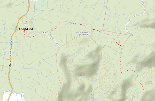
The Corn Trail is usually a one-way walk, most commonly from north to south (downhill) although some walkers do it in reverse or as a return hike. As a one-way walk it is necessary to have transport at both ends, which can be quite a logistical hassle since the start and end points are over 32 kilometers distant by road - including 18.5 kilometers of the narrow, winding and gravel Misty Mountain Road and No Name Mountain Road. On this occasion we planned to only walk part of the Corn Trail from north to south and return. The map shows the Corn Trail starting to the south of the Kings Highway at Clyde Mountain, but this access has been closed by the National Parks. The actual northern start point of the walking track is the Dasyurus picnic area. To get to Dasyurus, turn off the Kings Highway into River Forest Road which is just to the west of Clyde Mountain. Approximately 2 kilometers along River Forest Road turn left down a side track to Dasyurus.


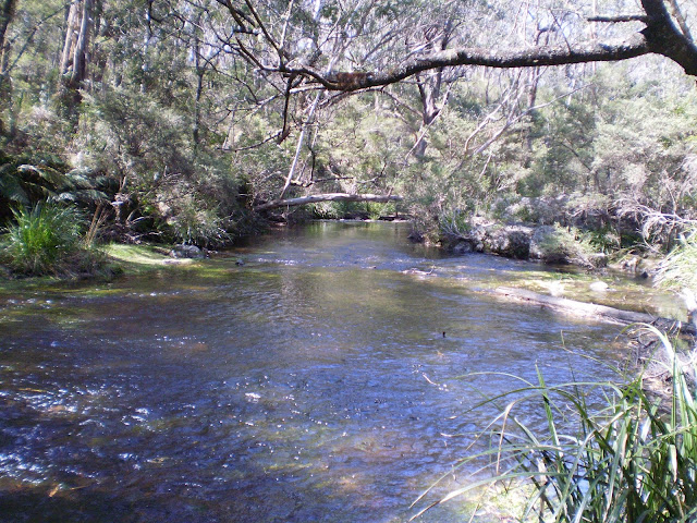
The Corn Trail is well marked at Dasyurus, but it is first necessary to cross the Mongarlowe River so waterproof boots are advised.


Just over the river we noticed a grassy area which had obviously been used as a camping area - perhaps useful for a later walk along the full length of the trail. The walking trail itself is well defined, passing first through forest and ferny undergrowth in an easterly direction.


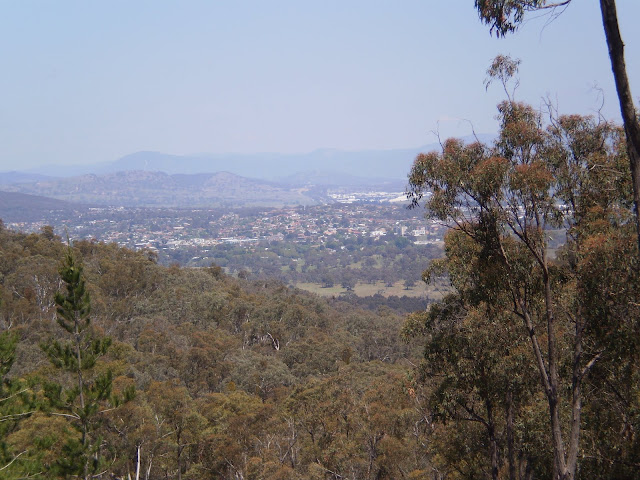
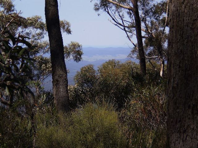
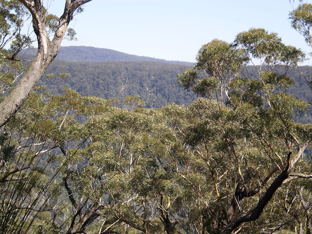
Passing north of Murrenburg Mountain the trail then heads south, joining the map-marked trail around grid reference GA670604. There are occasional views through the forest as you walk along the ridge.


About 5.5 kilometers into the walk, the trail starts its 600 meter descent to its end at No Name Mountain Road. We descended about 100 meters of this before deciding to head back.
This is an excellent walk through a very nice area with an interesting history. After finishing the walk we decided to do its full length north to south a few months later, but we were rained out before we could start the actual walking. It's still on the list, but difficult to organise due to the car placement logistics.

Thursday 1 October 2015

Deua National Park: Big Hole (2) and Marble Arch

General Information


Distance:  12.6 kilometers
Total climb:  475 meters
Time taken:  4 hours 20 minutes
Map:  Kain 8826-4S 1:25 000
Guide:  link
Start point distance by road from Canberra GPO:  129 kilometers
Start point map grid reference:  55H GA 39292 43340
Destination map grid reference:  Big Hole - 55H GA 40570 42986
                                                    Marble Arch - 55H GA 43468 43196
End point:  same as start


Route


http://maps.six.nsw.gov.au/

Description


The starting point for this hike was the Berlang camping area, which is off Krawaree Road at the Gundillion Cemetery. The camping area is well signposted fro Krawaree Road. Soon after leaving the camping area it is necessary to cross the Shoalhaven River. Since it is shin deep I decided to take off my boots and cross in a pair of thongs (Australian for flip-flops, just in case you were thinking of something else) to protect my feet from the sharp rocks.


The walking trail goes through largely open terrain, steadily climbing up the flank of a hill to the Big Hole viewing platform.


Unfortunately I've never been able to get a satisfactory picture of Big Hole itself, but there is a very good one in the guide referenced above. From Big Hole we continued along the trail, now through forest.


The trail as we followed it actually runs north of the trail as it is marked on the map (but still south of the Bettowynd Fire Trail). About 5.5 kilometers into the walk we started our decent to Marble Arch, which we reached about half a kilometer later. We passed through the arch and the cave beyond until we entered the slot canyon.


We followed the slot canyon until we came on a spring coming out of the limestone wall on the right, where we stopped for lunch. The limestone-filtered water coming out of the spring was pure and very cold.

After lunch we headed back the way we came, the climb out of the gully made easier by steps thoughtfully built in the trail.


This walk is well worth the 115 kilometer drive from my place to Berlang via Captains Flat. Both Big Hole and Marble Arch are striking natural features and are both easily accessible via a well defined walking track.