Showing posts with label Mount Tennent. Show all posts

Tuesday, 28 December 2021

Namadgi National Park: Mt Tennent

General Information

 
Grading: Hard
Distance:  13.9 kilometers
Total climb:  805 meters
Time taken:  4 hours
Map:  Williamsdale 8726-4N, 1:25 000
Start point distance by road from Canberra GPO:  36 kilometers
Start point map grid reference:  55H FA 87286 66083
Destination map grid reference:  55H FA 85340 64040
End point:  same as start
 

Previous Similar Walks

2 April 2016, 7 August 2016

Route


Description

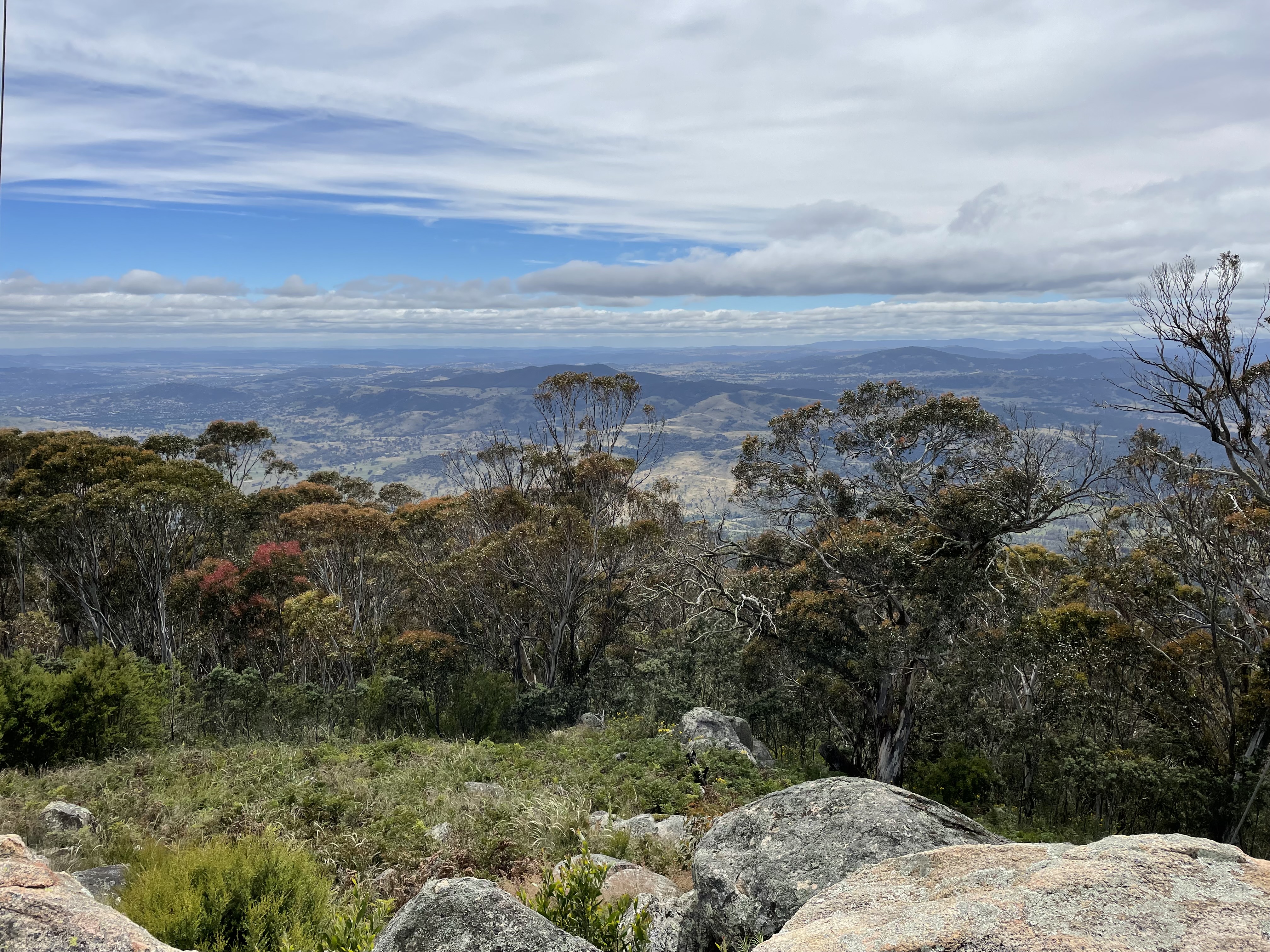
It having been some time since I'd climbed Mt Tennent from the Namadgi Visitor Centre, and since the new section of walking trail had recently opened, I decided to try it again. The first section of track, up to the top of the ridge, was unchanged and included the view from Cypress Pine Lookout:
At the top of the ridge I followed the new walking track to the summit. I returned via the old route down the management trail and along the ridge, and then straight back down the mountain again.

Sunday, 11 June 2017

Namadgi National Park: Mount Tennent (3) and Bushfold Flats (2)

General Information


Distance:  17.5 kilometers
Total climb:  approximately 700 meters
Time taken:  4 hours
Maps:  Williamsdale 8726-4N; Corin Dam 8626-1N
Start point distance by road from Canberra GPO:  48 kilometers
Start point map grid reference:  55H FA 83475 60752
Destination map grid reference:  55H FA 83643 66350
End point:  same as start


Route


http://maps.six.nsw.gov.au/


Description


Unlike my previous walks to the summit of Mt Tennent, this hike started at a point on the Apollo Road a few hundred meters past the Mt Tennent Firetrail, where there is a reasonably wide carpark on the side of the road. From here we walked to the Mt Tennent Firetrail and through the locked gate down to a ford on Honeysuckle Creek. From there the trail heads steadily upwards, eventually recahing the intersection with the Bushfold Flats Firetrail at map reference 55H FA 83667 62737. We continued along the Mt Tennent Firetrail to the summit.

Descending from the summit to map reference 55H FA 84747 64704 we turned left on to the Australian Alps Walking Track and followed it down to the Bushfold Flats Firetrail. We then returned to the car following the Bushfold Flats Firetrail, the Mt Tennent Firetrail and Apollo Road.

Sunday, 7 August 2016

Namadgi National Park: Mount Tennent (2)

General Information


Distance:  15.7 kilometers return
Total climb:  899 meters
Time taken:  4 hours 10 minutes
Map:  Williamsdale 8726-4N, 1:25 000
Guide:   link
Start point distance by road from Canberra GPO:  36 kilometers
Start point map grid reference:  55H FA 87286 66083
Destination map grid reference:  55H FA 85340 64040
End point:  same as start
Note: I had previously done this walk on 2 April 2016 in far better weather, so I have used photographs from this earlier walk.


Route


http://maps.six.nsw.gov.au/

Description


This hike follows part of the Australian Alps Walking Track (AAWT), which begins at the Namadgi Visitor Centre, as does this particular hike. The Visitor Centre is on Naas Road 2.5 kilometers south of the village of Tharwa. From the Visitor Centre carpark, the first part of the trail leads back to Naas Road about 500 meters southwest of the carpark entry. We crossed the road and continued the trail on the other side, having first entered our intentions on the walkers' register there. The track climbs fairly gently at first, but starts to get steeper. About 2.8 kilometers from the start, having climbed about 170 meters, Cypress Pine Lookout offers some good views over the valley of the Murrumbidgee River to the east.


About 2.3 kilometers from Cypress Pine Lookout, the track forks, with the AAWT continuing to the right, and another trail to Mount Tennent heading left, which is the one that we wanted. This is well signposted, so does not present any difficulties. [Note: The Williamsdale map shows no fork in the track and has the AAWT following the track to Mount Tennent. There was a rerouting of the AAWT into the valley west of Mount Tennent and this has yet to find its way onto the printed map.]

Continuing along the  track, after 1.3 kilometers we struck the Mount Tennent Fire Trail and continued uphill. The Fire Trail leg of the hike is only about 1.2 kilometres long, but climbs about 160 meters in elevation, so very steep in most places. It is quite a relief to get to the summit, where there are great views in most directions. Or at least there are in good weather - we found ourselves up in the clouds on this particular day, but on a good day:


We returned the same way we came up, but it is also possible to continue down the Mount Tennent Fire Trail until it meets Apollo Road. This would require, however, either someone to pick you up at that end, or a long walk of over 10 kilometers back up Naas Road to the Namadgi Visitor Centre.

Make no mistake, this is quite a climb, but a very rewarding one. It can be quite busy on weekends, so if you are the type of hiker who likes peace and solitude it's best to go on a weekday if you can. The track is easy to follow and quite well maintained. On a good day, the views are spectacular, but if there is cloud and rain about it's probably best to leave it for another time. 

Saturday, 2 April 2016

Namadgi National Park: Mount Tennent (1)

General Information


Distance:  15.7 kilometers return
Total climb:  899 meters
Time taken:  4 hours 10 minutes
Map:  Williamsdale 8726-4N, 1:25 000
Guide:   link
Start point distance by road from Canberra GPO:  36 kilometers
Start point map grid reference:  55H FA 87286 66083
Destination map grid reference:  55H FA 85340 64040
End point:  same as start


Refer to blog for the identical walk I completed on 7 August 2016.