Showing posts with label Yass Valley. Show all posts

Saturday, 28 December 2024

Yass Distrct: Mundoonen Nature Reserve South of the Hume Motorway

General Information

Grading:  medium
Distance:    15 kilometers
Total climb:    733 meters
Time taken:   4 hours 25 minutes
Maps:   Jerrawa 8728-3N 1:25 000
Start point distance by road from Canberra GPO:   65 kilometers
Start point map grid reference:  55H FB 87265 44055
Destination map grid reference:  none
End point:  Same as start
 

Previous Similar Walks

14 November 2020

Route


Description

This was very similar to the walk done in 2020 (link above).


Thursday, 10 October 2024

Yass District: Bango Nature Reserve

General Information

Grading:  medium
Distance:    9.9 kilometers
Total climb:    416 meters
Time taken:   3 hours 10 minutes
Maps:   Tangmangaroo 8628-1S 1:25 000 and Yass 8728-2N 1:25 000
Start point distance by road from Canberra GPO:   73 kilometers
Start point map grid reference:  55H FB 80613 54409
Destination map grid reference:  None
End point:  Same as start
 

Route


Description

The Bango Nature Reserve is about a 12 minutes drive north of Yass. It is accessible to the public only via a 250 meter frontage along Blakney Creek Road South. When travelling north from Yass look for a gate and a NSW National Parks sign on the right - this should be about 13 kilometers from the intersection of Laidlaw and Orion Streets in Yass. There is a small area suitable for roadside parking just near the gate. Unfortunately the gate is locked and there is no way to enter the reserve without climbing over either the gate or the fence.

Our plan was to explore the Nature Reserve by doing a loop around it. We first headed for a peak (55H FB 81576 54242) pretty much due east of our starting point. This was quite an easy climb, with the only obstacle being a fence a few hundred metres in, but there is an unlocked gate that can be used to get through. From this first peak we followed the ridge to Hawkins Trig (55H FB 81824 53582), which dates from 1887.

 
We paused for morning tea atop the trig before continuing along the ridge and making our way to the eastern border of the Reserve. We passed by a few grass trees at one point along the way:

We hit the eastern border at around map reference 55H FB 82704 52537. This gave us some great 180 degree views over the adjacent pastoral lands and a nearby wind farm (which we had earlier caught glimpses of through the trees).


We followed the fenceline for a while to see what other views presented themselves. At one point we could get a view taking in the nearby Mundoonen Nature Reserve (including Mt Mundoonen) and the distant Brindabella Range. Mt Tennent was clearly discernible about 90 kilometers away.

We then left the fenceline and descended a very steep slope down to the southern border of the Reserve before turning back to try and find the old farm track that cuts through the Reserve from the Bango property. We found this track relatively easily, but it was faint and difficult to follow. We passed through some very nice gullies on the western side of the Reserve.


Eventually we found the western fenceline which we followed back to our starting point.

While technically this walk was bush bashing, it was extremely easy walking through light forest and short grass. Although the Reserve is relatively small (441 hectares) it can easily provide three or four hours of excellent walking. There are no clear views from the highest peaks, but there are views all along those parts of the border fenceline that we walked along.

Saturday, 14 November 2020

Yass District: Mundoonen Nature Reserve South of the Hume Highway

General Information

Grading:  hard
Distance:    14 kilometers
Total climb:    567 meters
Time taken:   4 hours 45 minutes
Maps:   Jerrawa 8728-3N 1:25 000
Start point distance by road from Canberra GPO:   65 kilometers
Start point map grid reference:  55H FB 87265 44055
Destination map grid reference:  Margules Hill 55H FB 88361 43792
End point:  Same as start

Route

Description

The Mundoonen Nature Reserve straddles the Hume Highway between Yass and Gunning. Having done the smaller section of the Reserve north of the Hume Highway at the beginning of October (link) we decided to give the south side a go. Our starting point was Sheldricks Lane on the north side of the Hume Highway, about 3.4 kilometres along the Highway from its intersection with Yass Valley Way.

We began by walking under the Hume Highway via a culvert and then cutting through the bush to the highway trail. When we came to the Swamp Gully Trail we followed it for about 230 metres before turning left towards Margules Hill (791m). Passing by old charcoal pits...

...and making our way to the summit.

There were no great views from the summit due to the forest, so we walked back the way we had come back to the Swamp Gully Trail which we followed south for about 2.3 kilometres until we came to a power line clearing near a creek with some very nice Xanthorrhoeas.

From here we found the Old Gap Road, which in the 1830's was the equivalent of today's Hume Highway. 

We followed Old Gap Road until we reached the border of the Nature Reserve, and turning right we followed the border fence at first through light bush, then along the Dam Trail where we unsurprisingly found a nice dam by the side of which we could have some lunch.

Continuing along the Dam Trail until its end, we again headed bush along the boundary fence to a point  around map reference 55H FB 88939 41879. Here we decided to turn back, making our way through the bush by a direct route to the Swamp Gully Trail, retracing our steps back to tour starting point.

Sunday, 11 October 2020

Yass District: Bobbara Hill, Binalong

 General Information

Grading:  very easy
Distance:   3.3 kilometers
Total climb:   184 meters
Time taken:   1 hour 30 minutes
Maps:   Binalong 8628-4S 1:25 000
Start point distance by road from Canberra GPO:   100 kilometers
Start point map grid reference:  Binalong 55H FB 46326 66009
Destination map grid reference:  Yass 55H FB 45720 65760
End point:  Same as start

NOTE: Bobbara Hill and its access road are on private land. We did the walk as part of a charity event which is held once a year for the benefit of the Binalong Primary School P&C. The Hill is not accessible to the public at any other time without the landowner's permission.

Route

Description

The starting point for this walk was just off Bobbara Road about 5.5 kilometres past the Black Swan at Binalong. The walk to the summit of Bobbara Hill is a short one along a sealed service road, and although steep at some points, my 22-month-old granddaughter was able to walk it with us. At the top of the hill there is an Air Services Australia installation and a communications tower, but the views are spectacular all around. Blooming Patterson's curse, a noxious weed of the worst kind, covered the hill but I have to say it looked quite nice.

Thursday, 1 October 2020

Yass District: Mundoonen Nature Reserve North of the Hume Highway

General Information

Grading:  medium
Distance:   10.5 kilometers
Total climb:   470 meters
Time taken:   3 hours 40 minutes
Maps:   Jerrawa 8728-3N 1:25 000
Start point distance by road from Canberra GPO:   65 kilometers
Start point map grid reference:  Jerrawa 55H FB 872782 44043
Destination map grid reference:  Jerrawa 55H FB 87286 47036
End point:  Same as start

Route

Description

The Mundoonen Nature Reserve straddles the Hume Highway between Yass and Gunning. We decided to do the smaller section of the Reserve north of the Hume Highway. Our starting point was the Sheldricks Lane turnoff, about 3.4 kilometres along the Hume Highway from its intersection with Yass Valley Way.

Our first task was to climb up the access road to the summit of Mt Mundoonen. Unfortunately there are only limited views here due to the surrounding forest, but it's another peak to take off my list.

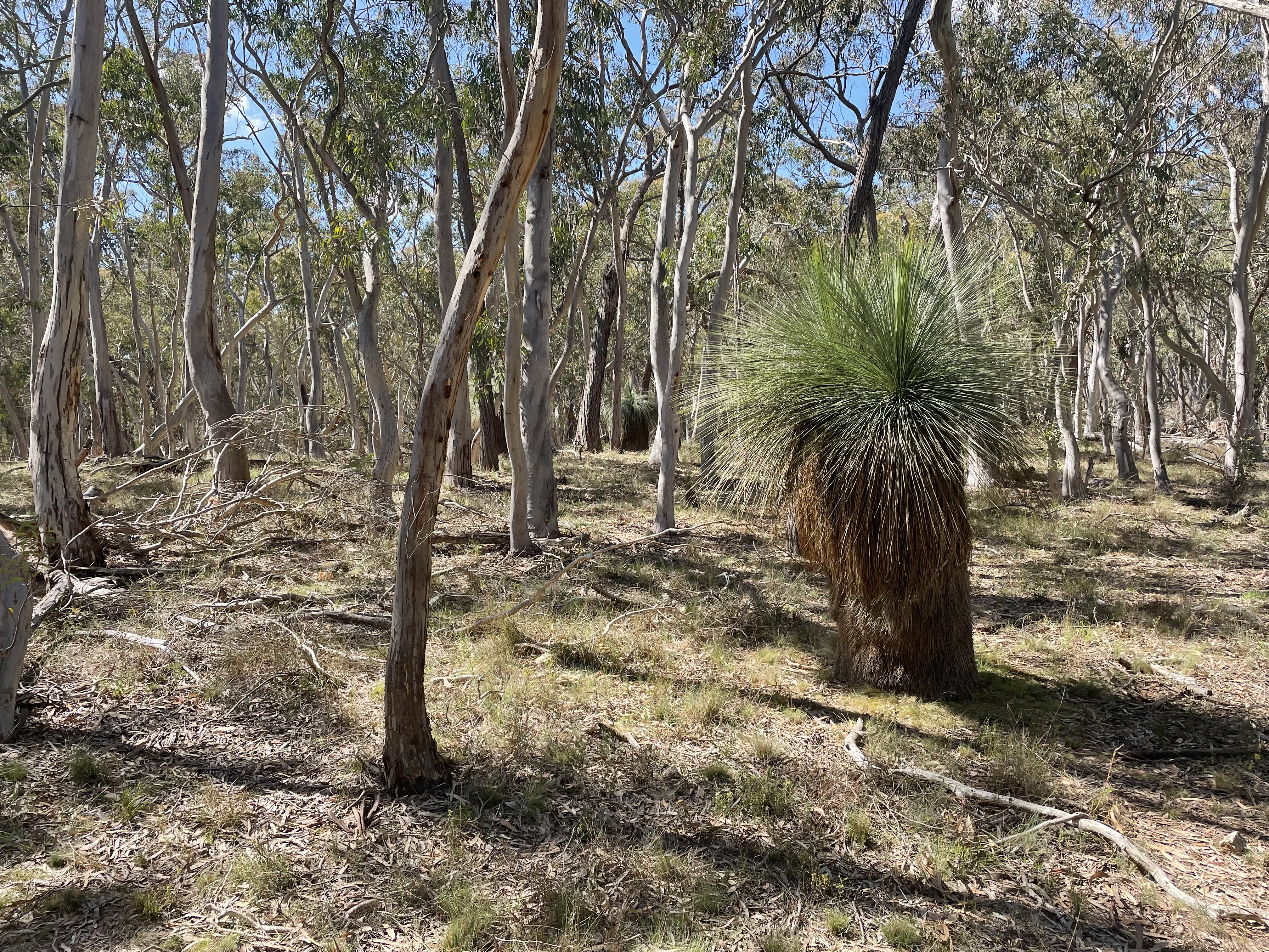
Passing the trig marker we continued to the end of the paved road near the towers in the distance. At the point we turned left to follow the ridge heading a bit east of north. The top of the ridge is easy walking through dry sclerophyll forest.

We followed the ridge until we came to a knoll at map reference 55H FB 87231 45102. Ahead of us was a deep gully with another hill on the other side, so we started to walk down the ridge on the left before heading north again at a lower elevation. We found a couple of mostly dry watercourses which were quite nice to walk along while they took us in roughly the right direction.

At map reference 55H FB 87008 46349 we found the abandoned farmhouse complex which we had heard about, all still in very good condition. We paused there for lunch.

From the farmhouse we made our way to the dam at map reference 55H FB 87196 46802...


...and from there continued north to the boundary fence of the Nature Reserve. We followed the boundary fence to the east, which took us to the hill at the end of the ridge we followed from Mt. Mundoonen.

There were some nice rural views to the north from there

We followed the ridge all the way back to Mt. Mundoonen and our starting point, including this time the steep hill we avoided on the outward journey.

Sunday, 27 September 2020

Yass District: Bowning Hill

 General Information

Grading: very easy
Distance:   4 kilometers
Total climb:   220 meters
Time taken:   1 hour 30 minutes
Maps:   Yass 8628-2N 1:25 000
Start point distance by road from Canberra GPO:   73.5 kilometers
Start point map grid reference:  Yass 55H FB 66960 49630
Destination map grid reference:  Yass 55H FB 67512 50027
End point:  Same as start

NOTE: Bowning Hill and its access road are on private land. We did the walk as part of a charity event which is held once a year for the benefit of the Yass Valley SPIN Foundation. The Hill is not accessible to the public at any other time without the landowner's permission.

Route

Description

Bowning Hill would be familiar to anyone travelling on the Hume Highway west of Yass: a large, steep hill just to the left of the highway. The starting point for the climb was off Common Road (which is about 8 kilometers past the Yass Service Centre turnoff). The climb was along a bitumen service road that zigzags up the western side of the hill.

As we got near the top we could see a rocky outcrop on the top of the hill, although we found that this is not the highest point.

The views from the top are spectacular. We could easily make out Black Mountain Tower, Mt Gingera and Mt Tennant, but the views in all directions were uninterrupted.

After spending quite a while at the top of the hill (despite the cold wind blowing), we made our way back down the hill by the same path.