Showing posts with label very easy grade. Show all posts

Monday, 10 June 2024

Canberrra Nature Park: Barrer Hill from Coombs

General Information

Grading:  very easy
Distance:   6.5 kilometers
Total climb:   147 meters
Time taken:   1 hour 30 minutes
Maps:   Canberra 8727-3N 1:25 000
Start point distance by road from Canberra GPO:   12.7 kilometers
Start point map grid reference: 55H FA 86356 89591
Destination map grid reference:55H FA 86253 90981
End point:  same as start
 

Route


Description

We started this walk on Harold White Avenue across from Bedbrook Street in the suburb of Coombs. We walked west along Harold White Avenue  and then down to the Molonglo River, which we crossed via a causeway at map reference 55H FA 86093 89684. We then followed the trrail along the other side of the river until we came to the Life Support Sculpture (map reference 55H FA 85442 90855) and took in the river views from there. We then backtracked and looped around to the top of Barrer Hill, and returned via the trail through the pine forest.

Monday, 27 May 2024

Canberra Nature Park: Coombs to Scrivener Dam and Return

General Information

Grading:  very easy
Distance:   7.2 kilometers
Total climb:   88 meters
Time taken:   1 hour 30 minutes
Maps:   Canberra 8727-3N 1:25 000
Start point distance by road from Canberra GPO:   12.7 kilometers
Start point map grid reference: 55H FA 86356 89591
Destination map grid reference: 
End point:  same as start
 

Route


Description

We started this walk at the intersection of Harold White Avenue and Pearlman Street in the suburb of Coombs. From there we walked down to the Molonglo River and crossed to the other side, following the river under Tuggeranong Parkway until we reached another river crossing at map reference 55H FA 88106 90660. This was a good place for a photograph of the river with the last vestiges of the morning's fog.


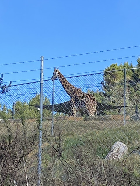
On the other side of the river we continued on to Scrivener Damand crossed it. We then followed the fenceline of The National Zoo and Aquarium, which gave us some views seldom seen on local bushwalks.


We continued back along the river, returning to our starting point.

Wednesday, 10 March 2021

Merimbula Boardwalk

General Information

Grading: very easy
Distance:   4.5 kilometers
Total climb:   4 meters
Time taken:   1 hour 10 minutes
Maps:   Pambula 8824-2S 1:25 000
Start point distance by road from Canberra GPO:   247 kilometers
Start point map grid reference:  street address
Destination map grid reference:   none
End point:  Same as start

Route

Description

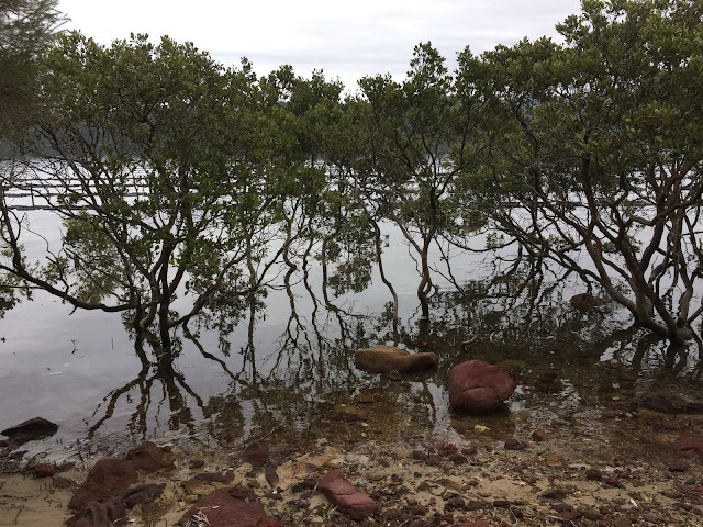
The Merimbula Boardwalk starts just to the right before crossing the bridge at Merimbula. It follows a mixture of gravel paths and wooden boardwalks. It follows the northern edge of Boggy Creek around to the boat ramp off Lakewood Drive. It's probably best just to leave it to the pictures to describe...


Sunday, 11 October 2020

Yass District: Bobbara Hill, Binalong

 General Information

Grading:  very easy
Distance:   3.3 kilometers
Total climb:   184 meters
Time taken:   1 hour 30 minutes
Maps:   Binalong 8628-4S 1:25 000
Start point distance by road from Canberra GPO:   100 kilometers
Start point map grid reference:  Binalong 55H FB 46326 66009
Destination map grid reference:  Yass 55H FB 45720 65760
End point:  Same as start

NOTE: Bobbara Hill and its access road are on private land. We did the walk as part of a charity event which is held once a year for the benefit of the Binalong Primary School P&C. The Hill is not accessible to the public at any other time without the landowner's permission.

Route

Description

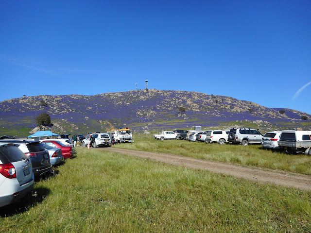
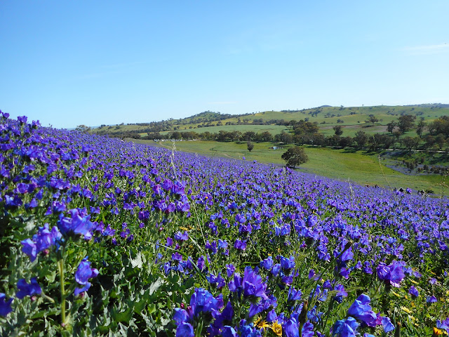
The starting point for this walk was just off Bobbara Road about 5.5 kilometres past the Black Swan at Binalong. The walk to the summit of Bobbara Hill is a short one along a sealed service road, and although steep at some points, my 22-month-old granddaughter was able to walk it with us. At the top of the hill there is an Air Services Australia installation and a communications tower, but the views are spectacular all around. Blooming Patterson's curse, a noxious weed of the worst kind, covered the hill but I have to say it looked quite nice.

Sunday, 27 September 2020

Yass District: Bowning Hill

 General Information

Grading: very easy
Distance:   4 kilometers
Total climb:   220 meters
Time taken:   1 hour 30 minutes
Maps:   Yass 8628-2N 1:25 000
Start point distance by road from Canberra GPO:   73.5 kilometers
Start point map grid reference:  Yass 55H FB 66960 49630
Destination map grid reference:  Yass 55H FB 67512 50027
End point:  Same as start

NOTE: Bowning Hill and its access road are on private land. We did the walk as part of a charity event which is held once a year for the benefit of the Yass Valley SPIN Foundation. The Hill is not accessible to the public at any other time without the landowner's permission.

Route

Description

Bowning Hill would be familiar to anyone travelling on the Hume Highway west of Yass: a large, steep hill just to the left of the highway. The starting point for the climb was off Common Road (which is about 8 kilometers past the Yass Service Centre turnoff). The climb was along a bitumen service road that zigzags up the western side of the hill.

As we got near the top we could see a rocky outcrop on the top of the hill, although we found that this is not the highest point.

The views from the top are spectacular. We could easily make out Black Mountain Tower, Mt Gingera and Mt Tennant, but the views in all directions were uninterrupted.

After spending quite a while at the top of the hill (despite the cold wind blowing), we made our way back down the hill by the same path.

Monday, 7 September 2020

Canberra Nature Park: Aranda Snowgums

General Information

Grading: very easy
Distance:   2 kilometers
Total climb:   18 meters
Time taken:   45 minutes
Maps:   Canberra 8727-2N 1:25 000
Start point distance by road from Canberra GPO:   6 kilometers
Start point map grid reference:  Canberra 55H FA 89746 94098
Destination map grid reference:   n/a
End point:  Same as start

Route


http://maps.six.nsw.gov.au/

Description

This walk started at the Black Mountain carpark near Glenloch Interchange. We walked down to the stile over the fence leading into the Aranda Snowgums and followed a loop pretty randomly around the area. A short walk for a little bloke.

Tuesday, 19 May 2020

Tidbinbilla Nature Reserve: Ashbrook Fire Trail

General Information

Grading:  very easy 
Distance:  4 kilometers 
Total climb:  116 meters 
Time taken:  1 hour 
Map:  Tidbinbilla 8627-2S, 1:25 000 
Guide:  link 
Start point distance by road from Canberra GPO:  49 kilometers 
Start point map grid reference:  55H FA 72353 72785 
Destination map grid reference:  55H FA 73048 74180 
End point:  same as start

Route

http://maps.six.nsw.gov.au/

Description

Having left one car at the Koala Enclosure carpark, we drove to the Hanging Rock carpark (off the Tidbinbilla Loop Road) where we started the walk. We followed the fire trail along and then over Ashbrook Creek, heading up through some beautiful forest until we came to a fork in the road. The left fork went up to the end of the fire trail at Mountain Creek Road, but we chose instead to follow the right fork which goes back to the Tidbinbilla Loop Road following the koala enclosure fence.

You can view photographs from a previous walk that included the Ashbrook Fire Trail through this link.


Thursday, 18 July 2019

Cairns Region: Cattana Wetlands Jabiru Lake Circuit

General Information

Grading: very easy
Distance:   1.5 kilometers
Total climb:   negligible
Time taken:   20 minutes
Start point distance by road from Cairns PO:   17 kilometers

Route

Cairns Regional Council

Description

This was a very short walk which we were able to fit in with a day's sightseeing around Cairns. It started from the Cattana Wetlands carpark off Dunne Road, Smithfield. With limited time we chose to do the loop around Jabiru Lake. The surface was flat and paved, making for easy walking and plenty of time to take in the wetlands and its birdlife.