Tuesday, 14 May 2019

Stromlo Forest: Mt Stromlo

General Information

Grading:  easy
Distance:   6.7 kilometers
Total climb:   235 meters
Time taken:   1 hour 30 minutes
Maps:   Canberra 8727-3N 1:25 000
Start point distance by road from Canberra GPO:   16 kilometers
Start point map grid reference:  55H FA 82558 91853
Destination map grid reference:   55H FA 82779 90045
End point:  Same as start

Route

http://maps.six.nsw.gov.au/

Description

Although I have been up Mt Stromlo many times, this was the first time I walked there. We started from the Stromlo Forest Park Western Carpark off Uriarra Road and followed the track generally southwards to the top of Mt Stromlo. There is still a mix of bushfire ruins and new buildings on the top of the mountain, and also some decent views.

On our return leg we followed a different trail east of the mountain.

Tuesday, 7 May 2019

Tallaganda National Park: South Black Range Trig

General Information

Grading:  easy
Distance:   7 kilometers
Total climb:   250 meters
Time taken:   1 hour 45 minutes
Maps:   Bombay 8827-3S 1:25 000
Start point distance by road from Canberra GPO:   50 kilometers
Start point map grid reference:  55H GA 30854 74319
Destination map grid reference:   55H GA 29995 76996
End point:  Same as start

Route

http://maps.six.nsw.gov.au/

Description

This walk was a bit of an afterthought following a tour of the Molonglo Observatory Synthesis Telescope at Hoskinstown. This is well worth a look if you are lucky enough to find a tour operating.

To reach the starting point for this walk we drove to Hoskinstown and turned left on to Forbes Creek Road until its intersection with the North Black Range Fire Trail, not far past the National Park border. While there is a parking area at the intersection, we were a bit pressed for time and drove part way up North Black Range Fire Trail and parked there.

The native forest in this part of Tallaganda National Park is particularly striking.

We followed the fire trail north, a mostly gentle uphill climb. At one point we diverted off the trail into the bush, partly to better enjoy the forest and partly to take a shortcut to the South Black Range Trig (1262 metres). As with many shortcuts this proved a lot more difficult than it looked, and after my co-hiker took a nasty fall we decided to get back on to the fire trail. Around map reference 55H GA 30300 76900 there is a walking track off to the left which leads up to South Black Range Trig. We followed this track until we found the Trig on top of a huge boulder.

There were the remains of a wooden extension ladder near the boulder, half of which was quietly decaying on the ground and the remainder was propped up against the tree to the right of the picture above.

I suppose this must have been used by thrill seekers to shimmy across a tree branch to the top of the boulder, but neither of us thought it worth the risk. Sadly there is no clear view in any direction from South Black Range due to the forest all around.

We returned to our car by the same route, but this time avoiding false shortcuts through the bush. 

Tuesday, 23 April 2019

Canberra Nature Park: Mulligans Flat North

General Information

Grading:  easy
Distance:   6.5 kilometers
Total climb:   174 meters
Time taken:   1 hours 45 minutes
Maps:   Hall 8727-4S 1:25 000
Start point distance by road from Canberra GPO:   18 kilometers
Start point map grid reference:  55H FB 96397 07741
Destination map grid reference:   no real destination
End point:  Same as start

Route

http://maps.six.nsw.gov.au/

Description

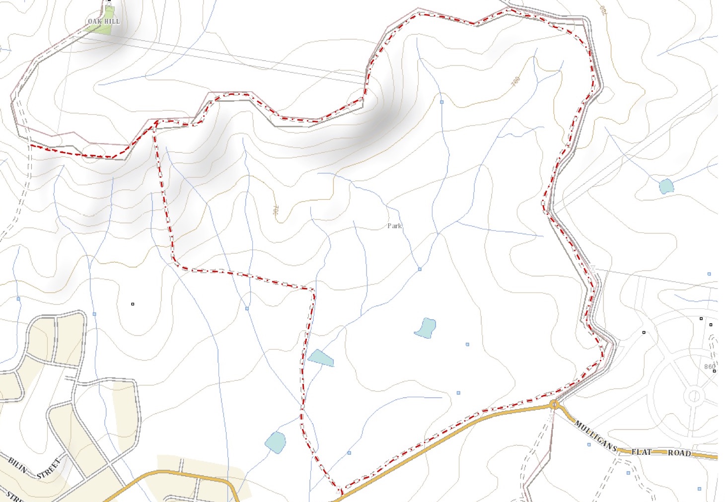
This was essentially the same walk completed on 9 October 2014 (link), except that it was done in the opposite direction. We also went a bit further along a walking track to the south of Oak Hill.

Thursday, 11 April 2019

Uriarra Forest: Condor Hill

General Information

Grading:  medium
Distance:   9 kilometers
Total climb:   350 meters
Time taken:   3 hours 30 minutes
Maps:   Cotter Dam 8627-2N 1:25 000
Start point distance by road from Canberra GPO:   40 kilometers
Start point map grid reference:  55H FA 71648 86832
Destination map grid reference:   55H FA 72969 88682
End point:  Same as start

Route

http://maps.six.nsw.gov.au/

Description

This walk began at the locked gate on the western side of Vanity's Crossing, only a few hundred meters from the Cotter River. We started out by walking to the weather station at map reference 55H FA 71629 86943, hoping to find a track that we knew paralleled Vanity's Crossing Road to the west. Although this track is very clear on SIXmaps satellite imagery it is not marked on maps. We could not find the track from the weather station so we went back up Vanity's Crossing Road to map reference 55H FA 71712 87505 where we turned right  and found the track we were looking for just off Vanity's Crossing Road.

When we got on the track we could see why we had trouble finding it: much of it is overgrown.

After a short distance we crossed Condor Creek, which was pretty much empty of water. If there was a good flow of water down the creek crossing it may be difficult.

Climbing out of the creek we continued to follow the track until it ended at Sinclair Circuit, a rough vehicular tack that goes around Condor Hill. From here we bush bashed our way up the hill at map reference 55H FA 72514 88592, having to walk around large blackberry growths which will probably make this route impassable in time. From this hill we had our first glimpse of Cotter Dam.

Continuing up Condor Hill we came across numerous reminders of the 2003 bushfires: blackened remains of pine trees and flaking boulders.

All the while dodging blackberry we eventually made it to the top of Condor Hill, where we had excellent views all around. The views towards Cotter Dam to the north and the Cotter River valley to the south were particularly nice.

Having come up the western side of Condor Hill we descended down the south side until we found Sinclair Circuit once again. We followed this road around to where the walking track was and followed it back to our car (with a short detour after taking a wrong turning). A late lunch on the cool banks of the Cotter River at Vanity's Crossing was a nice reward for all the effort.

Monday, 8 April 2019

Googong Dam: Kayaking the Queanbeyan River

General Information


Distance:   3 kilometers
Total climb:   n/a
Time taken:   35 minutes
Maps:   Hoskinstown 8727-2S 1:25 000
Start point distance by road from Canberra GPO:   40 kilometers
Start point map grid reference:  55H GA 05482 69442
Destination map grid reference:   55H GA 06564 68140
End point:  Same as start

Route


http://maps.six.nsw.gov.au/


Description


This was a spur-of-the-moment kayaking trip which, all things considered, wasn't worth the drive.

Parking at the Tin Hut carpark, I wheeled my kayak about 600 meters down a rough track to the nearest launching place at the end of Tin Hut Inlet. Already it was clear to me that the water level was down significantly from my last trip there in November 2016. Placing my kayak in the water I sunk up to my knees in sticky mud, which made getting into the kayak more difficult than usual, not to mention the cleanup when I got home. Heading south on the Queanbeyan River I came quickly to the junction of Burra Creek. The two pictures below show the difference in Burra Creek levels between late 2016 and today.


The water is considerably murkier too, to the extent that I couldn't even see the mud bar that stopped my progress upstream just short of Washpen Crossing until I was right on top of it. Being thwarted going upstream, I headed back the way I had come and continued further down the Queanbeyan River until a nasty headwind came up and made me decide not to bother going further. I paused for a picture to provide some indication of how far the river was down from its maximum level.


I headed back to Tin Hut Inlet, paddling the last few meters as furiously as I could to glide successfully up the bank out of the mud.

I think I'll stay away from Googong until water levels are replenished.

Tuesday, 26 March 2019

Cuumbeun Nature Reserve: Faunce Hill

General Information

Grading:  medium
Distance:   12.5 kilometers
Total climb:   503 meters
Time taken:   3 hours 45 minutes
Maps:   Bungendore 8726-2N 1:25 000; Hoskinstown 8727-2S  1:25 000
Start point distance by road from Canberra GPO:   20 kilometers
Start point map grid reference:  Bungendore 55H GA 06436 85040
Destination map grid reference:   Hoskinstown 55H GA 06027 81781
End point:  Same as start

Route

http://maps.six.nsw.gov.au/

Description

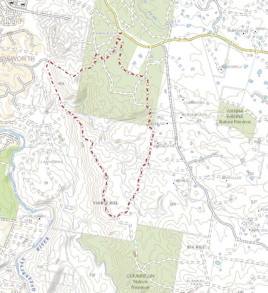
This walk began at the Link Road entrance to Cuumbeun Nature Reserve, just off the Captains Flat Road. 

Walking along the Link Trail for a short distance we turned off onto the Swamp Trail and followed it south to the Queanbeyan River Trail, which we in turn followed until we met another unnamed trail heading north towards Faunce Hill. The views from the Hill were restricted by surrounding trees.

The views opened up a bit, however, as we headed back north from Faunce Hill.

The track north was pretty rough, with one particularly steep and treacherous section just before we left it.

Leaving the track at map reference 55H GA 05398 83520 we followed a walking track which took us through light bush and past a rather nice gully where we stopped for lunch.

We continued along the walking trail until it ended at the Ellerton Drive Extension roadworks. We then started climbing to the water tanks at 55H GA 05096 84488 and then up the nearby peak (55H GA 05472 84207) where we found another walking trail heading back east towards our car via the Queanbeyan River Trail and the Link Trail.

Friday, 22 March 2019

Namadgi National Park: Ginini Creek Waterfalls North of Ginini Flats

General Information

Grading:  medium
Distance:   3.3 kilometers
Total climb:   128 meters
Time taken:   1 hour 45 minutes
Maps:   Corin Dam 8626-1N 1:25 000
Start point distance by road from Canberra GPO:   75 kilometers
Start point map grid reference:  Corin Dam 55H FA 61314 67102
Destination map grid reference:   Corin Dam 55H FA 61503 69130
End point:  Same as start

Route

http://maps.six.nsw.gov.au/

Description

This walk began at the locked gate on Mt Franklin Road at the base of Mt Ginini. We headed through the bush immediately to the north of the carpark, passing through gum trees and moderately dense waist-high scrub until we could see Ginini Flats below us.

Continuing on we came to the edge of the Ginini Flats swamp, which was a bit of a mistake as the scrub became considerably denser near the swamp, and the swamp itself naturally posed its own walking problems. Still, it was very nice to look at close up.

We headed back into the bush, climbing up to where the scrub was less dense. Eventually we saw the steep gully that Ginini Creek passes through, giving a nice view through the gap back towards Mt Franklin and Canberra in the far distance.

Descending steadily (and in places steeply) we made our way down to the top of the series of waterfalls on Ginini Creek.

While it would have been relatively easy to keep going down to where the more substantial falls are (these are visible from the Mt Franklin Summit), we noticed at this stage that some dark clouds were heading our way and there was a sound of distant thunder. Reluctantly we decided to head back in the interests of comfort and safety. We headed back along the ridge to the west of Ginini Flats, which was pretty easy bush to get through and is probably the best route down to the falls and back. We made it back to the car with minutes to spare before heavy rain set in.

Tuesday, 12 March 2019

Canberra Nature Park: Aranda Bushland and Black Mountain

General Information

Grading: easy
Distance:   11 kilometers
Total climb:   390 meters
Time taken:   2 hours 35 minutes
Maps:   Canberra 8727-2N 1:25 000
Start point distance by road from Canberra GPO:   6.4 kilometers
Start point map grid reference:  Canberra 55H FA 89102 96546
Destination map grid reference:   Canberra 55H FA 90789 94434
End point:  Same as start

Route


http://maps.six.nsw.gov.au/

Description

This walk began at the Aranda Shopping Centre in Bandjalong Crescent and, similar to the walk undertaken on 26 February 2019, followed a route through the suburb of Aranda and the Aranda Bushland until just short of Bindubi Street. From there we looped around through more of the Aranda Bushland to the Caswell Drive underpass. On the eastern side of Caswell Drive we proceeded south along the Swampy and Woodland Trails until we reached the Lakeview Trail, where we began a steep and somewhat treacherous climb towards Black Mountain Drive.

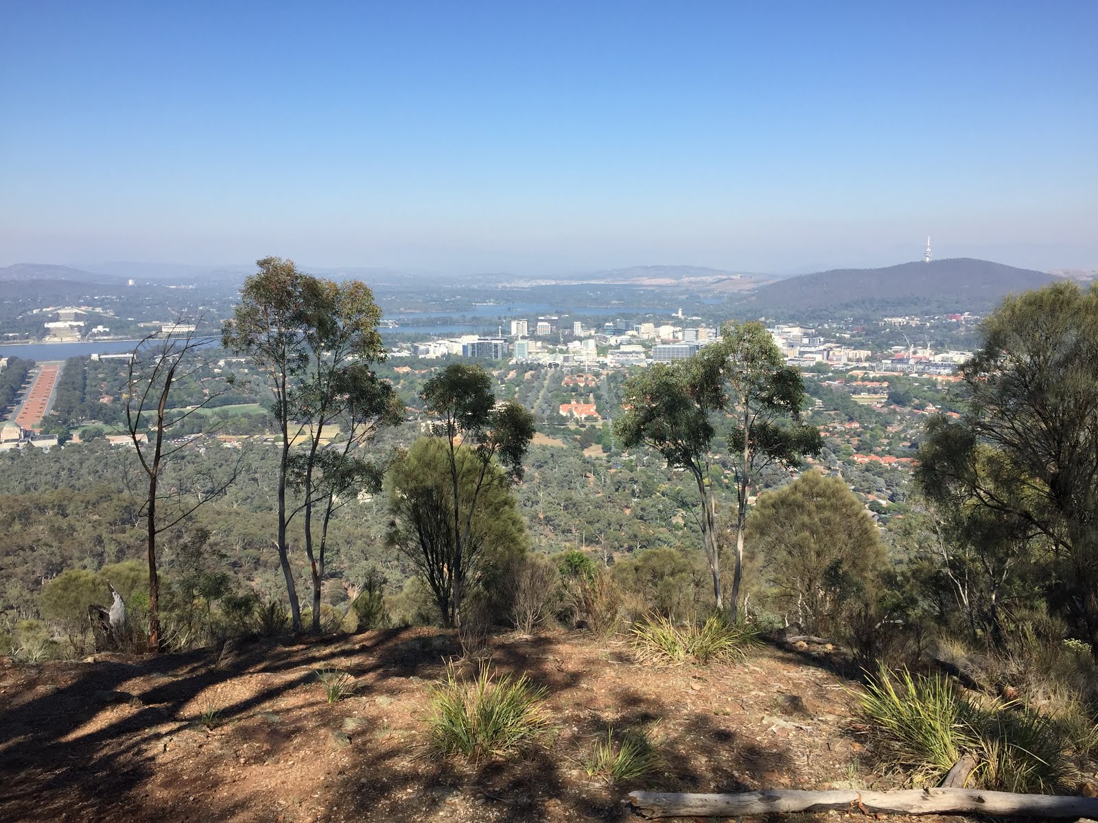
Reaching Black Mountain Drive we crossed over the road and slightly uphill from there we picked up a walking track to the old Black Mountain picnic area where we paused to take in the view.

We continued along a faint walking trail to the summit of the mountain, and then down the northern side, initially via a walking trail and then the Link Trail before turning west back towards Aranda. This time we crossed Caswell Drive via the overpass into Noala Street, Wangara Street and Bandjalong Crescent, back to the Aranda Shops.


Friday, 8 March 2019

Canberra Nature Park: Mount Ainslie Quarries

General Information

Grading:  easy
Distance:   5.5 kilometers
Total climb:   268 meters
Time taken:   2 hours
Maps:   Canberra 8727-2N 1:25 000
Start point distance by road from Canberra GPO:   2.3 kilometers
Start point map grid reference:  Canberra 55H FA 95455 94871
Destination map grid reference:   Canberra 55H FA 96504 94712
End point:  Same as start

Route


http://maps.six.nsw.gov.au/

Description

This walk began at the intersection of Chisholm and Duffy Streets in Ainslie. Initially we went through the bush following a rough path until it ended at a management trail which we followed to the left. Coming to the creek bed shown on the map we again went bush following the dry watercourse to the lookout just below the summit of Mt Ainslie looking south.

Taking the tourist path up to the road around the summit we walked around to the right until we found the path to the first of Mt Ainslie's quarries. Coming from the top of the mountain care is needed when approaching the quarry as there's a bit of a cliff drop to be avoided.

We walked around the top of the quarry to the left...

...quickly reaching the bottom.

To the southwestern side of the quarry is a path which we followed around the mountain before descending to another management trail which we followed until we came across the second quarry site on Mt Ainslie.

From there we went down towards the back of the War Memorial and the old CSIRO building back to where we started the walk.

Tuesday, 26 February 2019

Canberra Nature Park: Aranda Bushland and Mt Painter

General Information

Grading:  easy
Distance:   7.6 kilometers
Total climb:   247 meters
Time taken:   1 hour 40 minutes
Maps:   Canberra 8727-2N 1:25 000
Start point distance by road from Canberra GPO:   6.4 kilometers
Start point map grid reference:  Canberra 55H FA 89102 96546
Destination map grid reference:   Tuggeranong 55H FA 87748 95143
End point:  Same as start

Route


http://maps.six.nsw.gov.au/

Description

This walk began at the Aranda Shopping Centre in Bandjalong Crescent. From the carpark at the rear of the shops we followed a paved path through the suburb of Aranda to a management trail passing to the south of the suburb. Carefully crossing Bundubi Street we continued along another management trail to the south of the suburb of Cook, following this around to the northwest to acquire the main trail to the summit of Mt Painter. Although not quite 750 meters high, Mt Painter provides excellent 360-degree views of Canberra and its surrounds, both on the climb up and on the summit itself.

From the summit we descended via an indistinct trail on the eastern side of the mountain to link up again with the management trail behind Cook. When we reached the bitumen path that runs through Cook we headed southeast along it, passing underneath Bundubi Street via an underpass. taking to management trails once again, we passed through some of the prettiest sections of the Aranda Bushland before reaching the suburb of Aranda once again and returning to the carpark at the shops.