Friday, 14 May 2021

Tidbinbilla Nature Reserve: The Pyramid

General Information

Grading: medium
Distance: 6  kilometers 
Total climb: 386 meters 
Time taken: 3 hours 22 minutes 
Map: Tidbinbilla 8627-2S 1:25 000 
Start point distance by road from Canberra GPO:  46 kilometers
Start point map grid reference:  55H FA 74391 73673 
Destination:  55H FA 74948 72338 
End Point:  Same as start
 

Route


Description

The Pyramid (1172 metres) is a peak on the southeastern side of the Tidbinbilla Valley between Devils Gap and Stantons Gap. Note that the Tidbinbilla map does not name the peak as "The Pyramid", but marks it with the elevation only. Note also that there is no walking track to the summit of The Pyramid from Devils Gap.

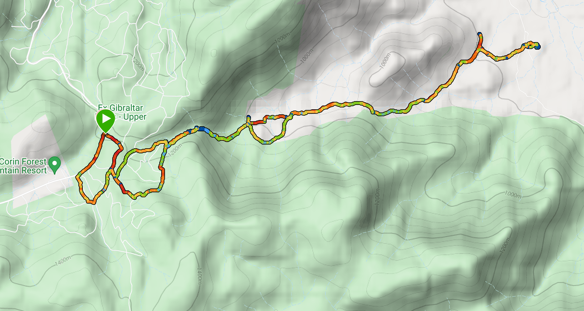
The start point for this walk is the Devils Gap carpark just off the Tidbinbilla Ring Road. We crossed to the other side of the road from the carpark and started up the Devils Gap fire trail. We followed to the fire trail to the Devils Gap signpost (about 2 kilometres from our starting point), getting some views of our destination along the way.

Just past the Devils Gap signpost on the right is a walking trail which forms part of the "Devils loop" walk. We walked down this trail for a short distance until we found a point where we thought it made sense to head bush and commence our climb to the summit. The climb was quite steep and we had to negotiate our way through some scrub and avoid prickly plants. Near the summit we started to see large boulders, some with interesting shapes.

In short order we made it to the summit which was quite rocky and covered with ferns below and small trees all around. There is a cairn that presumably marks the summit, or perhaps just someone's idea of where the summit might be.

Due to the fairly dense tree cover we could only get partial views of the surrounding area, although we tried a number of vantage spots.

We returned to the carpark the same way we had come up.


Friday, 30 April 2021

Canberra Nature Park: The Pinnacle, Weetangera Cemetery and Kama

General Information

Grading:  easy
Distance:   8.6 kilometers
Total climb:   218 meters
Time taken:   2 hours 10 minutes
Maps:   Canberra 8727-3N 1:25 000
             Hall 8727-4S 1:25 000
Start point distance by road from Canberra GPO:   3 kilometers
Start point map grid reference:  street address
Destination map grid reference:   none
End point:  Same as start
 

Route


Description

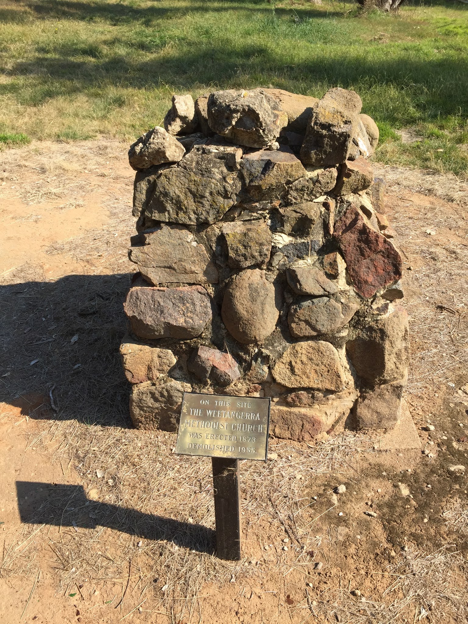
We started this walk at the parking area for Kama Nature Reserve off William Hovell Drive. From there we followed the track up into The Pinnacle Nature Reserve and to The Pinnacle itself. We then headed west and northwest, behind the suburb of Hawker, to an underpass under William Hovell Drive. From there it is a short walk to the historic site of the Weetangera Methodist Church and its cemetery. The site is in far better condition that when I last visited it in 1976.


We were then faced with a choice of going back the way we had come or following William Hovell Drive back towards Kama Nature Reserve. With our aversion to backtracking we decided on the latter. At first we tried to follow the fence line on the west of William Hovell Drive where there was a track of sorts. When this gave way to long, thick grass and drainage ditches we crossed to the other side, only to find much the same conditions there. Reluctantly we had to walk along the roadside back to the Kama parking area. Rather than stop there, however, we decided to quickly do the Kama Dam Walk before heading off for lunch.

Tuesday, 20 April 2021

Canberra Nature Park: Mt Wanniassa and Farrer Ridge

General Information

Grading: easy
Distance:   7 kilometres
Total climb:   257 meters
Time taken:   1 hour 45 minutes
Maps:   Tuggeranong 8727-3S 1:25 000
Start point distance by road from Canberra GPO:   21.5 kilometres
Start point map grid reference:  street address
Destination map grid reference:   55H FA 92284 81649 (Mt Wanniassa)
End point:  Same as start
 

Route


Description

This walk begins at the end of a rough dirt track that leads off Sulwood Drive just before Erindale Drive. From here we walked under the first of three underpasses - this time under Erindale Drive - and made our way up to the summit of Mt Wanniassa via management trails.


Descending down the other side we made our way towards the second of our underpasses - under Long Gully Lane. Paralleling Long Gully Lane on our left we headed through some denser bushland to the corner of Isaacs Nature Reserve and through another tunnel under Erindale Drive to Farrer Ridge Nature Reserve. We followed management trails and walking tracks back through the Reserve to our starting point.

Friday, 16 April 2021

Blythburn Cottage

General Information

Grading:  hard
Distance: 17.8 kilometers
Total climb: 727 meters
Time taken: 6 hours
Map: Corin Dam 8626-1N 1:25 000
Start point distance by road from Canberra GPO:  50 kilometers
Start point map grid reference:  55H FA 74893 68589
Destination:  55H FA 80286 69556
End Point:  Same as start

NOTE: Blythburn Cottage and most of this walk are on privately leased land. We undertook the walk with the leaseholder's permission, for which we express our gratitude.

Route 

Description

We started this walk at the point where the Smokers Trail meets the Corin Road. We first proceeded up management trails through native bushland and residual pine plantations to a point at map reference
55H FA 75654 68474. From here we had to find a walking track which headed east paralleling the south side of Punch Bowl Creek. This proved to be more difficult than we hoped since the rock cairn that was supposed to be there has disappeared. Eventually we found it on the eastern side of the management trail slightly up from the point where it turns sharply to the left. It's a bit tricky to pick out initially, but obvious once you see it.

We followed the trail and after a short time started to hear roaring waters ahead: the waterfalls on Punch Bowl Creek.

The trail continues through some very beautiful bushland...

...until it clears to give some more open views to the east.

Eventually the trail comes to a gate at the border of Namadgi National Park, at which point there are some old vehicular tracks leading through the private lease land. We followed these through White Horse Flat and into an open valley. With thistles.

After some looking around we located Blythburn Cottage and paused there for lunch. Blythburn was the home of "pastoralist and poet" Elizabeth McKeahnie, from 1882 until her death in 1919. It's well worth following the link to find out more about this fascinating woman.

We headed back pretty much the same way we had come. A slight glitch at the end where management trails marked on the map leading back down to Corin Road seem to have disappeared over time, and this added a bit of distance to the overall tally.

Saturday, 3 April 2021

Tidbinbilla Nature Reserve: Cascade Trail

General Information

Grading: easy
Distance: 2  kilometers 
Total climb: 110 meters 
Time taken: 50 minutes 
Map: Tidbinbilla 8627-2S 1:25 000 
Start point distance by road from Canberra GPO:  49 kilometers 
Start point map grid reference:  55H FA 71466 74628 
Destination:  Loop walk
End Point:  Same as start

Route

Description

The starting point for this walk is the Mountain Creek carpark in the west of the Tidbinbilla Nature Reserve, at the end of Mountain Creek Road. We started by following the well signposted Lyrebird Trail and then turned off to follow the Cascade Trail, which loops back to the Lyrebird and thence back to the carpark.

Friday, 2 April 2021

Canberra Nature Park: Black Mountain

General Information

Grading:  easy
Distance:   8.5 kilometers
Total climb:   339 meters
Time taken:   3 hours
Maps:   Canberra 8727-3N 1:25 000
Start point distance by road from Canberra GPO:   3 kilometers
Start point map grid reference:  street address
Destination map grid reference:   none
End point:  Same as start

Route

Description

Yet another loop around and up Black Mountain. We parked near the electricity sub-station on Frith Road and entered the Botanic Gardens through the Black Mountain Gate. Walking through the lower part of the Gardens we made our way to the Bushland Nature Walk Gate and then followed the Nature Walk itself up to the lookout. From there we continued along the track until we met the fire trail which we followed up to Black Mountain Drive. From there we climbed to the summit and back down to then down due east to the Botanical Gardens again. We went back into the Gardens for a coffee before heading back to our parked car.

Thursday, 1 April 2021

Canberra Nature Park: Melrose Nature Reserve and Enchanted Hill

General Information

Grading: medium
Distance:   11.7 kilometers
Total climb:   533 meters
Time taken:   3 hours 40 minutes
Map:   Tuggeranong 8727-3S 1:25 000
Start point distance by road from Canberra GPO:   22 kilometres
Start point map grid reference:  street address
Destination map grid reference:  55H FA 94882 73565 (Enchanted Hill)
End point:  same as start

Route

Description

The starting point for this walk was the parking area just off the Monaro Highway on Old Tuggeranong Road (near the paintball area). We started by climbing up the road through pine forests until we found a sign saying Melrose Nature Reserve on the right. We entered the Reserve and headed roughly south, with some good views towards Melrose Valley.

About 2.8 kilometres into the walk we headed east towards the site of the old railway workers camp and then on to the disused Goulburn-Bombala Railway line itself.

We followed the tracks for s short distance to the point where it crossed Rocky Gully, where we turned off to the left and followed the Gully up to a point where we could climb Enchanted Hill. This last climb was rather steep, but the views from Enchanted Hill were very good in all directions.


To return we followed an old trach down the Hill and eventually came to the Monaro Highway which we followed back to the starting point.

Tuesday, 30 March 2021

Canberra Nature Park: Cooleman Ridge and Mt Arawang

General Information

Grading:  easy
Distance:   7.5 kilometers
Total climb:   253 metres
Time taken:   2 hours
Maps:   Canberra 8727-3N 1:25 000; Tuggeranong 8727-3S 1:25 000
Start point distance by road from Canberra GPO:   16 kimometres
Start point map grid reference:  55H FA 84743 85116
Destination map grid reference:  Mt Arawang - 55H FA 85840 84231
End point:  same as start

Route

Description

This walk was pretty much identical to the one completed on 18 February 2020 (link), but we followed the trail clockwise this time. This meant that the climb to the summit of Mt Arawang was shorter and less steep.

Thursday, 18 March 2021

Stromlo Forest: Brown Hill

 General Information

Grading:  easy
Distance:   10.2 kilometers
Total climb:   351 meters
Time taken:   2 hours 30 minute
Maps:   Canberra 8727-3N 1:25 000
             Cotter Dam 8627-2N 1:25 000 
Start point distance by road from Canberra GPO:   18 kilometres
Start point map grid reference:  Canberra 55H FA 82646 89755
Destination map grid reference:  Cotter Dam 55H FA 80526 88953 (Brown Hill)
End point:  same as start

Route

Description

This was another loop around the Stromlo Forest, taking in the Observatory and Brown Hill. We started from the (still closed) cafe near the top of Mt Stromlo and headed north where we struck some good views:

We primarily walked along management trails down to the western edge of the forest which we followed around to Brown Hill, which we climbed. We were a bit surprised to find a mini-bus full of sightseers from the National Arboretum already on the summit. After taking in the views we headed back up Mt Stromlo to our starting point.

Wednesday, 10 March 2021

Merimbula Boardwalk

General Information

Grading: very easy
Distance:   4.5 kilometers
Total climb:   4 meters
Time taken:   1 hour 10 minutes
Maps:   Pambula 8824-2S 1:25 000
Start point distance by road from Canberra GPO:   247 kilometers
Start point map grid reference:  street address
Destination map grid reference:   none
End point:  Same as start

Route

Description

The Merimbula Boardwalk starts just to the right before crossing the bridge at Merimbula. It follows a mixture of gravel paths and wooden boardwalks. It follows the northern edge of Boggy Creek around to the boat ramp off Lakewood Drive. It's probably best just to leave it to the pictures to describe...