General Information
Total climb: 727 meters
Time taken: 6 hours
Map: Corin Dam 8626-1N 1:25 000
Start point distance by road from Canberra GPO: 50 kilometers
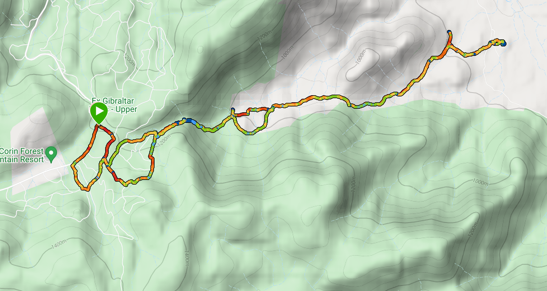
Start point map grid reference: 55H FA 74893 68589
Destination: 55H FA 80286 69556
End Point: Same as start
NOTE: Blythburn Cottage and most of this walk are on privately leased land. We undertook the walk with the leaseholder's permission, for which we express our gratitude.
Route
Description
We started this walk at the point where the Smokers Trail meets the Corin Road. We first proceeded up management trails through native bushland and residual pine plantations to a point at map reference
55H FA 75654 68474. From here we had to find a walking track which headed east paralleling the south side of Punch Bowl Creek. This proved to be more difficult than we hoped since the rock cairn that was supposed to be there has disappeared. Eventually we found it on the eastern side of the management trail slightly up from the point where it turns sharply to the left. It's a bit tricky to pick out initially, but obvious once you see it.

We followed the trail and after a short time started to hear roaring waters ahead: the waterfalls on Punch Bowl Creek.


The trail continues through some very beautiful bushland...

...until it clears to give some more open views to the east.

Eventually the trail comes to a gate at the border of Namadgi National Park, at which point there are some old vehicular tracks leading through the private lease land. We followed these through White Horse Flat and into an open valley. With thistles.

After some looking around we located Blythburn Cottage and paused there for lunch. Blythburn was the home of "pastoralist and poet" Elizabeth McKeahnie, from 1882 until her death in 1919. It's well worth following the link to find out more about this fascinating woman.

We headed back pretty much the same way we had come. A slight glitch at the end where management trails marked on the map leading back down to Corin Road seem to have disappeared over time, and this added a bit of distance to the overall tally.
No comments:
Post a Comment