General Information
Grading: easy
Distance: 8.6 kilometers
Total climb: 218 meters
Time taken: 2 hours 10 minutes
Maps: Canberra 8727-3N 1:25 000 Hall 8727-4S 1:25 000
Start point distance by road from Canberra GPO: 3 kilometers
Start point map grid reference: street address
Destination map grid reference: none
End point: Same as start
Route
Description
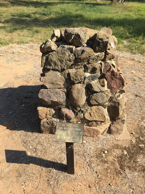
We started this walk at the parking area for Kama Nature Reserve off William Hovell Drive. From there we followed the track up into The Pinnacle Nature Reserve and to The Pinnacle itself. We then headed west and northwest, behind the suburb of Hawker, to an underpass under William Hovell Drive. From there it is a short walk to the historic site of the Weetangera Methodist Church and its cemetery. The site is in far better condition that when I last visited it in 1976.
We were then faced with a choice of going back the way we had come or following William Hovell Drive back towards Kama Nature Reserve. With our aversion to backtracking we decided on the latter. At first we tried to follow the fence line on the west of William Hovell Drive where there was a track of sorts. When this gave way to long, thick grass and drainage ditches we crossed to the other side, only to find much the same conditions there. Reluctantly we had to walk along the roadside back to the Kama parking area. Rather than stop there, however, we decided to quickly do the Kama Dam Walk before heading off for lunch.


No comments:
Post a Comment