Tuesday, 12 March 2019

Canberra Nature Park: Aranda Bushland and Black Mountain

General Information

Grading: easy
Distance:   11 kilometers
Total climb:   390 meters
Time taken:   2 hours 35 minutes
Maps:   Canberra 8727-2N 1:25 000
Start point distance by road from Canberra GPO:   6.4 kilometers
Start point map grid reference:  Canberra 55H FA 89102 96546
Destination map grid reference:   Canberra 55H FA 90789 94434
End point:  Same as start

Route


http://maps.six.nsw.gov.au/

Description

This walk began at the Aranda Shopping Centre in Bandjalong Crescent and, similar to the walk undertaken on 26 February 2019, followed a route through the suburb of Aranda and the Aranda Bushland until just short of Bindubi Street. From there we looped around through more of the Aranda Bushland to the Caswell Drive underpass. On the eastern side of Caswell Drive we proceeded south along the Swampy and Woodland Trails until we reached the Lakeview Trail, where we began a steep and somewhat treacherous climb towards Black Mountain Drive.

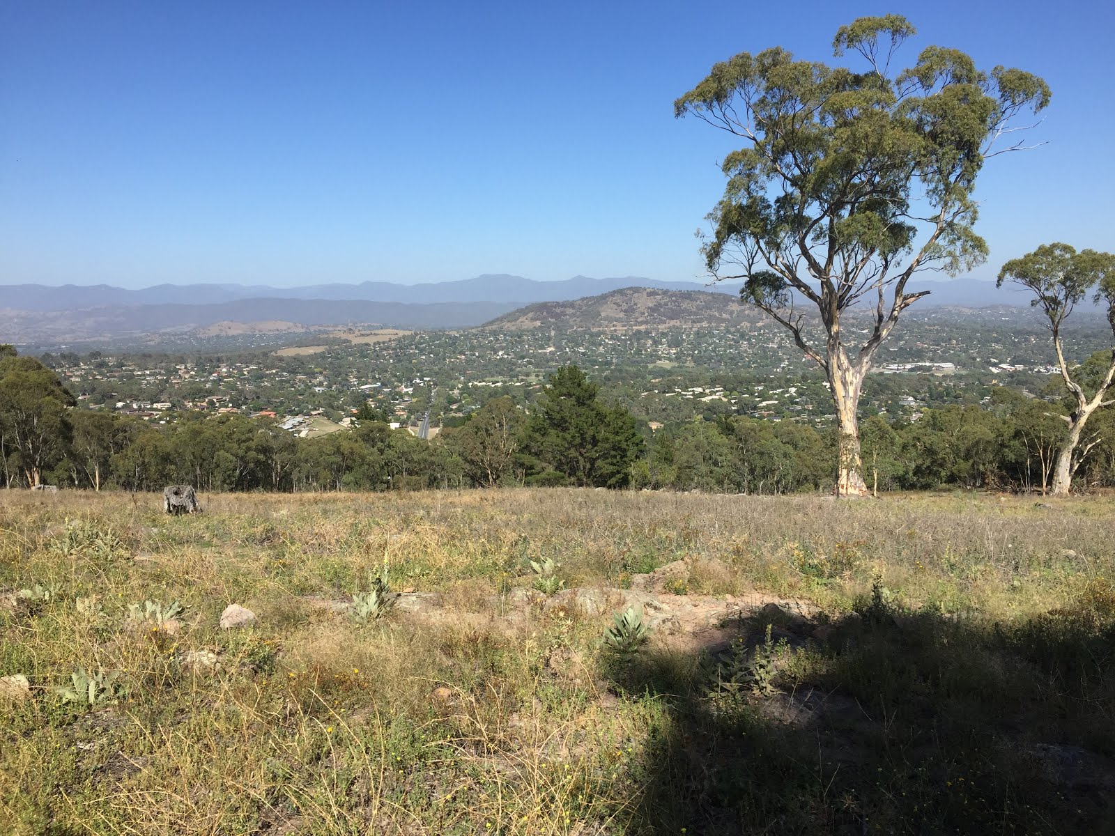
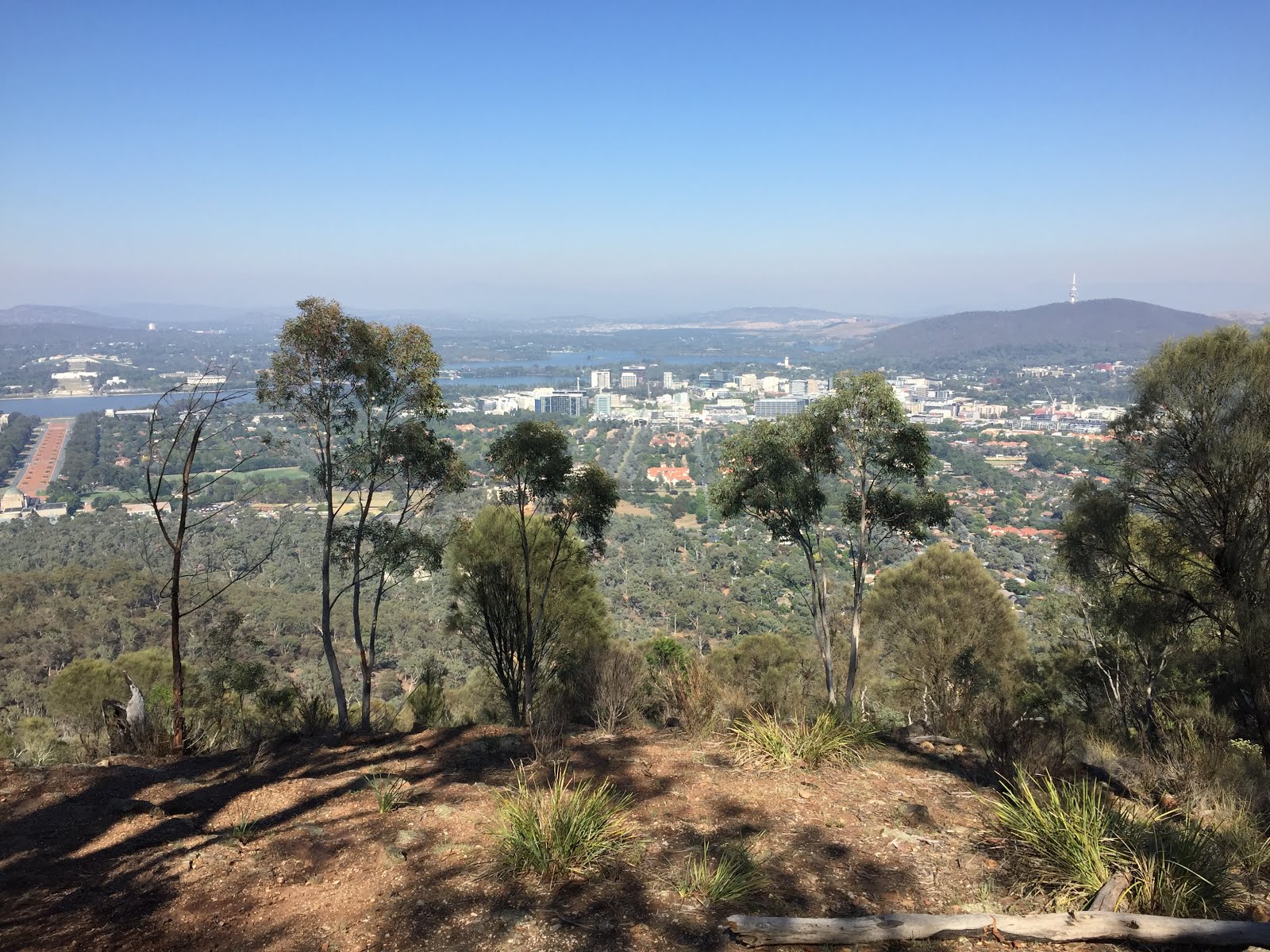
Reaching Black Mountain Drive we crossed over the road and slightly uphill from there we picked up a walking track to the old Black Mountain picnic area where we paused to take in the view.

We continued along a faint walking trail to the summit of the mountain, and then down the northern side, initially via a walking trail and then the Link Trail before turning west back towards Aranda. This time we crossed Caswell Drive via the overpass into Noala Street, Wangara Street and Bandjalong Crescent, back to the Aranda Shops.


Friday, 8 March 2019

Canberra Nature Park: Mount Ainslie Quarries

General Information

Grading:  easy
Distance:   5.5 kilometers
Total climb:   268 meters
Time taken:   2 hours
Maps:   Canberra 8727-2N 1:25 000
Start point distance by road from Canberra GPO:   2.3 kilometers
Start point map grid reference:  Canberra 55H FA 95455 94871
Destination map grid reference:   Canberra 55H FA 96504 94712
End point:  Same as start

Route


http://maps.six.nsw.gov.au/

Description

This walk began at the intersection of Chisholm and Duffy Streets in Ainslie. Initially we went through the bush following a rough path until it ended at a management trail which we followed to the left. Coming to the creek bed shown on the map we again went bush following the dry watercourse to the lookout just below the summit of Mt Ainslie looking south.

Taking the tourist path up to the road around the summit we walked around to the right until we found the path to the first of Mt Ainslie's quarries. Coming from the top of the mountain care is needed when approaching the quarry as there's a bit of a cliff drop to be avoided.

We walked around the top of the quarry to the left...

...quickly reaching the bottom.

To the southwestern side of the quarry is a path which we followed around the mountain before descending to another management trail which we followed until we came across the second quarry site on Mt Ainslie.

From there we went down towards the back of the War Memorial and the old CSIRO building back to where we started the walk.

Tuesday, 26 February 2019

Canberra Nature Park: Aranda Bushland and Mt Painter

General Information

Grading:  easy
Distance:   7.6 kilometers
Total climb:   247 meters
Time taken:   1 hour 40 minutes
Maps:   Canberra 8727-2N 1:25 000
Start point distance by road from Canberra GPO:   6.4 kilometers
Start point map grid reference:  Canberra 55H FA 89102 96546
Destination map grid reference:   Tuggeranong 55H FA 87748 95143
End point:  Same as start

Route


http://maps.six.nsw.gov.au/

Description

This walk began at the Aranda Shopping Centre in Bandjalong Crescent. From the carpark at the rear of the shops we followed a paved path through the suburb of Aranda to a management trail passing to the south of the suburb. Carefully crossing Bundubi Street we continued along another management trail to the south of the suburb of Cook, following this around to the northwest to acquire the main trail to the summit of Mt Painter. Although not quite 750 meters high, Mt Painter provides excellent 360-degree views of Canberra and its surrounds, both on the climb up and on the summit itself.

From the summit we descended via an indistinct trail on the eastern side of the mountain to link up again with the management trail behind Cook. When we reached the bitumen path that runs through Cook we headed southeast along it, passing underneath Bundubi Street via an underpass. taking to management trails once again, we passed through some of the prettiest sections of the Aranda Bushland before reaching the suburb of Aranda once again and returning to the carpark at the shops.

Tuesday, 19 February 2019

Canberra Nature Park: Isaacs Ridge

General Information


Distance:   8.2 kilometers
Total climb:   244 meters
Time taken:   1 hour 50 minutes
Maps:   Canberra 8727-2N 1:25 000
             Tuggeranong 8727-3S 1:25 000
Start point distance by road from Canberra GPO:   14 kilometers
Start point map grid reference:  Canberra 55H FA 91831 84120
Destination map grid reference:   Tuggeranong 55H FA 93032 82608
End point:  Same as start

Route


http://maps.six.nsw.gov.au/


Description


This walk began at the Isaacs Shopping Centre carpark. passing behind the shopping centre we followed the footpath under Julia Flynn Avenue to the edge of the nature reserve. Reaching a management trail we followed it north before starting the fairly steep climb to the top of the ridge. From here there were extensive views towards the Woden Valley.


Continuing along the management trail at the top of the ridge we also had some views of the northern Tuggeranong Valley and the mountains beyond.


Passing a series of transmission towers on top of the ridge we eventually reached our destination, the highest point on the ridge at around 850 meters elevation. The view here was limited, however, by surrounding trees.

From our destination we started the descent back down the ridge to the southwest before heading north again on a management trail. At around map reference 55H FA 92671 82648 (Tuggeranong) we deviated off the management trail to the right, following a very nice walking track running parallel to the management trail. We then followed management trails and suburban streets back to our starting point.

Tuesday, 12 February 2019

Uriarra Forest: Mt McDonald

General Information


Distance:   6.8 kilometers
Total climb:   240 meters
Time taken:   1 hour 40 minutes
Maps:   Cotter Dam 8627-2N 1:25 000
Start point distance by road from Canberra GPO:   26 kilometers
Start point map grid reference:  55H FA 77061 90367
Destination map grid reference:   55H FA 76550 91170
End point:  Same as start

Route

http://maps.six.nsw.gov.au/


Description


This walk began at the small carpark just off Brindabella Road about 2 kilometers north of Cotter Road. From here we followed a neat walking trail uphill until it ended at the Mount McDonald Road which we followed to the Summit of Mount McDonald. From here we had some good 360-degree views, with perhaps the best being towards the Murrumbidgee River near the pumping station...


...and towards Tidbinbilla Reserve.


Leaving Mount McDonald we continued along the road in a generally northwest direction until we came to Crusher Road which we followed south, with some good views of the Cotter Reservoir starting to open up.


Continuing south on Priors Road we eventually met Lookout Road which we followed back to the carpark.

Tuesday, 5 February 2019

Urban Canberra: Parliament House, Red Hill and Embassies

General Information


Distance:   9.5 kilometers
Total climb:   180 meters
Time taken:   2 hours
Maps:   Canberra 8727-3N 1:25 000
Start point distance by road from Canberra GPO:   4 kilometers
Start point map grid reference:  55H FA 92487 91648
Destination map grid reference:   55H FA 92141 88953 (Red Hill)
End point:  Same as start

Route

http://maps.six.nsw.gov.au/


Description


Although this was more of a city walk than a bushwalk I decided it was worth including in this blog. 
The starting point for the walk was the carpark at the Canberra Yacht Club in Mariner Place, Yarralumla. From here we headed via Parliament House to Melbourne Avenue, which we followed to a management road along the base of Red Hill. Picking up a walking track a bit further down the management road we climbed past an electricity station painted to resemble Doctor Who's Tardis towards the lookout at map reference 55H FA 92141 88953. From there we walked back down Red Hill following Hopetoun Circuit past Adelaide Avenue. We then followed Hampton Circuit and Empire Circuit past a number of Embassies and back to the Yacht Club.

Monday, 7 January 2019

Canberra Nature Park: Mt Arawang and Cooleman Ridge

General Information


Distance:   5.5 kilometers
Total climb:   unknown
Time taken:   2 hours
Maps:   Canberra 8727-3N 1:25 000; Tuggeranong 8727-3S 1:25 000
Start point distance by road from Canberra GPO:   18 kilometers
Start point map grid reference:  55H FA 86230 84684
Destination map grid reference:   Mt Arawang 55H FA 85840 84231
                                                     Cooleman Trig 55H FA 84402 85689
End point:  55H FA 83909 86302

Route


http://maps.six.nsw.gov.au/


Description


This walk started on Namatjira Drive, Chapman though to avoid backtracking we had first left another car at the end of Kathner Street. There is a locked gate into the Nature Reserve and a small parking area near this gate. We set off straight up Mt Arawang, which offered views in all directions (apologies for the lack of pictures for this walk). Descending Mt Arawang on the other side we followed management trails in a generally northwest direction, always trying to keep to the more elevated options to avoid unnecessary climbing. Eventually we reached Cooleman Hill on the right and climbed up to the trig for some more views. Continuing down the other side of the Hill we continued on management trails to the car we had left at Kathner Street.

Saturday, 1 December 2018

Murrumbidgee Corridor North of Kambah Pool (1)

General Information


Distance:   9.2 kilometers
Total climb:   unknown
Time taken:   3 hours
Maps:   Tuggeranong 8727-3S 1:25 000
Start point distance by road from Canberra GPO:   19 kilometers
Start point map grid reference:  55H FA 82696 81011
Destination map grid reference:   55H FA 80388 83533 (not reached)
End point:  same as start

Route


http://maps.six.nsw.gov.au/


Description


We started this walk from the Kambah Pool carpark and found the track leading off to the north off Kambah Pool road. The track is very clear and even has distance markers. It starts by heading down into a gully which has to be climbed out again on the other side. before the next gully we changed direction and climbed cross-country to the peak of Forster Hill to take in the view. Coming down Forster Hill on the other side of the gully, we reacquired the walking track and continued on until we had travelled about 5 kilometres. At this point, as our time was limited and I was struggling a bit in the heat, we headed back towards Kambah Pool without getting quite as far as we had intended, following the walking track the entire way back. Just off the track at one point is a rocky outcrop to the west which offers some views over the Murrumbidgee River.

Tuesday, 20 November 2018

Canberra Nature Park: Davidson Hill Trig and Red Hill

General Information


Distance:   8.2 kilometers
Total climb:   300 meters
Time taken:   2 hours
Maps:   Canberra 8627-3N 1:25 000
Start point distance by road from Canberra GPO:   12 kilometers
Start point map grid reference:  55H FA 91628 86904
Destination map grid reference:  Davidson Hill 55H FA 92290 87556
                                                    Red Hill 55H FA 92384 88494
End point:  same as start

Route


http://maps.six.nsw.gov.au/


Description


This walk commenced at The Garran Shopping Centre. The first part of the walk was through suburban Garran Streets to Astley Place, where we were able to access the Red Hill Nature Reserve. Following tracks we ascended Davidson Hill which offered good views of surrounding Canberra.


Continuing on the ridge from Davidson Hill we climbed Red Hill before descending down its western side to the Federal Golf Club. We then did a loop around the Golf Club before returning to Garran Shops via Brereton Street.

Friday, 16 November 2018

Brindabella National Park: Goodradigbee River/Flea Creek Area

General Information


Distance:   9.8 kilometers
Total climb:   570 meters
Time taken:   4 hours 45 minutes
Maps:   Cotter Dam 8627-2N 1:25 000
Start point distance by road from Canberra GPO:   56 kilometers
Start point map grid reference:  55H FA 59838 86629
Destination map grid reference:  exploratory hike - no specific destination
End point:  same as start

Route


http://maps.six.nsw.gov.au/


Description


Our starting point for this exploratory walk was originally going to be the camping area at Flea Creek near its confluence with the Goodradigbee River. This campground is accessed by Gentle Annie Trail off Brindabella Road. Gentle Annie Trail is a very steep and bumpy gravel road, and about halfway down it I had had enough and decided to walk the rest of the way to the campground, and while this added some distance to the walk we were in no particular hurry.
Following Gentle Annie Trail past the Flea Creek campground we continued on to the Goodradigbee River with the intention of following it for some distance if possible. The river at this point is very clear and peaceful, good for swimming and (apparently) fishing.


We first attempted to walk upstream, but were soon thwarted by rocks that we would have had to climb around. Then heading downstream we found it quite scrubby and difficult to negotiate and soon turned back from there too. It became clear that in order to follow the river on the Brindabella National Park side we would have had to move further up the slope, away from the river itself, where it looked like there would be some clearer terrain. Alternatively, the other side of the river seemed to be relatively flat and clear.
Returning to the campground, we started up the Webbs Ridge Trail to Webbs Ridge. This trail is also very steep, gaining 200 meters in the first kilometre of winding road. We had views of the western side of the Brindabella Range, with the cliffs on the southwestern side of Mount Coree prominent.


Eventually climbing above 700 meters elevation, the trail flattens out a bit as it follows Webbs Ridge.


At this stage we decided to head back: a steep descent back down Webbs Ridge Trail and another steep ascent up Gentle Annie Trail back to the car.