Thursday, 15 October 2015

Kowen Pine Forest: Mount Reedy

General Information


Distance: 11.2 kilometers
Total climb: 445 meters
Time taken: 4 hours
Maps:  Canberra 8627-3N 1:25 000; Bungendore 8727-2N 1:25 000
Guide:  link
Start point distance by road from Canberra GPO:  19 kilometers
Start point map grid reference:  55H GA 04479 88164 [Canberra]
Destination map grid reference:  55H GA 05428 90559 [Bungendore]
End point:  same as start


Route


Commentary


This walk started at the Molonglo Gorge picnic area, which is off the Sutton Road approximately 5 kilometers north of Queanbeyan. The 3 kilometer walking trail trough Molonglo Gorge begins here. It is well-marked at the start and very clear along its entire length.


We proceeded east along the walking trail on the north side of the Gorge, with the Canberra-Goulburn railway line across on the other side of the river. The trail starts close to river level, but climbs up the side of the Gorge, giving some good views of the river down below.


At the end of the Molonglo Gorge walking trail is Blue Tiles picnic area, where we stopped for a snack. Apparently there is good swimming here in warmer weather. From Blue Tiles we headed north into the Kowen Pine Forest along wide and clear management trails.


Veering northwest, we picked our way through the 5 kilometers to Mount Reedy (763 meters) on the edge of Kowen Forest. There were some views towards Canberra and Queanbeyan both from the higher management trails and the summit of Mount Reedy.


Leaving the summit we headed southwest along a management trail, but after about 1 kilometer the trail ended unexpectedly - not as it is marked on the map. We were then obliged to cut through the bush into a gully with a creek at the bottom. This was a bit of a scramble and quite a climb back out of the gully, but turned out to be quite picturesque.


At the top of the gully we met up with Kowen Road which we followed to the west before turning south into the road back to the Molonglo Gorge picnic area.


Assessment


Molonglo Gorge is a great short walk in its own right, but it was even better to go on to Mount Reedy than to just backtrack the way we had come. Navigating through the pine forest requires a map with the management trails marked, or wrong turns could easily be taken.

Tuesday, 6 October 2015

Monga National Park: Corn Trail (part)

General Information


Distance: 11.4 kilometers
Total climb: 484 meters
Time taken: 3 hours
Map: Monga 8826-1N 1:25 000
Guide:  link
Start point distance by road from Canberra GPO:  110 kilometers
Start point map grid reference:  55H GA 64832 60829
Destination:  None - hike was exploratory
End point:  same as start


Route


http://maps.six.nsw.gov.au/

Description


The Corn Trail is usually a one-way walk, most commonly from north to south (downhill) although some walkers do it in reverse or as a return hike. As a one-way walk it is necessary to have transport at both ends, which can be quite a logistical hassle since the start and end points are over 32 kilometers distant by road - including 18.5 kilometers of the narrow, winding and gravel Misty Mountain Road and No Name Mountain Road. On this occasion we planned to only walk part of the Corn Trail from north to south and return. The map shows the Corn Trail starting to the south of the Kings Highway at Clyde Mountain, but this access has been closed by the National Parks. The actual northern start point of the walking track is the Dasyurus picnic area. To get to Dasyurus, turn off the Kings Highway into River Forest Road which is just to the west of Clyde Mountain. Approximately 2 kilometers along River Forest Road turn left down a side track to Dasyurus.


The Corn Trail is well marked at Dasyurus, but it is first necessary to cross the Mongarlowe River so waterproof boots are advised.


Just over the river we noticed a grassy area which had obviously been used as a camping area - perhaps useful for a later walk along the full length of the trail. The walking trail itself is well defined, passing first through forest and ferny undergrowth in an easterly direction.


Passing north of Murrenburg Mountain the trail then heads south, joining the map-marked trail around grid reference GA670604. There are occasional views through the forest as you walk along the ridge.


About 5.5 kilometers into the walk, the trail starts its 600 meter descent to its end at No Name Mountain Road. We descended about 100 meters of this before deciding to head back.

This is an excellent walk through a very nice area with an interesting history. After finishing the walk we decided to do its full length north to south a few months later, but we were rained out before we could start the actual walking. It's still on the list, but difficult to organise due to the car placement logistics.

Thursday, 1 October 2015

Deua National Park: Big Hole (2) and Marble Arch

General Information


Distance:  12.6 kilometers
Total climb:  475 meters
Time taken:  4 hours 20 minutes
Map:  Kain 8826-4S 1:25 000
Guide:  link
Start point distance by road from Canberra GPO:  129 kilometers
Start point map grid reference:  55H GA 39292 43340
Destination map grid reference:  Big Hole - 55H GA 40570 42986
                                                    Marble Arch - 55H GA 43468 43196
End point:  same as start


Route


http://maps.six.nsw.gov.au/

Description


The starting point for this hike was the Berlang camping area, which is off Krawaree Road at the Gundillion Cemetery. The camping area is well signposted fro Krawaree Road. Soon after leaving the camping area it is necessary to cross the Shoalhaven River. Since it is shin deep I decided to take off my boots and cross in a pair of thongs (Australian for flip-flops, just in case you were thinking of something else) to protect my feet from the sharp rocks.


The walking trail goes through largely open terrain, steadily climbing up the flank of a hill to the Big Hole viewing platform.


Unfortunately I've never been able to get a satisfactory picture of Big Hole itself, but there is a very good one in the guide referenced above. From Big Hole we continued along the trail, now through forest.


The trail as we followed it actually runs north of the trail as it is marked on the map (but still south of the Bettowynd Fire Trail). About 5.5 kilometers into the walk we started our decent to Marble Arch, which we reached about half a kilometer later. We passed through the arch and the cave beyond until we entered the slot canyon.


We followed the slot canyon until we came on a spring coming out of the limestone wall on the right, where we stopped for lunch. The limestone-filtered water coming out of the spring was pure and very cold.

After lunch we headed back the way we came, the climb out of the gully made easier by steps thoughtfully built in the trail.


This walk is well worth the 115 kilometer drive from my place to Berlang via Captains Flat. Both Big Hole and Marble Arch are striking natural features and are both easily accessible via a well defined walking track.

Tuesday, 29 September 2015

Canberra Centennial Trail: Mulligans Flat to Hall

General Information


Distance: 17 kilometers
Total climb: 462 meters
Time taken: 3 hours 35 minutes
Map:  Hall 8727-4S 1:25 000
Guide:  link
Start point distance by road from Canberra GPO:  17 kilometers
Start point map grid reference:  55H FB 96448 07768
Destination map grid reference:  55H FB 88578 06552
End Point:  same as destination


Route


http://maps.six.nsw.gov.au/

Description


This walk is through two stages of the Canberra Centennial Trail: part of the Watson to Northern Border Campsite stage and all of the Northern Border Campsite to Hall stage. It mainly follows the northern border of the Australian capital Territory (ACT) and New South Wales (NSW). While it is all along a formed trail, some care is needed as the trail is used by fast-moving mountain bikers who can sometimes come around blind corners at breakneck speed. We started the walk at Mulligans Flat Nature Reserve, just off Mulligans Flat Road northeast of the suburb of Forde. The first part of the walk is a climb through the Nature Reserve towards Oak Hill, which is unfortunately on private property on the NSW side of the border. From here the trail follows the ACT/NSW border through the Northern Border campsite, which has some facilities for the hiker, including toilets. About 7.5 kilometers into the walk, the northernmost tip of the ACT is reached and the trail heads southwest towards One Tree Hill, which is reached about 11.5 kilometers into the walk. We ascended One Tree Hill to take in the excellent views of canberra and its environs, which adds about 1 kilometer (and some climbing) on to the total walk. Backtracking from the summit of One Tree Hill, we continued to follow the Centenary Trail to the village of Hall.

This is a very pleasant walk through some nice rural bushland only a short distance from the city. The track is very dry and stony, however, and can be hard on the feet. There is no water along the trail apart from a rainwater tank at the Northern Border campsite, which I suppose could provide drinking water if you have some form of reliable water purification device. I prefer to take plenty of water with me. There are some nice rural and urban views along the trail. If you look carefully along the fence line that marks the ACT/NSW border, some of the original survey markers can still be seen.

Sunday, 20 September 2015

Tomaree National Park: Fort Tomaree and Tomaree Head Summit

General Information


Distance: 2.9 kilometers
Total climb: 150 meters
Time taken: 1 hour
Map:  Port Stephens 9332-4S 1:25 000
Guide:  link
Start point distance by road from Canberra GPO:  490 kilometers
Start point:  
Destination:  
End Point:  Same as start


Route


http://maps.six.nsw.gov.au/

Description


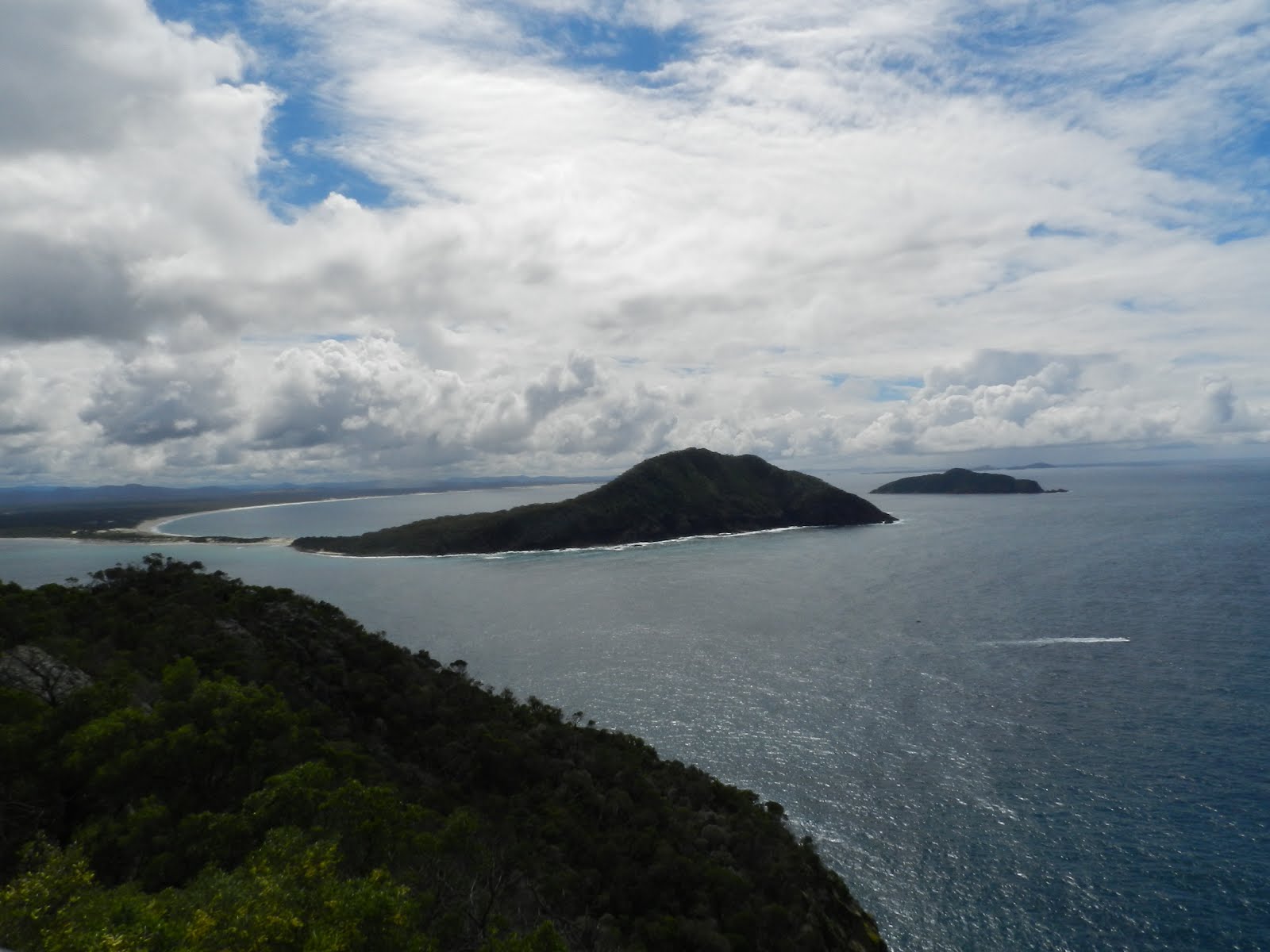
Tomaree Head is the southern head of Port Stephens, north of Newcastle. The start for this walk is accessed from Shoal Bay Road just after the suburb of Shoal Bay. It is along a paved trail with, if I remember correctly, some ladders to be climbed in the steeper sections. The trail is well signposted, so no map or guide is really necessary. We decided to walk to the remains of Fort Tomaree first. This fort was part of the defences of Port Stephens and the Australian coastline during World War II.


We backtracked about 350 meters from the Fort remains to commence the final part of the climb to the Tomaree Head summit. Plenty of excellent views, but lots of people too.


Having taken in the views we headed back to the starting point back down the trail. A great short walk with some historical interest as well as fabulous views. 

Thursday, 10 September 2015

Namadgi National Park: Orroral Heritage Walking Track

General Information


Distance: 12 kilometers
Total climb: 158 meters
Time taken: 3 hours
Map: Rendezvous Creek 8626-1S 1:25 000
Guide:  none
Start point distance by road from Canberra GPO:  61 kilometers
Start point map grid reference:  55H FA 77105 55439
Destination map grid reference:  55H FA 80017 51574
End Point:  Same as start


Route


http://maps.six.nsw.gov.au/

Description


This is a walk through grassland at the southeastern end of the Orroral Valley. It takes in Aboriginal, pioneer and modern sites in the Valley, which are well signposted with informative information boards. We started the walk at the site of the former Orroral Tracking Station and followed the track through grassland littered with grazing kangaroos.


Before long we reached passed old stockyards before arriving at the Orroral Homestead, built next to the ruins of an older homestead.


We continued walking through the valley, eventually crossing the Orroral River via a footbridge and continuing on beside the river to the Orroral campground.


We returned to the starting point by the same route. This is a very nice walk through open grassland with forested hills on either side. There is plenty to see and learn about the history and prehistory of the area.

Tuesday, 18 August 2015

Bullen Range Nature Reserve: Southern Ridge and Pierces Creek Pine Forest

General Information


Distance:  14.8 kilometers
Total climb:  579 meters
Time taken:  3 hours 35 minutes
Maps:  Tuggeranong 8727-3S 1:25 000
Guide:  none
Start point distance by road from Canberra GPO:  34 kilometers
Start point map grid reference:  55H FA 83723 73862
Destination:  Loop walk
End Point:  Same as start


Route


http://maps.six.nsw.gov.au/

Description


We started at the entrance to the Bullen Reserve off Tidbinbilla Road about 1.6 kilometers west of the Point Hut Road intersection. Following the Bullen Range fire trail we started to climb up to the ridge of the Range. We diverted off the fire trail, however, to reach the peak of Barnes Hill, which gave some some good views in all directions.


Continuing along the ridge of the Bullen Range, we passed from open grassland to fairly dense forest on either side of the fire trail.


After hiking almost 5 kilometers we reached the highest elevation on our walk: just over 910 meters (the starting point was at elevation 710 meters). After another kilometer we paused for a break before staring down a very steep management trail on the western side of the range at map reference FA824790. 


Eventually this took us through to a locked gate with "no trespassing" signs, so we followed the fence line south on the Reserve side until we struck the pine forest. Here we were again able to follow management trails through the forest on the western side of Bullen Range back to our starting point. This was a great walk with some excellent views, particularly where it goes through grassland. It is also very easy to access from South Canberra.

Sunday, 9 August 2015

Canberra Nature Park: Shepherds Lookout, Molonglo River Plank Bridge and Uriarra Loop (2)

General Information


Distance:  9.3 kilometers
Total climb:  275 meters
Time taken:  3 hours 15 minutes
Map:  Umburra 8727-1S 1:25 000
Guide:  Marion Stuart, Best Bush, Town and Village Walks in and around the ACT (2012), 
                                     pp.80-83 & 76-79.
Start point distance by road from Canberra GPO:  19 kilometers
Start point map grid reference:  55H FA 809211 97979
Destination map grid reference:  Shepherds Lookout - 55H FA 79899 98441
                                                    Molonglo River plank bridge - 55H FA 78470 98044
                                                    Uriarra Crossing - 55H FA 77646 98169
End Point:  Same as start


Previous Similar Walks

Uriarra Crossing: 11 October 2014

Route


http://maps.six.nsw.gov.au/

Description


I had previously done this walk on 11 October 2014, but it was worth repeating. 
The walk starts at a carpark on the northern side of Stockpile Drive, about 3 kilometres past the entrance to the golf club. There is a well-marked trail here to Shepherd's Lookout, which provides elevated views of a bend in the Murrumbidgee River.


From there the trail continues past the sewage treatment works - not pretty, but at least it doesn't smell! - with continuing views of the river below.


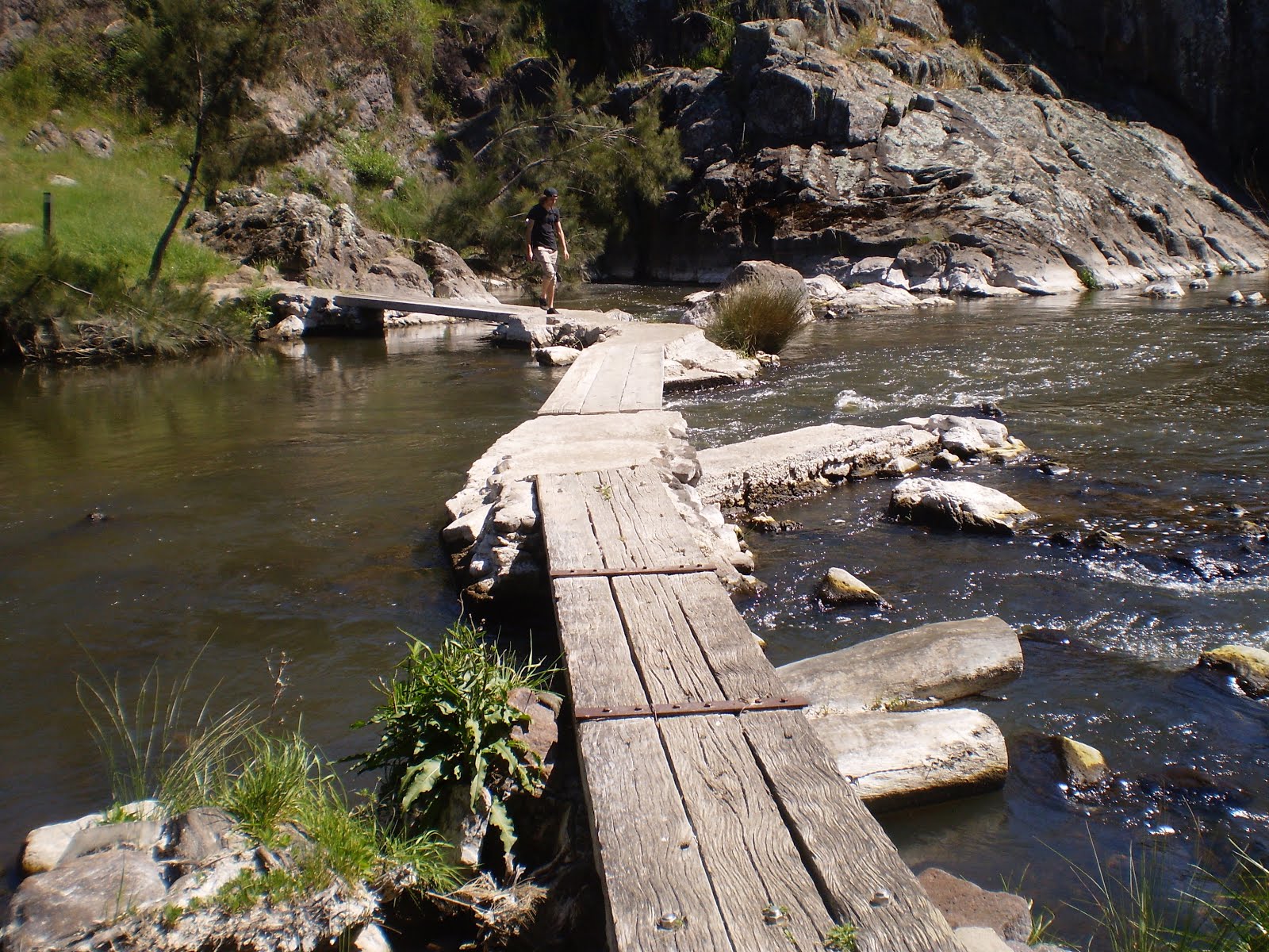
About 2.7 kilometers into the walk, the trail meets the Molonglo River just a bit upstream from where it flows into the Murrumbidgee. A plank footbridge allows hikers to cross the river to the Uriarra Loop.


Crossing the river we turned to the right and cut across to the Murrumbidgee River, which we followed around to Uriarra Crossing. We took the opportunity to have a break at the picnic area south of the Crossing before continuing up the access road form the picnic area to Uriarra Road. Across Uriarra Road is a stile that marks the recommencement of the Uriarra Loop Trail. This brought us back to the plank bridge and the trail back to our starting point.

Leaving aside the sewage treatment works, which is more of an eyesore than an assault on multiple senses, this is a very pleasant walk. It has the advantage of being one of the closest ones to my home. The river views are good, there is enough of a physical challenge in the terrain and opportunities for a swim if it gets too hot.

Tuesday, 28 July 2015

Tidbinbilla Nature Reserve: Lyrebird Trail and Cascades Trail

General Information


Distance: 2.9 kilometers
Total climb: 158 meters
Time taken: 1 hour
Map: Tidbinbilla 8627-2S 1:25 000
Guide:  link
Start point distance by road from Canberra GPO:  49 kilometers
Start point map grid reference:  55H FA 71466 74628
Destination:  Loop walk
End Point:  Same as start


Description


The starting point for the Lyrebird Trail is the Mountain Creek carpark in the west of the Tidbinbilla Nature Reserve, at the end of Mountain Creek Road. The start of the trail is well signposted. The first part of the Lyrebird Trail passes through a wet and cool gully covered in ferns and mosses.


A moderate uphill climb eventually leads to the Cascades Trail on the right.


Continuing up the Cascades Trail you eventually come to its highest point, just over 1 kilometer into the walk, where there is a small cascade in the creek. It is best to leave the trail and get under the overhanging rock to see the cascade at its best.


From there I headed back down the Cascades Trail until it met the Lyrebird Trail near where I left it. Turning right I followed the Lyrebird trail back to the carpark. This is a very good short walk if you only have limited time at Tidbinbilla