General Information
Grading: easy
Distance: 6.9 kilometers
Total climb: 307 meters
Time taken: 2 hours 30 minutes
Map: Mittagong 8929-2S 1:25 000
Start point distance by road from Canberra GPO: 175 kilometers
Start point map grid reference: 56H KG 62016 85533
Destination: none
End Point: Same as start
Route
Description
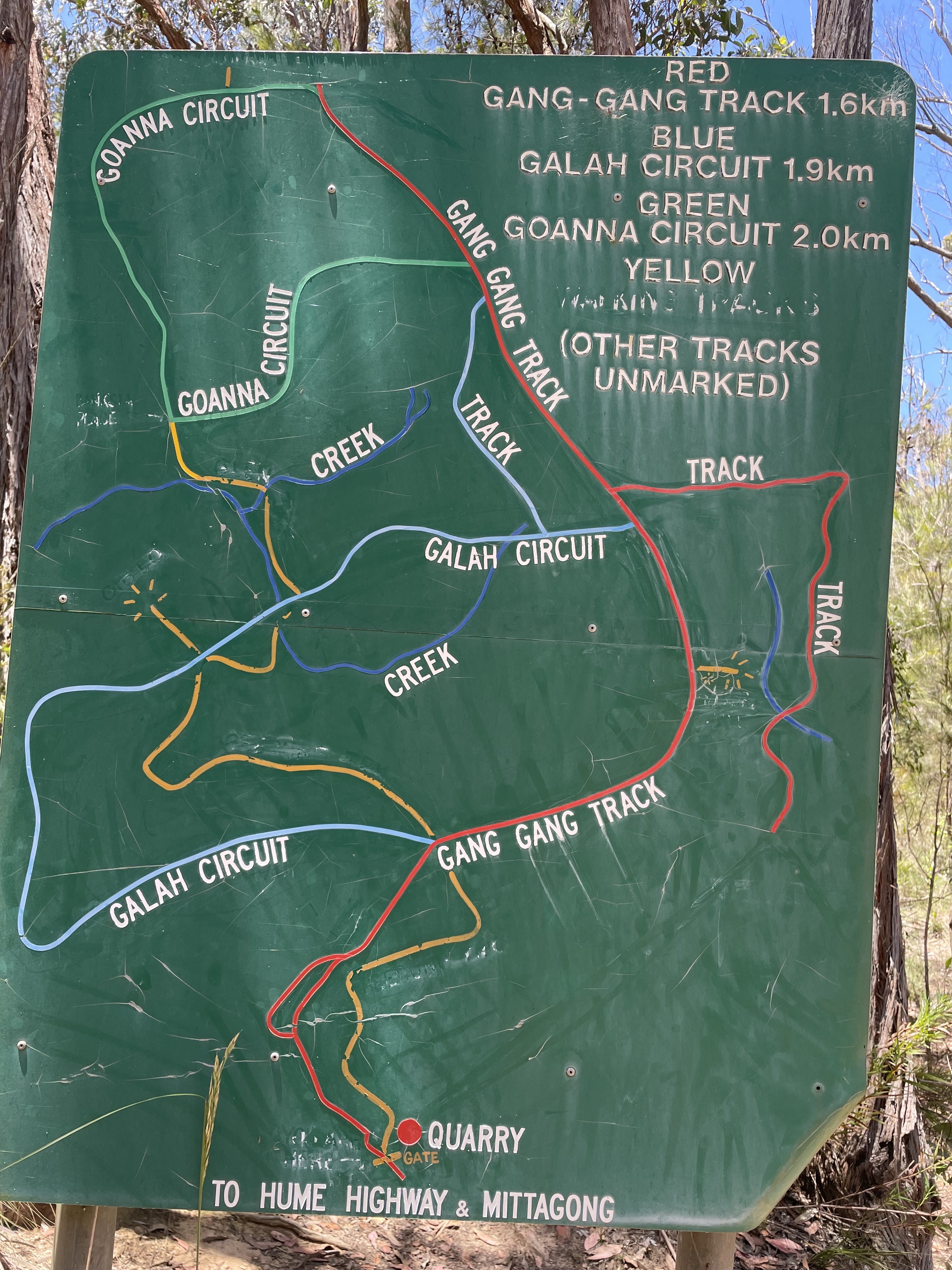
Gibbergunyah is a small reserve that sits between Mittagong and Bowral. It can be accessed from either town, but we started our walk from the Mittagong side. The access point is a locked gate on Howards Way, about 4 kilometers west of the centre of Mittagong. There is a sign here with a map of the walking tracks in the Reserve, and it's a good idea to take a picture of it before setting out. It should be noted that there is traffic noise from the nearby Hume Motorway on the Mittagong side of the Reserve, so this really isn't a walk for people who like the quiet sounds of the bush.
We started up the walking track to the right of the locked gate (shown in yellow on the guide map) and gradually climbed through forest until it met the Gang Gang Track. There were still plenty of wildflowers about, even though it was (notionally) Summer.
We followed the Gang Gang track to the right until we came to a walking trail on the right leading up to Ninety Acre Hill lookout, which has limited views to the northwest.
Returning to Gang Gang Track, we followed it to the end and turned left onto Goanna Track, which we followed around until it turned sharply left. Here we left Goanna Track and followed a walking trail down into a rainforest gully.
Unfortunately we found the trail a bit difficult to follow and soon lost it altogether. We were able to bush bash our way out of the gully and back to the Gang Gang Track, which we followed back to our starting point.


No comments:
Post a Comment