General Information
Grading: easyDistance: 9 kilometers
Total climb: 350 meters (approximate)
Time taken: 2 hours
Start point distance by road from Canberra GPO: 2,517 kilometers (but only 4 kilometers
from Cairns Post Office)
Start point: Red Arrow Walking Track off Collins Avenue, Edge Hill
Destination: Mount Whitfield (364 meters)
End point: same as start
from Cairns Post Office)
Route
Description
Having parked my car along Collins Avenue, not far from Sheridan Street, I started up the beautifully maintained bitumen Red Arrow Walking Track. Coming to the junction where the Red Arrow loops around, I took the right hand fork which led me through thick rainforest and at one point a bamboo thicket.
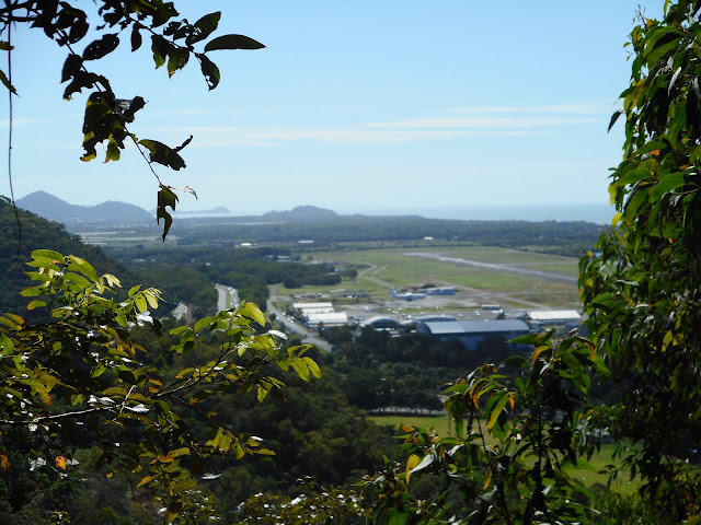
After some heavy climbing I came to a lookout which gave some views northeast towards Cairns Airport and the ocean.
Soon after this point I came to the junction of the Red Arrow and Blue Arrow tracks and followed the Blue Arrow, leaving smooth bitumen for a narrow dirt track crisscrossed with tangled roots providing an excellent tripping hazard.
Coming to a junction where the Blue Arrow loops around, I followed the left hand track and continued climbing through the rainforest until I came to the intersection of the Blue Arrow and Green Arrow tracks. I followed the Green Arrow a short distance up to Mt Whitfield, which I possibly would have missed had it not been for a sign telling me I had arrived.
There are no views from Mt Whitfield, but the star of this walk is more the rainforest than the elevation.
Running a bit short of timeI quickly retraced my steps back along the Green and Blue Arrows to the Red Arrow. I turned right at the Red Arrow to take me down the un-walked section back to the parked car.


No comments:
Post a Comment