Saturday, 23 March 2024

Tarlo River National Park: Exploration of Areas South and North of Towrang Road

General Information


Grading:  medium
Distance:   8.9 kilometers
Total climb:   343 meters
Time taken:   3 hours 45 minutes
Map:  Chatsbury 8828-1N 1:25 000
Start point distance by road from Canberra GPO:   123 kilometers
Start point map grid reference:  55H GB 69327 69324
Destination map grid reference:  no specific destination
End point:  same as start

Route


Description

The Tarlo River National Park is difficult to access, with only one public road (Towrang Road) passing through a small part of the Park's south eastern extremity. A good starting point for walking in Tarlo River National Park north or south of Towrang Road is where it meets the Quarry Trail, only a few hundred metres inside the Park. This is where we started.

We decided to explore the area south of Towrang Road first, and made our way along Towrang Road for about 350 metres before heading into the bush. It wasn't long before we came across the first of the Permian conglomerate outcrops which are a feature of this area.
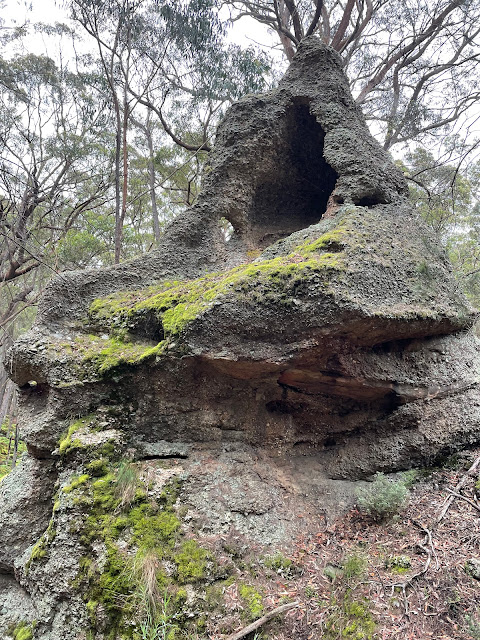
These can be found around the numerous steep, but easily accessible gullies that pervade the area. The bottoms of most gullies are covered in thick ferns, and care needs to be taken when walking through it as it obscures fallen trees and other hazards.

We headed generally south, going down into one gully and back again up the ridge before the next gully. The ridges were dry forest and the walking around them was very easy.

Reaching as far south as we wanted to go, and wanting to leave some time to explore north of the road, we turned around and navigated to the Yururga Trail which we followed back to Towrang Road and our starting point. Stopping for lunch here, we then went into the northern section and had a bit of a look around. It was also a series of ridges and gullies, but less interesting than the southern section.
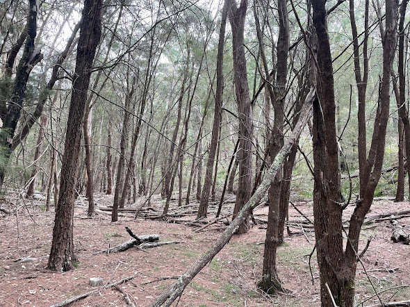
After exploring for only a relatively short distance we decided to return to our starting point, although by a different route.

It might be useful in the future to spend a day walking north of Towrang Road to see how far we could get into the main area of the Park. 

Saturday, 2 March 2024

Hume and Hovell Walking Track: Along Micalong Creek to Micalong Creek Camp Ground

General Information


Distance:   15.3 kilometers
Total climb:   363 meters
Time taken:   4 hours 26 minutes
Map:  Bobbys Plains 8627-3N 1:25 000
Start point distance by road from Canberra GPO:   90 kilometers (via Brindabella)
Start point map grid reference:  55H FA 39856 94716
Destination map grid reference:  55H FA 43189 98472
End point:  same as start

Route


Description

This walk starts at the Bossowa Campsite, about 1 kilometer north of Brindabella Road on Micalong Creek. We started the walk by crossing the footbridge over the creek and following the trail around to the north east. Before long we came to a ford with some stepping stones and went back to the original side of the creek. The crossing was not easy as the rocks were irregular and slippery in places.

From here we followed the Hume & Hovell Track signs. At first we were walking along a vehicular trail which paralleled Micalong Creek. Pine forest was on the right, with native bush and views of the creek on the left.

At map reference 55H FA 41486 96674 the rack narrows to a walking trail which winds through a narrow gully above the creek with some great views.


The trail crosses over the creek, normally by a footbridge which was not at its best when we were there:

Nevertheless, we were able to cross and continue following the trail signs to the Micalong Creek Camp Ground, which is right on a very nice part of the creek.

Unfortunately the camp ground itself was a bit disappointing, with structures graffitied and items of rubbish left around.

We returned to the starting point by much the same route, but took the more direct trail at the end.

Wednesday, 24 January 2024

Canberra Nature Park: The Pinnacle and Mt Painter

General Information

Grading:  easy
Distance:   9.2 kilometers
Total climb:   341 meters
Time taken:   3 hours
Maps:   Canberra 8727-3N 1:25 000
Start point distance by road from Canberra GPO:   9.4 kilometers
Start point map grid reference: 55H FA 86284 96432
Destination map grid reference:  Mt Painter - 55H FA 87754 95142
                                                     The Pinnacle - 55H FA 85674 96486
End point:  same as start
 

Route


Description

This walk starts at the parking area off Springvale Drive near De Salis Street.

Entering The Pinnacle Reserve, I followed the Bicentennial National Trail to the left and down to Coulter Drive. I walked down  Coulter Drive and then turned off onto the trail up to the summit of Mt Painter. Returning back to The Pinnacle Reserve the same way, I did a clockwise loop around the Reserve, stopping at The Pinnacle itself before heading back to the starting point.

Thursday, 2 November 2023

Brindabella National Park: Devils Peak

General Information

 
Grading:  medium
Distance:   4.9 kilometers
Total climb:   268 meters
Time taken:   3 hours 30 minutes
Maps:   Cotter Dam 8627-2N 1:25 000
Start point distance by road from Canberra GPO:   48 kilometers
Start point map grid reference:  55H FA 66441 95586
Destination map grid reference:   55H FA 66448 94353
End point:  Same as start

Route


Description

This walk started at a point on Two Sticks Road under some power lines about 1.5 kilometers from the intersection of Two Sticks Road and Blue Range Road. We headed straight into the bush, which was quite thick and difficult to walk through, with virtually no hope of being able to walk in a straight line.


As we were walking the terrain kept turning us to the right, so we decided to make for the lesser peak to the north west of Devils Peak. This was not a bad decision since it gave us some good views to the north and west.

We then turned south east towards Devils Peak. We arrived at the actual peak itself, but it was thickly forested and gave no decent views. We continued south east, however, until we came to the rock face looking east, and there were great views towards Mount Blundell and Mount Coree.


We returned to our starting point pretty much the same way (but obviously not going back up the lesser peak we had climbed earlier).

Thursday, 26 October 2023

Yanununbeyan State Conservation Area: Spring Creek Gorge

General Information


Grading:  medium
Distance:   10.2 kilometers
Total climb:   407 meters
Time taken:   4 hours  20 minutes
Maps:   Captains Flat 8726-1N 1:25 000
Start point distance by road from Canberra GPO:   50 kilometers
Start point map grid reference:  55H GA 13034 63448
Destination map grid reference:  55H GA 12805 60486
End point:  same as start

Route


Description

I had previously done a version of this walk on 14 September 2018 (link), but this later route was considerably easier and arguably more interesting. As on the previous walk, we started at the day use area carpark off Woolcara Lane about 14 kilometers south of Captains Flat Road. We first climbed the ridge to the summit of Corner Hill and followed the Corner Hill Fire Trail to the south. Just before the ridge we were on started to get steeper as it approached the Queanbeyan River, we headed east and then south through some moderately difficult terrain (but not as difficult as the previous route following the river).

Eventually we found ourselves on a ridge line taking us due south towards our destination. This was easy walking through dry forest. The most interesting sight was a rusty old truck in the middle of nowhere partly crushed by a fallen tree.

Eventually the ridge we were on fell down towards the river and with a bit of a final steep descent we were in the Spring Creek gorge.


We paused in the gorge for lunch and then climbed out the same way we had climbed down. We made our way to another ridge further to the east of the one we had followed to get to the gorge, and this took us north to Woolcara Lane. We walked along Woolcara Lane back to our starting point.

Thursday, 19 October 2023

Namadgi National Park: Gorilla Rock

General Information

Grading : medium
Distance:  6.6 kilometers 
Total climb:  176 meters
Time taken:  2 hours 30 minutes
Map:  Corin Dam 8626-1N, 1:25 000 
Start point distance by road from Canberra GPO:  53.3 kilometers 
Start point map grid reference:  55H FA 78933 60480
Destination map grid reference:  55H FA 78676 62527
End point:  same as start

Route


Description

This walk starts from the Honeysuckle Creek Camping Ground near the end of Apollo Road. We first followed the walking track towards Booroomba Rocks. At map reference 55H FA 79161 61901, where the track crosses a creek, we headed bush pretty much in a straight line towards Gorilla Rock (which can't be seen until you are close to it). The bush wasn't too bad to fight through, and we eventually found what we were looking for.

 
After a look around, we headed back the same way we had come.
 

Thursday, 21 September 2023

Uriarra: Blue Range

General Information

 
Grading: hard
Distance:   18.2 kilometers
Total climb:   737 meters
Time taken:   4 hours 25 minutes
Maps:   Cotter Dam 8627-2N 1:25 000
Start point distance by road from Canberra GPO:   37 kilometers
Start point map grid reference:  55H FA 70471 92950
Destination map grid reference:   no specific destination
End point:  Same as start

Route


Description

This walk started at the locked gate before the Blue Range Hut Camping Ground. We started by heading north, intending to visit the Sherwood daffodils, but after we turned off to the right we found that the Sherwood area was closed due to feral animal culls and we had to retrace our steps to One Stick Road. We then started climbing up towards Blue Range, at first to the west and then veering round more to the north-east, following whichever trail looked to be promising. Crossing the ACT/NSW border we found ourselves eventually on Genges Trail, which meanders along Blue Ridge. We followed Genges Trail for some distance until it ended at Blue Range Road, which we then followed back down the range. There were some great views to the east along the way from both Genges Trail and Blue Range Road.


We then followed whatever trails seemed to take us in the right direction until we came back to our starting point.
 

Tuesday, 12 September 2023

Uriarra: Two Sticks Hill and Lower Blue Ridge

General Information

Grading: hard
Distance:   16.5 kilometers
Total climb:   717 meters
Time taken:   3 hour 50 minutes
Maps:   Cotter Dam 8627-2N 1:25 000
Start point distance by road from Canberra GPO:   32 kilometers
Start point map grid reference:  55H FA 74137 95543
Destination map grid reference:   55H FA 71375 95817
End point:  Same as start

Route


Description

This walk started at a small carpark just off Mountain Creek Road 1.5 kilometers north of Uriarra Road, my usual starting point for the Sherwood Daffodils walk. Proceeding through the gate at the carpark I climbed to the top of the ridge. Passing the dam and the fence I turned off on to the rougher track to the right through the trees:


This track took me to the power lines and gave some good views to the south and east.


Past the power lines the trail follows the border of the pine plantation and becomes less distinct. Recently fallen pine trees cover the trail in a number of places. After a short distance the trail turns sharply to the west and I gradually made my way back to Sherwood Road, which I followed past the turnoff to the daffodils and over the locked gate. Keeping to the right I followed the track on the western side of Two Sticks Hill, looking for a place to climb to the summit. At map reference 55H FA 71059 96088 I found this place, which looked promising enough to try:


It was a very steep climb, but it did take me up to the NSW/ACT border marker, and past that to the rather unimpressive summit of Two Sticks Hill.


I descended the same way, which was quite tricky and treacherous given the gradient and loose surface. Back at the main track I continued north to a locked gate where I turned left up a very rough and steep trail, where I had a rare sighting of a lyrebird. This trail turned around to the south, following the base of Blue Ridge. At first the track was rough, steep and slippery, but soon became a well-maintained management trail. This trail proved to be one of the highlights of the walk: beautiful native bush and all I could hear was birds and my own footsteps. It helped that by this time the sun had come out.


I continued south along this trail until I came to map reference 55H FA 70149 94632, where I turned left and followed that trail to One Stick Road and West Knob Road, which took me back to Sherwood Road and my starting point at the carpark.


Thursday, 27 April 2023

Canberra Nature Park: Gossan Hill Nature Reserve

General Information

Grading:  easy
Distance:   9.2 kilometers
Total climb:   216 meters
Time taken:   1 hour 50 minutes
Maps:   Canberra 8727-3N 1:25 000
Start point distance by road from Canberra GPO:   6.3 kilometers
Start point map grid reference: street address
Destination map grid reference:  Gossan Hill - 55H FA 89735 97589
End point:  same as start
 

Route


Description

I started this walk from the Aranda shops in Bandjalong Crescent, Aranda, partly because it would be easy to park there, and partly because I wanted to extend the length of the walk to get to my preferred length of at least 10 kilometers. Parking was a bit more difficult than I had anticipated because it was school drop-off time. And I came up a few hundred meters short of the 10 kilometer mark.

From Bandjalong Crescent I walked down a pathway towards the Aranda playing fields and crossed Belconnen Way via the pedestrian footbridge. From there I turned left up towards Bitumen Track (aptly named) and then turned off onto Urban FT and Radford FT (tracks in the Reserve are pretty well signposted). I then took the Gossan Six FT up to a 667 meter lookout with views to the west.


Continuing past the lookout I turned right on to Gossan Seven FT where I had my first look at Gossan Hill and some views to the north and east.


At the end of Gossan Seven FT I turned left on to Middle FT, which took me to College Street near Radford College. Going bush, I followed the Radford College fence line until it took me back to Radford FT and Gossan One FT which parallels Haydon Drive. Again to extend the walking distance I crossed Haydon Drive and walked the trails behind Calvary Hospital. Near the Calvary parking station I had to go bush again. It probably would have been better to head towards Gungahlin Drive and then down to the track next to Belconnen Way.

I eventually made it back to where I started the Calvary Hospital deviation and walked up Urban FT and Middle FT to the top of Gossan Hill (at 669 meters the highest point of the walk. There wasn't much to look at there, and even the kangaroos seemed surprised that I even took the trouble.


From the summit I went back to Gossan Three FT and headed downhill to Urban FT, which took me back to the Bitumen Track near where I had left it. I decided to follow the Bitumen Track to the right (just to see what was there) and was rewarded with this view:


From there I headed back towards my starting point, taking a few deviations (again, just to see what was there).


Thursday, 6 April 2023

Kowen Forest: Glenburn Heritage Precinct

General Information

Grading:  easy
Distance:   11.9 kilometers
Total climb:   236 meters
Time taken:   2 hours 30 minutes
Maps:   Bungendore 8727-2N 1:25 000
Start point distance by road from Canberra GPO:   24.7 kilometers
Start point map grid reference: 55H GA 11271 87328
Destination map grid reference:  none
End point:  same as start
 

Route


Description

This walk started at a small car parking area before the gate on Charcoal Kiln Road, just off the Kings Highway about 200 meters past the ACT border. There is a map just inside the gate showing a number of walking options in the historic precinct, but I chose the Precinct Loop Trail and decided to do it counter-clockwise, although I have since done it in the other direction as well. The walk is pretty well signposted.

I started walking up Charcoal Kiln Road and after a bit over 3 kilometers came to the Glenburn Homestead area. There is a mown path off to the right which loops around the homestead passing by the shearing quarters and shearing shed, the Colverwell grave site and the homestead itself.


After getting back to Charcoal Kiln Road I continued past the Kowen school and the charcoal kiln sites. After the gate I turned south and followed River Road, which follows Glen Burn Creek to its junction with the Molonglo River. I continued along River Road until map reference 55H GA 08684 88952 where I turned to the right to view the Coppins Homestead ruins.


I then backtracked to map reference 55H GA 09133 89181where I turned off River Road and crossed Glen Burn Creek. At the top of the next rise I had a great view of Colliers Homestead ruins in the distance, and soon came to the ruin itself.


I continued to follow the signs to Mt Atkinson, and from there back to Charcoal Kiln Road and the car park.