Saturday, 23 April 2022

Kosciuszko National Park: Charlotte Pass to Guthega [and return]

General Information

Grading:  medium
Distance:    19 kilometers
Total climb:    660 meters
Time taken:   4 hours 30 minutes
Maps:   Perisher Valley 8525-2S  1:25 000
Start point distance by road from Canberra GPO:   220 kilometers
Start point map grid reference:  55H FV 19089 67358
Destination map grid reference:  55H FV 23213 73018
End point:  same as start
 

Route


Description

This new walking trail is the first section of the planned Snowies Alpine Walk.

We started at Charlotte Pass, and at the car park walked down the very steep track towards the Snowy River below. The start of the trail to Guthega begins on the right, a few hundred meters before the river. Much of the initial section is along raised metal causeway following along beside the Snowy River.


After a while the track starts to go up and down and through some nice stands of gum trees

Perhaps the highlight of the walk is the suspension bridge over Spencers Creek.


The track also passes beside the Illawong Bridge over the Snowy River and Guthega Dam before taking you into Guthega itself.


My walking companion (actually my wife) was pretty worn out by the time we reached Guthega, so she stayed behind in the cafe while I walked back to Charlotte Pass to fetch the car. The climb up from the Snowy River to the Charlotte Pass car park was a killer at the end of such a long walk.

Thursday, 21 April 2022

Namadgi National Park: Honeysuckle Creek Tracking Station Site to Booroomba Rocks

General Information

Grading : medium
Distance:  12.9 kilometers 
Total climb:  405 meters
Time taken:  4 hours
Map:  Corin Dam 8626-1N, 1:25 000 
Start point distance by road from Canberra GPO:  53 kilometers 
Start point map grid reference:  55H FA 79143 60486
Destination map grid reference:  55H FA 81967 62279
End point:  same as start

Route


Description

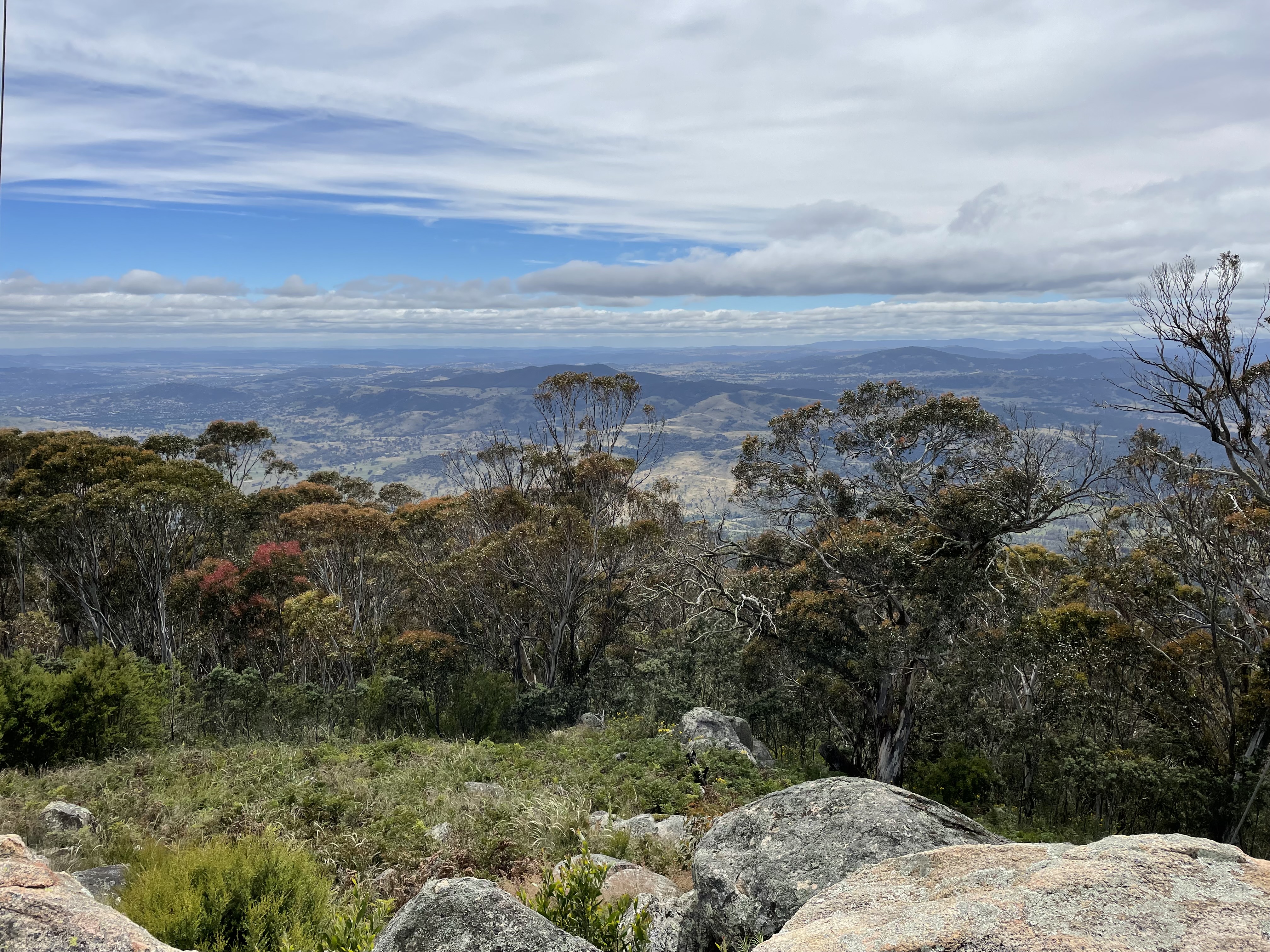
This walk began at the Honeysuckle Creek Tracking Station site car park at the end of Apollo Road. We walked down to the campsite and turned off onto the walking track towards Booroomba Rocks at map reference 55H FA 78928 60481. This is a very picturesque and easy-to-follow track that took us to the Booroomba Rocks car park. We then followed the track up to Booroomba Rocks and took in the magnificent views:


We returned to our starting point by the same route.

This is a great way of extending the otherwise short walk to Booroomba Rocks from the Booroomba Rocks car park. Sadly and inexplicably I failed to take any pictures of the track from Honeysuckle to Booroomba. My bad.

Monday, 18 April 2022

Corin Forest: Smokers Trail to Orroral River

General Information

Grading : hard
Distance:  22 kilometers 
Total climb:  795 meters
Time taken:  5 hours 50 minutes
Map:  Corin Dam 8626-1N, 1:25 000 
Start point distance by road from Canberra GPO:  51.5 kilometers 
Start point map grid reference:  55H FA 73687 67792
Destination map grid reference:  55H FA 72960 61299
End point:  same as start

Route


Description

This walk began at the Square Rock car park just off Corin Road. We initially followed the walking trail towards Square Rock. At map reference 55H FA 72421 66150 there is a link track off to the left that takes you down to the Smokers Trail, and we followed this. When we reached Smokers Trail we turned right and followed it alongside a creek with a number of small waterfalls. As we neared the ridge above Orroral Valley there was plenty of evidence of damage from the 2020 bushfire.


We descended along Smokers Trail down to the Orroral River at the head of Orroral Valley. While the crossing is rather nondescript, the river itself is quite pretty.


Pausing here for some lunch, we then made our way back up Smokers Trail. Instead of walking back up the link trail to the Square Rock track, we continued along Smokers Trail until we came to a marker directing us back to the car park. This turned out to be a rather interesting walking track, quite narrow and treacherous in some places, but through some very pretty bushland.

This took us back to our starting point.

Tuesday, 28 December 2021

Namadgi National Park: Mt Tennent

General Information

 
Grading: Hard
Distance:  13.9 kilometers
Total climb:  805 meters
Time taken:  4 hours
Map:  Williamsdale 8726-4N, 1:25 000
Start point distance by road from Canberra GPO:  36 kilometers
Start point map grid reference:  55H FA 87286 66083
Destination map grid reference:  55H FA 85340 64040
End point:  same as start
 

Previous Similar Walks

2 April 2016, 7 August 2016

Route


Description

It having been some time since I'd climbed Mt Tennent from the Namadgi Visitor Centre, and since the new section of walking trail had recently opened, I decided to try it again. The first section of track, up to the top of the ridge, was unchanged and included the view from Cypress Pine Lookout:

At the top of the ridge I followed the new walking track to the summit. I returned via the old route down the management trail and along the ridge, and then straight back down the mountain again.

Tuesday, 23 November 2021

Ginninderry Conservation Corridor: Strathnairn to Shepherd's Lookout

General Information

Grading : easy
Distance:  7.1 kilometers 
Total climb:  114 meters
Time taken:  1 hour 20 minutes
Map:  Hall 8727-4S 1:25 000 and Umburra 8727-1S 1:25 000
Start point distance by road from Canberra GPO:  15 kilometers 
Start point map grid reference:  55H FA 81451 99526
Destination map grid reference:  55H FA 79900 98440
End point:  same as start

Route


Description

This walk began at The Link Community and Information Centre in McClymont Way, Ginninderry Village. It is along a newly constructed walking trail which is signposted, easy to follow and quite scenic. There are even a few artworks along the way. The best description of the walk is in the pictures:


The track is fairly flat and there are a few stiles to climb over. Parts of the track can also be muddy, I found. You may encounter livestock along the trail too, as the land it passes through is used for grazing: I had to make my way through a large herd of cattle near the start of the walk.

Thursday, 18 November 2021

Gibraltar Pines and [Not Quite] Punch Bowl Creek Falls

General Information

Grading : medium
Distance:  7.2 kilometers 
Total climb:  314 meters
Time taken:  2 hours
Map:  Corin Dam 8626-1N, 1:25 000 
Start point distance by road from Canberra GPO:  49 kilometers 
Start point map grid reference:  55H FA 74894 68592
Destination map grid reference:  55H FA 76117 68607
End point:  same as start

Route


Description

This walk began at the Smokers Trail car park just off Corin Road. We walked straight up the hill from the car park and turned left at the top. This took us on a loop trail through some very nice grassy native bushland.

Looping back around to the southwest, we made our way to Punch Bowl Creek, but due to a navigational error on my part ended up climbing a very steep hill after we had crossed the creek, which we then had to walk down again. At roughly map reference 55H FA 75649 68431 we eventually found the beginning of the walking track down Punch Bowl Creek. This track is quite difficult to find by sight, which is why we ended up unnecessarily climbing the hill.

Making our way along the track we were confronted with a newly-built fence going right across the track.

Assuming that this was a less-than-subtle form of saying "No Access", we decided to turn back short of the falls. [After the walk I asked the Parks people why the track had been closed, only to be informed that it was meant only to keep livestock out, not interfere with walkers, and that a gate allowing access was to be put in. This gate has now been constructed.]

Making our way back to the start of the walking track we decided not to climb that steep hill again, but went up another trail that parallels it on the west. This proved much easier. We then looped back to the starting point along randomly selected management trails.

Wednesday, 6 October 2021

Tidbinbilla Nature Reserve: Spur 1 Trail to Camelback Fire Trail

General Information

Grading : easy
Distance:  9.33 kilometers 
Total climb:  460 meters
Time taken:  2 hours 15 minutes
Map:  Tidbinbilla 8627-2S, 1:25 000 
Start point distance by road from Canberra GPO:  47 kilometers 
Start point map grid reference:  55H FA 73043 74179
Destination map grid reference:  55H FA 71866 75588
End point:  same as start

Route


Description

I began this walk at the Koala Enclosure car park just off Tidbinbilla Reserve Road. I walked back along the road until I saw a track off to the left and followed that in a generally northeast direction through a mix of management facilities for the Reserve and some very nice bushland.


This turned out to be the Man on Horse Trail, which I followed until I turned left at the Spur 1 Trail. This trail is relatively steep in some places, but gave some views of the Tidbinbilla Range as I climbed.


Eventually I reached the Camelback Trail, and briefly considered bush bashing my way through to Red Hill, off to the southeast from there. I decided against it due to the fact that I was on my own (never a good idea while bush bashing in unfamiliar terrain where nobody knew I might be going) and thickening scrub.


So instead I walked back down the Spur 1 Trail and the Man on Horse Trail until I reached Tango's Track on the right (this is signposted - photographed below on the way up). 

I followed Tango's Track back to Mountain Creek Road, and from there back to the start point.


Thursday, 8 July 2021

Namadgi National Park: "Legoland"

General Information

Grading : medium
Distance:  11.1 kilometers 
Total climb:  424 meters
Time taken:  3 hours 
Map:  Corin Dam 8626-1N, 1:25 000 
Start point distance by road from Canberra GPO:  53.3 kilometers 
Start point map grid reference:  55H FA 79072 60456
Destination map grid reference:  55H FA 76329 58623
End point:  same as start

Route


Description

"Legoland" is the unofficial name given to the series of block-like rocky outcrops on the ridge east of Orroral Valley.
 
The walk began at the Honeysuckle Creek Observatory site at the end of Apollo Road. From there we made our way to the Orroral Ridge Road, taking us through bushland recovering from the bushfire 18 months ago.
 
 
The Orroral Ridge Road itself is in excellent condition and this made for easy walking although it was moderately steep in some places. It was nice to walk along Honeysuckle Creek for some of the trail.


Continuing past the turnoff to the Orroral Valley link track on the left we eventually reached the carpark on the top of the ridge at 55H FA 76822 58304. I continued along a walking track along the ridge to the peak at 55H FA 76329 58623, but getting a view was difficult because it meant climbing over or walking around huge boulders. I'm not a huge fan of rock climbing. Nevertheless I managed to find a view down into the Valley and across to Cotter Rocks.


Returning to the ridge-top carpark I followed another short trail to the nearby rock outcrop where we found a rocky vantage point giving a spectacular view down the valley. We were able to clearly discern the old tracking station, the homestead and the geodesic dome.


After having a spot of lunch and admiring the view we headed back to our starting point by the same route.

Tuesday, 6 July 2021

Canberra Nature Park: Molonglo Gorge Nature Reserve

General Information

Grading: easy
Distance: 7.9 kilometers 
Total climb: 344 metres 
Time taken: 3 hours
Maps:  Canberra 8627-3N 1:25 000; Bungendore 8727-2N 1:25 000 
Start point distance by road from Canberra GPO:  19 kilometers 
Start point map grid reference:  Canberra 55H GA 04479 88164 
Destination map grid reference:  Bungendore 55H GA 06798 87761 
End point:  same as start

Route


Description

This was essentially the same as the walk completed on 6 November 2020 (link).

Sunday, 20 June 2021

Tidbinbilla Nature Reserve: Tidbinbilla Mountain

General Information

Grading: hard
Distance:  7.9 kilometers 
Total climb:  772 meters 
Time taken:  4 hours 12 minutes 
Map:  Tidbinbilla 8627-2S, 1:25 000 
Start point distance by road from Canberra GPO:  52 kilometers 
Start point map grid reference:  55H FA 71471 74628 
Destination map grid reference:  55H FA 69509 75951 
End point:  same as start

Route


Description

This was essentially the same as the walk I completed on 7 December 2019 (link).