Tuesday, 28 October 2014

Canberra Nature Park: One Tree Hill (1)

General Information


Distance: 7.2 kilometers return
Total climb: 232 meters
Time taken: 1 hour 50 minutes
Map:  Hall 8727-4S, 1:25 000
Guide:  ACT Centenary Trail - link
Start point distance by road from Canberra GPO:  15 kilometers
Start point map grid reference:  55H FB 88578 06552
Destination map grid reference:  55H FB 90528 09191
End point:  same as start


See blog for later identical walk on 23 July 2016.

Tuesday, 21 October 2014

Tidbinbilla Nature Reserve: Devils Gap

General Information


Distance:  4 kilometers
Total climb:  190 meters
Time taken:  about 1 hour
Map:  Tidbinbilla 8627-2S, 1:25 000
Guide:  link
Start point distance by road from Canberra GPO:  46 kilometers
Start point map grid reference:  55H FA 79265 73679
Destination map grid reference:  55H FA 75293 72706
End point:  same as start


Route


http://maps.six.nsw.gov.au/

Description


This walk starts at the Devils Gap carpark on the eastern side of the Tidbinbilla ring road. From the carpark I followed the Devils Gap fire trail in a short but steep climb up to Devils Gap. There were some views along the way, although most of the walk was through fairly thick forest.


From Devils Gap it is possible to go on for about 1 kilometer to reach Corin Road near Woods Reserve. As I had tacked this walk onto an already full day of walking, however, I decided to stop at Devils Gap and return the same way. While this isn't a particularly scenic walk, the climb up the range gets the heart pumping. It's a good short walk for the sake of having a walk through the forest.

Tidbinbilla Nature Reserve: Hanging Rock, Ashbrook Fire Trail, Koala Enclosure, Peppermint Trail and The Sanctuary

General Information


Distance:  8.5 kilometers
Total climb:  about 110 meters
Time taken:  about 2 hours
Map:  Tidbinbilla 8627-2S, 1:25 000
Guide:  link
Start point distance by road from Canberra GPO:  49 kilometers
Start point map grid reference:  55H FA 72373 72783
Destination map grid reference:  loop walk
End point:  same as start


Route


http://maps.six.nsw.gov.au/

Description


This walk is a combination of several walking trails in the Tidbinbilla nature Reserve. I started at the Hanging Rock carpark and headed first along Ashbrook Creek towards Hanging Rock, a group of granite tors once used for shelter by local Aboriginal people.


Retracing my steps back to the carpark, I then walked up the Ashbrook fire trail. This follows the very pretty Ashbrook Creek west for a bit over one kilometer before turning north.


The fire trail runs through thick forest and eventually meets Mountain Creek, which I was able to cross without getting my feet wet thanks to some well-placed rocks.


Form Mountain Creek there is a final climb to the end of the Ashbrook fire trail at Mountain Creek Road. I turned right down Mountain Creek Road, all the time scanning the trees to my right for koalas in the koala enclosure. No luck this time. Reaching the Tidbinbilla ring road, I went into the koala enclosure and walked the 1.8 kilometer Peppermint Trail loop before entering the northern end of the Sanctuary.


Walking through the Sanctuary I eventually came to the main Sanctuary entrance and back onto the ring road which I followed to the left back to my car. This is a nice series of walks that allow you to see many of the attractions of this part of the Nature Reserve.

Saturday, 11 October 2014

Canberra Nature Park: Shepherds Lookout, Molonglo River Plank Bridge and Uriarra Loop (1)

General Information


Distance:  9.3 kilometers
Total climb:  275 meters
Time taken:  3 hours 15 minutes
Map:  Umburra 8727-1S 1:25 000
Guide:  Marion Stuart, Best Bush, Town and Village Walks in and around the ACT (2012), 
                                     pp.80-83 & 76-79.
Start point distance by road from Canberra GPO:  19 kilometers
Start point map grid reference:  55H FA 809211 97979
Destination map grid reference:  Shepherds Lookout - 55H FA 79899 98441
                                                    Molonglo River plank bridge - 55H FA 78470 98044
                                                    Uriarra Crossing - 55H FA 77646 98169
End Point:  Same as start


I did this walk again on 9 August 2015. Refer to blog for this later walk.

Thursday, 9 October 2014

Canberra Nature Park: Mulligans Flat North

General Information


Distance:  4.7 kilometers
Total climb:  120 meters
Time taken:  about 1 hour
Map:  Hall 8727-4S 1:25 000
Guide:  Marion Stuart, Best Bush, Town and Village Walks in and around the ACT (2012). 
                                     pp. 98-101.
Start point distance by road from Canberra GPO:  17 kilometers
Start point map grid reference:  55H FB 96460 07752
Destination map grid reference:  loop walk
End point:  same as start


Route


http://maps.six.nsw.gov.au/

Description


This walk starts at the carpark on the northern side of Mulligans Flat Road about 2.3 kilometers northeast of Horse Park Drive. Although the walk starts right on the edge of suburbia, it takes you through some very nice rural and forest landscapes along a well- marked trail. I chose to do the walk in a clockwise direction, which means that the first 1.4 kilometers is a relentless 100 meter climb, almost to Oak Hill.


From there I turned east to follow the trail along the fence line that is the ACT/NSW border. There are some nice rural views from this section with the city of Canberra in the background to the south.


After a while the track (and the border fence) descends to the south back towards Mulligans Flat Road. There are some more nice spots here.


Staying within the Nature Reserve, the track parallels Mulligans Flat Road back to the carpark. A nice view here back towards Oak Hill.


This is a very enjoyable (and quite popular) walk which is easily accessible. The trail is easy to follow, and apart from the last bit of climb up towards Oak Hill, not all that strenuous.

Saturday, 27 September 2014

Deua National Park: Big Hole (1)

General Information


Distance:  3.6 kilometers
Total climb:  120 meters
Time taken:  1 hour
Map:  Kain 8826-4S 1:25 000
Guide:  link
Start point distance by road from Canberra GPO:  129 kilometers
Start point map grid reference:  55H GA 39292 43340
Destination map grid reference:  55H GA 40570 42986
End point:  same as start


Route


http://maps.six.nsw.gov.au/

Description


The starting point for this hike was the Berlang camping area, off Cooma Road about 43 kilometers south of Braidwood. Soon after leaving the camping area I came to the Shoalhaven River. The water was shin-deep, so I took off my boots and waded across. This proved to be a bit painful, however, since the rocks I was walking over were quite sharp and painful on the soles of my feet.


After the river the walking trail gradually climbs through scrubby terrain with occasional views back to the valley.


At about 750 meters elevation the track curved around to the south taking me directly to Big Hole. This was actually far more impressive than I was expecting, and a viewing platform to one side of the Hole gives a pretty good view of the feature. I need a better camera though.


I returned to the carpark by the same route. This is a very good short walk, although it is in a fairly remote area. Walkers might want to consider having some form of footwear to make the river crossing a little less painful.

Friday, 12 September 2014

Nowra: Ben's Walk and The Grotto North

General Information


Distance:  6 kilometers (about 3 kilometers each walk)
Total climb:  unknown
Time taken:  2 hours 30 minutes
Maps:  Nowra 9028-3S 1:25 000; Berry 9028-3N 1:25 000
Guide: none
Start point distance by road from Canberra GPO:  194 kilometers
Start point map grid reference:  Ben's Walk - 56H KG 79713 38368 [Nowra]
                                                   The Grotto North - 56H KG 79205 391205 [Berry]
Destination map grid reference:  loop walks
End point:  same as start


Note: These are actually two separate walks with a short drive between them. Ben's walk follows Nowra Creek on the south side of the Shoalhaven River at Nowra, while The Grotto North follows cliffs on the northern bank of the Shoalhaven at North Nowra.


Route


Ben's Walk


http://maps.six.nsw.gov.au/


The Grotto North

http://maps.six.nsw.gov.au/

Description


The start of Ben's Walk is on Scenic Drive just behind the Nowra Showgrounds. I followed the trail south above Nowra Creek past a suspension footbridge through a light forest with rocky outcrops.


Eventually the trail crossed the creek and started back north on the opposite bank through more bushland and a large grassy reserve back to the suspension footbridge.


Crossing the footbridge I then made my way to the point where Nowra Creek joins the Shoalhaven River. I then climbed up to Hanging Rock Lookout, which provided panoramic views over the Shoalhaven.


Returning from there to my car, I drove over to North Nowra to do The Grotto North walk starting at the western intersection of Yurunga Drive and Kareela Crescent. Following the trail I first had a great view of Nowra Creek and Hanging Rock Lookout from the other side of the Shoalhaven.


Descending towards the river I passed through some very nice forest with views of the escarpment above me.


After continuing along the river for a way I turned back and climbed back up the escarpment to my car. I could have continued further along the river and climbed back up the escarpment at Murrell Place, but after a long day of walking on my own I felt I had done enough.

These are both reasonably nice short walks if you happen to be in the Nowra area. Of the two I think that The Grotto North is the more interesting.

Abrahams Bosom Reserve: Coomies Walk

General Information


Distance:  8.2 kilometers
Total climb:  100 meters
Time taken:  2 hours 30 minutes
Map:  Currarong 9027-1N 1:25 000
Guide:  link
Start point distance by road from Canberra GPO:  218 kilometers
Start point map grid reference:  56H LG 01850 23575
Destination map grid reference:  loop walk
End point:  same as start


Route


http://maps.six.nsw.gov.au/

Description


I started this walk at the Abrahams Bosom Beach carpark at the end of Beecroft Parade in Currarong. After crossing Abrahams Bosom Creek and walking on a bit further I took the side track to see the wreck of the SS Merimbula which ran aground there in 1928. Retracing my steps for a short distance I followed the walking trail past Abrahams Head and Honeysuckle Point, which had occasional ocean views, before returning to the main track.


From there I followed the main track east until at map grid reference 56H LG 03088 23839 I followed the sigs towards Gosangs Tunnel and Mermaids Inlet. Gosangs Tunnel leads to a rock shelf above the ocean cliffs, while Mermaids Inlet is a step and narrow inlet just north of Beecroft Head.


Retracing my steps to where I left the main track, I continued along Coomies Walk. Initially this was through light forest, but as I gained elevation the vegetation changed to shoulder-high scrub giving some more nice views towards the ocean. The views from Merimbula Trig (62 meters) were quite good.


From the trig the trail started to head back to the starting point, at first through scrub and then back through light forest. There is an Aboriginal rock shelter on the way back that is well worth a look.

A beautiful walk in a beautiful part of the world. The trail is easy to follow, although some parts were covered with water and needed to be walked around.

Monday, 1 September 2014

Canberra Nature Park: Molonglo Gorge

General Information


Distance: 6.6 kilometers
Total climb: negligible
Time taken: 2 hours
Maps:  Canberra 8627-3N 1:25 000; Bungendore 8727-2N 1:25 000
Guide:  link
Start point distance by road from Canberra GPO:  19 kilometers
Start point map grid reference:  55H GA 04479 88164 [Canberra]
Destination map grid reference:  55H GA 06798 87761 [Bungendore]
End point:  same as start


Route


http://maps.six.nsw.gov.au/

Description


This walk started at the Molonglo Gorge picnic area, which is off the Sutton Road approximately 5 kilometers north of Queanbeyan. I followed the clear and well-marked trail through Molonglo Gorge with scenic views of the Molonglo River below.


The walking trail ends at Blue Tiles picnic area between the Molonglo River and the Kowen Pine Forest. There is a pool here that could be used for swimming, but you would need to beware of the blackberry bushes growing around its edge.


I walked back the way I had come. This is a great short walk that isn't too difficult to get to. It can be done as a return walk, as I did on this occasion, or can also be a start point for longer walks through the Kowen Pine Forest.

Monday, 11 August 2014

Canberra Nature Park: The Pinnacle Nature Reserve

General Information

Grading:  easy
Distance: 5 kilometers 
Total climb: unknown 
Time taken: 1 hour 30 minutes 
Maps:  Canberra 8627-3N 1:25 000 
Guide:  link 
Start point distance by road from Canberra GPO:  10 kilometers 
Start point map grid reference:  55H FA 86165 96565 
Destination map grid reference:  loop walk
End point:  same as start


Route


http://maps.six.nsw.gov.au/

Description


I started this walk on Springvale Drive near its intersection with De Salis Street where there is a bit of a car parking area on the Hawker side of the street. From here I followed a track around to the top of The Pinnacle, about 650 meters in elevation. There were some reasonable views over rural landscapes with parts of Canberra in the background.


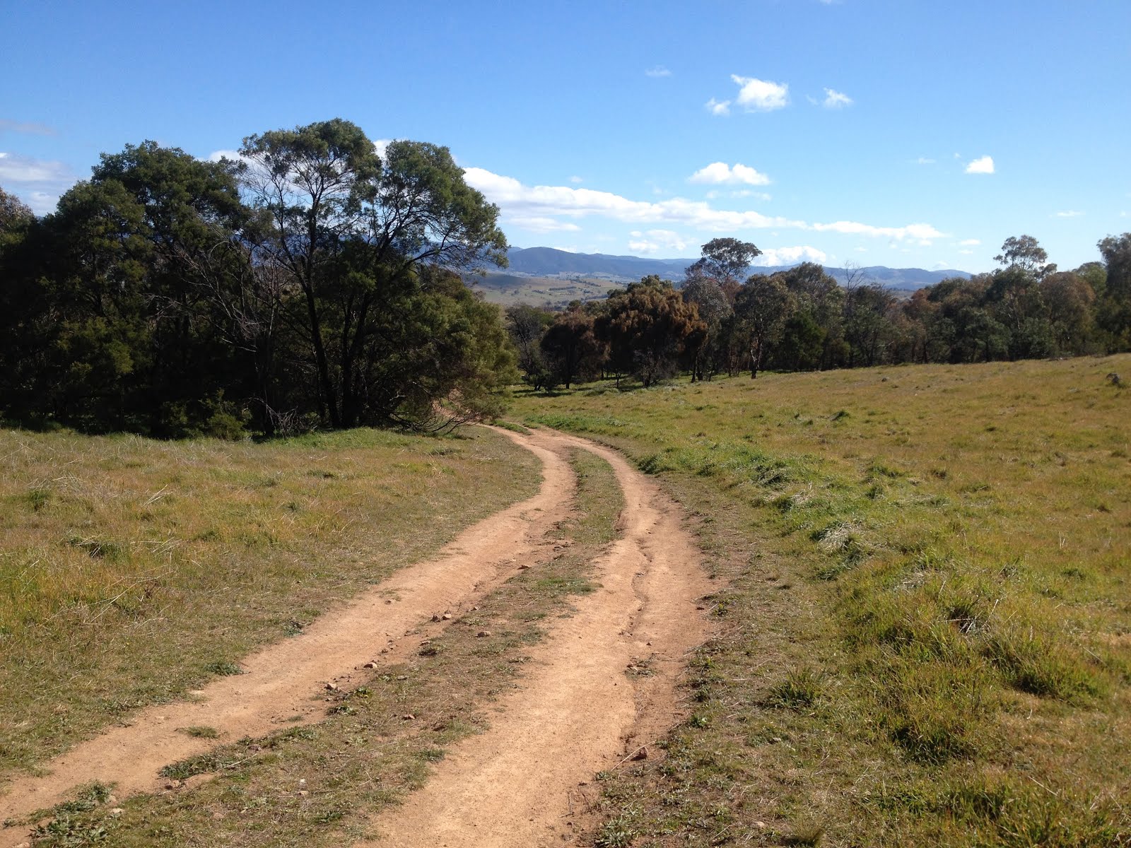
From The Pinnacle I followed the track west until I came close to Kama homestead, coming across some more rural views towards the Brindabellas.


I then followed the track around in a loop to get back to my starting point, again passing through some very nice landscapes.


This is a very popular walking area, being right next to suburbia but feeling like you are in the middle of nowhere. I was lucky enough (possibly because it was a freezing cold weekday) to have the place almost to myself. A great short walk; the closest one to my home.