Thursday, 10 November 2022

Tidbinbilla Nature Reserve: Gibraltar Peak via Devils Gap

General Information

Grading: medium
Distance: 12 kilometers 
Total climb: 575 meters 
Time taken: 3 hours
Map: Tidbinbilla 8627-2S 1:25 000 
Start point distance by road from Canberra GPO:  46 kilometers
Start point map grid reference:  55H FA 74405 73675
Destination:  55H FA 76675 74314
End Point:  Same as start
 

Route 

 
Note: Forget about the straight line shown below at the end of the walk. It appears that my GPS watch had a slight glitch.


Description 

This walk started at the Devils Gap carpark on the Tidbinbilla Reserve ring road. I  followed the Devils Gap fire trail past the gate at the border of the Tidbinbilla Nature Reserve and down to the intersection of numerous management trails at map reference 55H FA 75791 72572.


I took the first trail on the left, which headed back in the general direction I had come from.

This trail is quite rough and a bit overgrown, so I started my habitual snake scanning as I progressed up the hill. At map reference 55H FA 75730 73058 there was another trail heading off to the left.

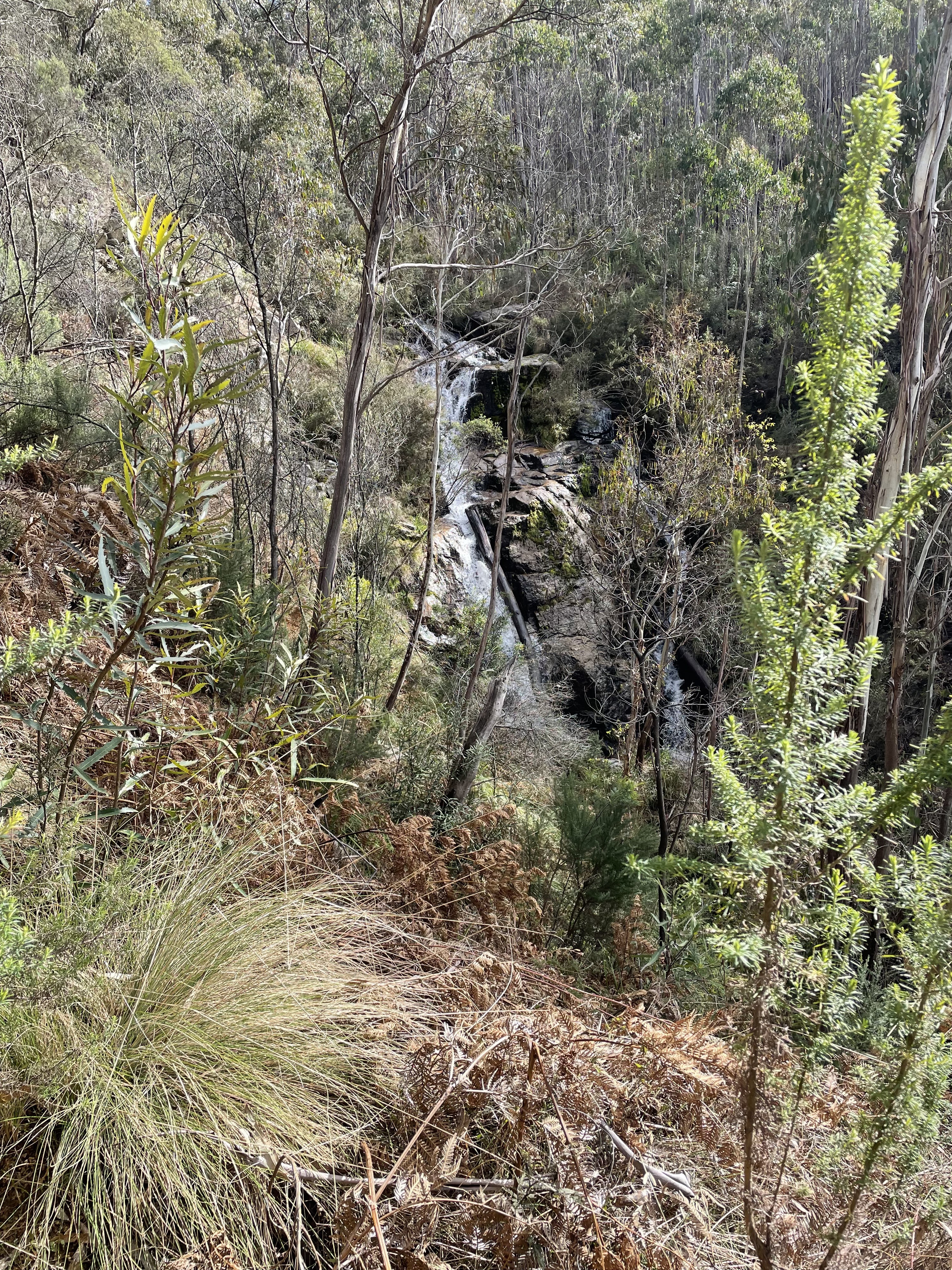
I followed this trail around to the top of the hill just north of Devils Gap. At map reference 55H FA 75630 73273 I left the track and went bush, following the ridge line down the first hill and up and down a second. The bush was not easy, but not particularly difficult either. Initially it was a bit like this:

Toward the top of the second hill, however, it became a bit rocky and scrubby and my progress was a lot slower. I was also looking out for snakes behind every rock and fallen branch.

By following the ridge I eventually came to the fire trail leading up to Gibraltar Peak, which I had to climb once again to take in the view.

Coming back down from the Peak to the management trail I turned left and went down a very steep slope and followed the signs towards Woods Reserve. This took me along the Gibraltar South fire trail and back to the Devils Gap trail. From there it was an easy walk back to the car park.

Wednesday, 19 October 2022

Cotter Area: Stony Creek Nature Reserve, Uriarra Forest and Mt McDonald

General Information


Grading:  medium
Distance:   13.8 kilometers
Total climb:   473 meters
Time taken:   3 hours 30 minutes
Maps:   Cotter Dam 8627-2N 1:25 000
Start point distance by road from Canberra GPO:   26 kilometers
Start point map grid reference:  55H FA 77061 90367
Destination map grid reference:   Cotter Campground 55H FA 77183 89391
                                                      Mt. McDonald 55H FA 76550 91170
End point:  Same as start

Route


Description


This walk began at the small car park just off Brindabella Road about 2 kilometers north of Cotter Road. From the car park I headed through the bush and across Brindabella Road to find the gate into Stony Creek Nature Reserve (map reference: 55H FA 77214 89929). Through the gate I followed a fairly indistinct track down to Grasstree Lookout, which has a bench from which to enjoy the view.


After the lookout the trail starts to zigzag down the side of the hill to the Murrumbidgee River. At first it passes through fairly open forest (with at one point a fantastic view of the Cotter Pumping Station and bridge over the Murrumbidgee) and then through fairly thick scrub at the bottom.


I followed the trail right to the bridge over the Murrumbidgee and then turned around and headed back. At map reference 55H FA 77192 89740, which is right at the first acute bend of the main trail, I followed a trail off to the side which I thought could be a trail along the bank of the river, but the trail was soon lost in a grassy opening and I returned to the main trail. I then climbed all the way back up to the car park the way I had come. This trail is quite steep in places, but is in excellent condition.

Getting back to my starting point at the car park I headed off again, this time through the locked gate at the car park down Lookout Road towards Cotter Dam. I then followed Priors Road as close as I could get to the Dam.

Continuing along Priors Road there were some nice views and reflections off the catchment.

I turned off Priors Road on to to Crusher Road and followed for some distance, taking a slight detour at one point to climb to a high point at map reference 55H FA 75733 91406, with views to the south.

Returning to Crusher Road I followed it through to the Uriarra Village Fire Trail which I then followed down to some power lines which cut through the pine forest. This is pictured below from the eastern side:

The track following the power lines was extremely wet, muddy and slippery, but it eventually comes out on Crusher Road again. From there I headed up the trail to the summit of Mt McDonald, which has a decent view towards Canberra.


From the summit I headed down Mt McDonald Road. I took a brief detour to the Cotter Dam Lookout, and then took the Lookout walking track back to the car park. The Lookout walking track was quite badly eroded along much of its length and I had to take care not to fall over stepping on loose rocks.

I'll finish with a couple of warnings about the Cotter Dam/Mt McDonald part of this walk. First, there is little shade to be found, so it may not be a pleasant walk in high summer. Second, blackberry bushes are all over the place, so cutting through the bush can be problematic.

Thursday, 25 August 2022

Gibraltar Pines: Punch Bowl Creek

General Information

Grading : medium
Distance:  9.8 kilometers 
Total climb:  417 meters
Time taken:  3 hours 30 minutes
Map:  Corin Dam 8626-1N, 1:25 000 
Start point distance by road from Canberra GPO:  49 kilometers 
Start point map grid reference:  55H FA 74894 68592
Destination map grid reference:  n/a
End point:  same as start

Route


Description

This walk began at the Smokers Trail car park off Corin Road. We walked up to the top of the hill, then turned slightly right and cut through the bush to another management trail which we followed round to the start of the walking track along Punch Bowl Creek (map reference 55H FA 75649 68431).

We followed the walking track past the two waterfalls on Punch Bowl Creek...


...and then continued down to an old gate before turning left and crossing Punch Bowl Creek at map reference 55H FA 76680 68759. From here we hit exploration mode, following an old and rough track paralleling the north side of the creek. We followed this for a few kilometers just to see where it went. We were hopeful that it might climb up the ridge on our left, but it soon became apparent that it most likely just went to the Booroomba Homestead (as it turned out we were right about this) and decided to turn back.

We followed mostly the same route back to our starting point, although we re-crossed Punch Bowl Creek a bit further downstream than on the outward journey.

Tuesday, 2 August 2022

Port Macquarie Coastal Walk

General Information

Grading : easy
Distance:  8.8 kilometers 
Total climb:  195 meters
Time taken:  2 hours
Map:  Port Macquarie 9435-2S, 1:25 000 
Start point distance by road from Canberra GPO:  661 kilometers

Route


Description

We started this walk at Town Beach and followed the marked trail to the south along the coastline. This meanders through bushland (including Sea Acres Nature Reserve) and along beaches, with the trail mostly easy to follow and with great views from time to time.


The trail officially ends at the Tacking Point Lighthouse.


We went on a little bit further down Lighthouse Beach so that we could have a brief camel ride along the beach and have a good lunch at the Tacking Point SLSC.


Note: 

I haven't included the return journey as part of this blog posting. We walked back along Lighthouse Road and Pacific Drive, just shy of 6 kilometers and not particularly interesting. Other options include returning via the Coastal Walk or catching a bus from Pacific Drive.


Thursday, 14 July 2022

Rob Roy Nature Reserve: Some Waterfalls, the Black and White Mine and Monks Hill

General Information

Grading : medium
Distance:  9.4 kilometers 
Total climb:  521 meters
Time taken:  3 hours 50 minutes
Map:  Tuggeranong 8727-3S, 1:25 000 
Start point distance by road from Canberra GPO:  29 kilometers 
Start point map grid reference:  55H FA 91194 72673
Destination map grid reference:  Waterfalls 55H FA 91349 70137 (approximate)
                                                     Mine 55H FA 91016 71165
                                                     Monks 55H FA 91216 71267
End point:  same as start

Route


Description

This walk began at the car park just off Orange Tree Crescent in Banks. Through the gate we started walking up a steep sealed track which turns into a more level gravel track at the top of this first ascent. About 2 kilometers into the walk the track divides, with the track on the right heading towards Monks Hill and the left track heading towards Mount Rob Roy. We went up towards Monks Hill for as short distance, and then went bush following a fence line south until we came to a creek in a deep gully with some small waterfalls.


We then headed back along the same fence line for a while before heading west towards the Black and White Mine.

After inspecting the mine we headed up to Monks Hill to take in some of the views before retracing our route back to the starting point.


Saturday, 23 April 2022

Kosciuszko National Park: Charlotte Pass to Guthega [and return]

General Information

Grading:  medium
Distance:    19 kilometers
Total climb:    660 meters
Time taken:   4 hours 30 minutes
Maps:   Perisher Valley 8525-2S  1:25 000
Start point distance by road from Canberra GPO:   220 kilometers
Start point map grid reference:  55H FV 19089 67358
Destination map grid reference:  55H FV 23213 73018
End point:  same as start
 

Route


Description

This new walking trail is the first section of the planned Snowies Alpine Walk.

We started at Charlotte Pass, and at the car park walked down the very steep track towards the Snowy River below. The start of the trail to Guthega begins on the right, a few hundred meters before the river. Much of the initial section is along raised metal causeway following along beside the Snowy River.


After a while the track starts to go up and down and through some nice stands of gum trees

Perhaps the highlight of the walk is the suspension bridge over Spencers Creek.


The track also passes beside the Illawong Bridge over the Snowy River and Guthega Dam before taking you into Guthega itself.


My walking companion (actually my wife) was pretty worn out by the time we reached Guthega, so she stayed behind in the cafe while I walked back to Charlotte Pass to fetch the car. The climb up from the Snowy River to the Charlotte Pass car park was a killer at the end of such a long walk.

Thursday, 21 April 2022

Namadgi National Park: Honeysuckle Creek Tracking Station Site to Booroomba Rocks

General Information

Grading : medium
Distance:  12.9 kilometers 
Total climb:  405 meters
Time taken:  4 hours
Map:  Corin Dam 8626-1N, 1:25 000 
Start point distance by road from Canberra GPO:  53 kilometers 
Start point map grid reference:  55H FA 79143 60486
Destination map grid reference:  55H FA 81967 62279
End point:  same as start

Route


Description

This walk began at the Honeysuckle Creek Tracking Station site car park at the end of Apollo Road. We walked down to the campsite and turned off onto the walking track towards Booroomba Rocks at map reference 55H FA 78928 60481. This is a very picturesque and easy-to-follow track that took us to the Booroomba Rocks car park. We then followed the track up to Booroomba Rocks and took in the magnificent views:


We returned to our starting point by the same route.

This is a great way of extending the otherwise short walk to Booroomba Rocks from the Booroomba Rocks car park. Sadly and inexplicably I failed to take any pictures of the track from Honeysuckle to Booroomba. My bad.

Monday, 18 April 2022

Corin Forest: Smokers Trail to Orroral River

General Information

Grading : hard
Distance:  22 kilometers 
Total climb:  795 meters
Time taken:  5 hours 50 minutes
Map:  Corin Dam 8626-1N, 1:25 000 
Start point distance by road from Canberra GPO:  51.5 kilometers 
Start point map grid reference:  55H FA 73687 67792
Destination map grid reference:  55H FA 72960 61299
End point:  same as start

Route


Description

This walk began at the Square Rock car park just off Corin Road. We initially followed the walking trail towards Square Rock. At map reference 55H FA 72421 66150 there is a link track off to the left that takes you down to the Smokers Trail, and we followed this. When we reached Smokers Trail we turned right and followed it alongside a creek with a number of small waterfalls. As we neared the ridge above Orroral Valley there was plenty of evidence of damage from the 2020 bushfire.


We descended along Smokers Trail down to the Orroral River at the head of Orroral Valley. While the crossing is rather nondescript, the river itself is quite pretty.


Pausing here for some lunch, we then made our way back up Smokers Trail. Instead of walking back up the link trail to the Square Rock track, we continued along Smokers Trail until we came to a marker directing us back to the car park. This turned out to be a rather interesting walking track, quite narrow and treacherous in some places, but through some very pretty bushland.

This took us back to our starting point.