Thursday, 24 September 2020

Canberra Nature Park: Gungaderra Grasslands Nature Reserve

General Information

Grading:  easy
Distance:   4 kilometers
Total climb:   128 meters
Time taken:   1 hours 15 minutes
Maps:   Canberra 8727-2N 1:25 000
Start point distance by road from Canberra GPO:   8 kilometers
Start point map grid reference:  Canberra 55H FB 92425 01103
Destination map grid reference:   n/a
End point:  Same as start

Route

Description

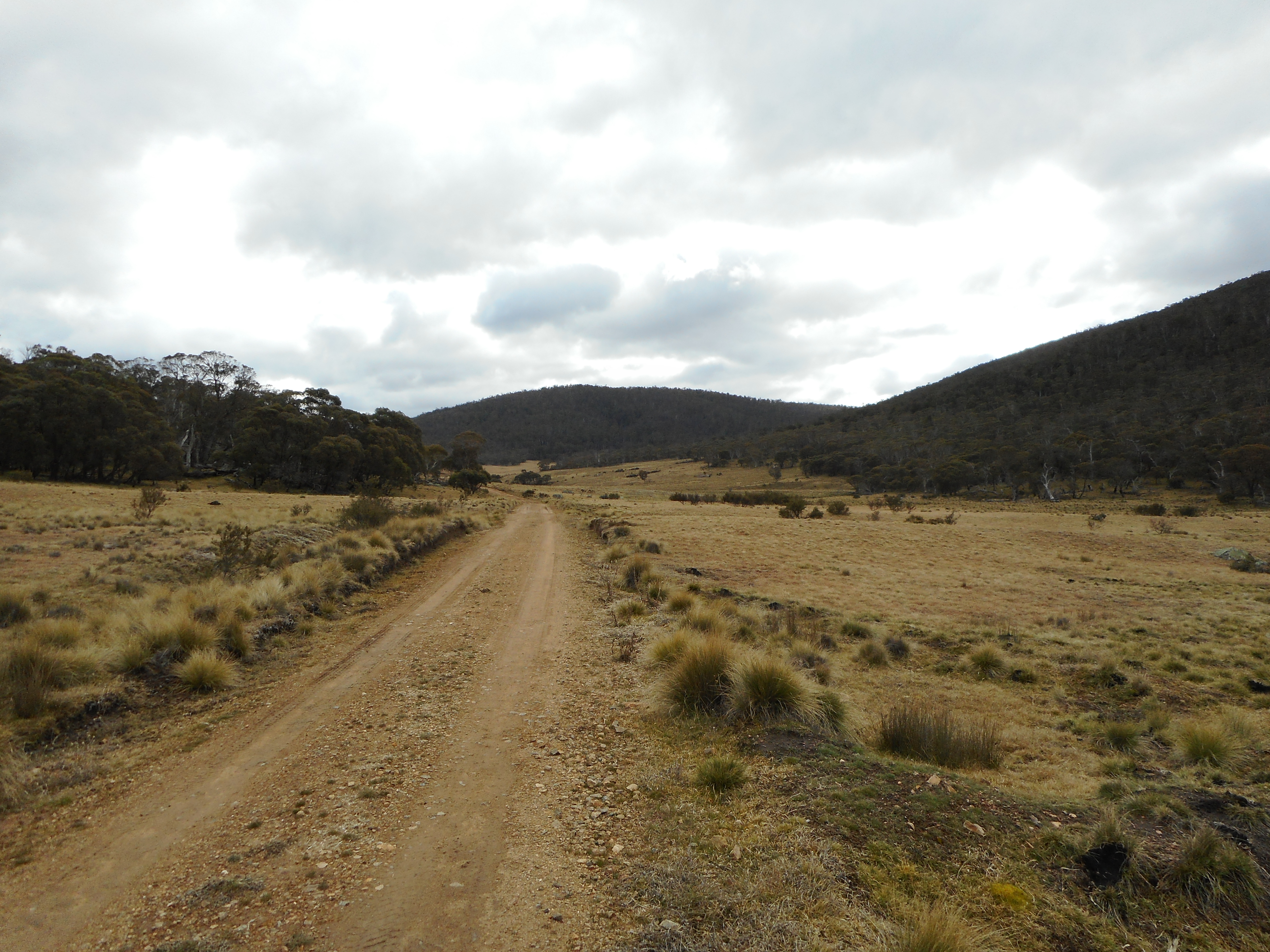
This walk commenced just off the Barton Highway outside the entrance to the 1RPH radio station. We had to climb a barbed wire fence near a locked gate to get into the reserve (we found a few other wire fences during the walk but we were able to find gaps in them).

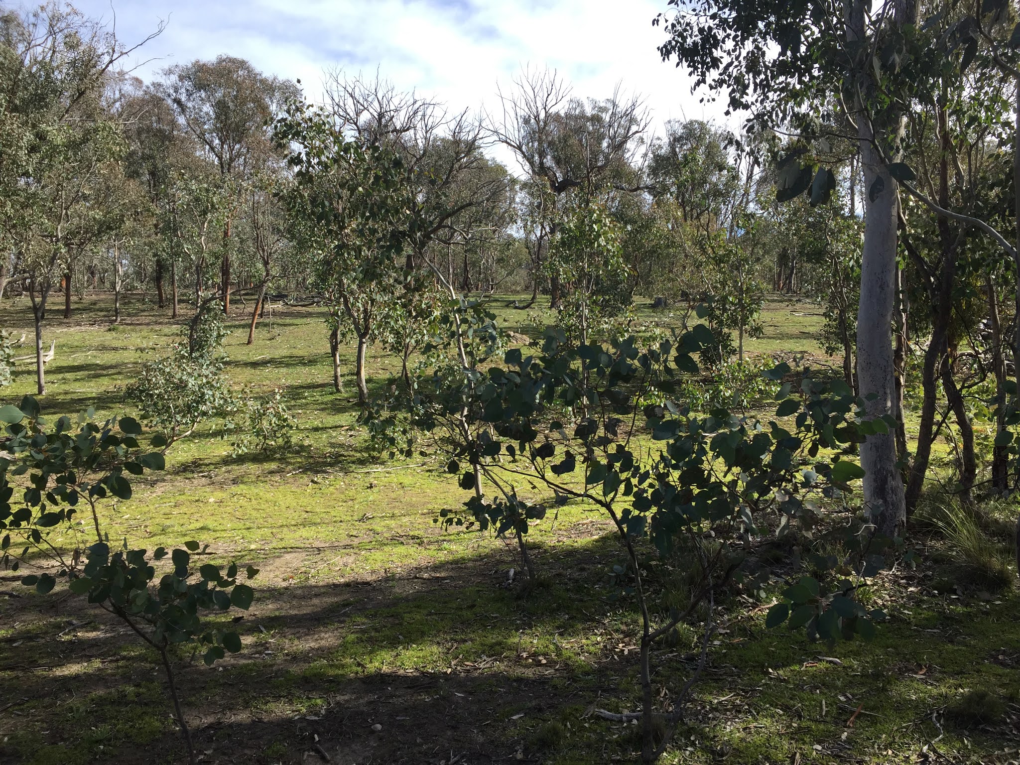
Proceeding up the track inside the gate our first order of business was to find some ancient gnarly trees that we had heard about. This required some backtracking, but we eventually found the trees one after another in the light forest to the left of the track.

After finding the trees we walked up to the top of Gungahlin Hill (map ref. 55H FB 92348 01747) before heading northeast to another hill at the northern end of the grasslands (map ref. 55H FB 92173 02334). There were some nice views across the grasslands from here.

Turning back we headed for a third hill in the grasslands (map ref. 55H FB 92933 01600), also with some nice views.

 From here it was a short walk back through grassland and light forest back to our starting point.

Tuesday, 22 September 2020

Canberra Nature Park: Black Mountain Circuit (2)

General Information

Grading:  easy
Distance:   7 kilometers
Total climb:   350 meters
Time taken:   2 hours 40 minutes
Maps:   Canberra 8727-2N 1:25 000
Start point distance by road from Canberra GPO:   3 kilometers
Start point map grid reference:  Canberra 55H FA 91816 94932
Destination map grid reference:   n/a
End point:  Same as start

Route

http://maps.six.nsw.gov.au/

Description

Another loop walk around Black Mountain. The starting point was the carpark near the electricity sub-station on Frith Road. From there I really just explored any tracks and paths that looked interesting, following the Kids Lookout Trail, climbing over Little Black Mountain and coming back around to the Black Mountain Summit Walk. Rather than go to the summit I walked around the western side of the Forest Loop Walk. From the picnic area on Black Mountain Drive I headed bush straight down a spur to the Botanic Gardens Trail which follows the fence line of the Botanic Gardens back to Frith Road.

Tuesday, 8 September 2020

Uriarra: Sherwood Daffodils (2)

General Information

Grading:  easy
Distance:   8.6 kilometers
Total climb:   249 meters
Time taken:   3 hours 10 minutes (including a long break at the daffodils)
Maps:   Cotter Dam 8627-2N 1:25 000
Start point distance by road from Canberra GPO:   32 kilometers
Start point map grid reference:  55H FA 74137 95543
Destination map grid reference:   55H FA 72104 95061
End point:  Same as start

Route


http://maps.six.nsw.gov.au/

Description

This walk was similar to the one undertaken on 10 September 2019 (link), at least in terms of starting point and destination. The difference was that about 1.6 kilometres into the walk we turned north into the pine forest to loop around towards Two Sticks Hill before heading south towards the daffodils site. We returned the same way we had taken last year.

Monday, 7 September 2020

Canberra Nature Park: Aranda Snowgums

General Information

Grading: very easy
Distance:   2 kilometers
Total climb:   18 meters
Time taken:   45 minutes
Maps:   Canberra 8727-2N 1:25 000
Start point distance by road from Canberra GPO:   6 kilometers
Start point map grid reference:  Canberra 55H FA 89746 94098
Destination map grid reference:   n/a
End point:  Same as start

Route


http://maps.six.nsw.gov.au/

Description

This walk started at the Black Mountain carpark near Glenloch Interchange. We walked down to the stile over the fence leading into the Aranda Snowgums and followed a loop pretty randomly around the area. A short walk for a little bloke.

Friday, 4 September 2020

Canberra Nature Park: Goorooyaroo Nature Reserve - Old Joe Hill and Gooroo Hill

General Information

Grading:  medium
Distance:   9.4 kilometers
Total climb:   290 meters
Time taken:   2 hours 20 minutes
Maps:   Hall 8727-4S 1:25 000
             Sutton 8727-1S 1:25 000 
             See also (link)
Start point distance by road from Canberra GPO:   13 kilometers
Start point map grid reference:  55H GB 98346 01230
Destination map grid reference:   Old Joe Hill 55H FB 99407 03215
                                                      Gooroo Hill 55H GB 00037 04192
End point:  Same as start

Route

http://maps.six.nsw.gov.au

Description

This walk commenced at the Goorooyaroo Nature Reserve carpark off Horse Park Drive. We started by going through the gate and following the management trail north for a bit, taking a right hand turn at the first intersection we came to. Following this second track for a short distance we then went bush and climbed Gecko Hills where we could get some great views.

From there we followed the border fence up Old Joe and Gooroo Hills. From Gooroo Hill we followed the track back to our starting point. This was definitely the less interesting part of the walk.

Thursday, 13 August 2020

Namadgi National Park: Boboyan Valley

General Information

Grading:  medium
Distance:  17.65 kilometers 
Total climb:  219 meters 
Time taken:  4 hours 5 minutes 
Map:  Yaouk 8626-2N, 1:25 000 
Start point distance by road from Canberra GPO:  81 kilometers 
Start point map grid reference:  55H FA 79942 30000 
Destination map grid reference:  Boboyan Homestead ruin 55H FA 78620 31278
                                                     Lutons Crutching Shed 55H FA 75795 33510 
                                                     Lone Pine Homestead ruin 55H FA 74859 32454  
End point:  same as start

Route

 
http://maps.six.nsw.gov.au/

Description

The starting point for this walk was the locked gate on Old Boboyan Road, about one kilometer from Boboyan Road.

Passing through the gate we followed Old Boboyan Road through Boboyan Valley with Naas Creek on our right and views of snow-capped mountains.

At about the 2 kilometer point we reached the Boboyan Homestead ruin just off the road on the left. There is not much left of the early-1900's homestead apart from foundation stones and the chimney, but it is in a beautiful elevated position above Naas Creek.

We continued along Old Boboyan Road until near the point where it crosses over Naas Creek.

We headed up Sams Creek Firetrail through to the 1960's-era Lutons Crutching Shed, where we paused for a break.

From here we decided to look for the Lone Pine Homestead ruin, taking a shortcut through the bush to Grassy Creek Firetrail. Although we were looking in the right place we didn't manage to find the ruin. We suspect that it may have been obscured among the fallen trees and  bushfire damage, but maybe we just didn't look well enough.

We started our return journey back the way we came along the Grassy Creek Firetrail with Sheep Station Creek on our left. The Creek was particularly spectacular.

After passing through the forested are on our right we cut across country back to Old Boboyan Road which we followed back to our starting point.

Most of the area we walked through was not affected by the 2020 bushfires, although the area north of Sheep Station Creek was burnt. To get through to this part of Namadgi National Park, however, we had to drive through almost constant severe bushfire damage south of Apollo Road.

Thursday, 6 August 2020

Canberra Nature Park: Black Mountain Circuit (1)

General Information

Grading:  easy
Distance:   11.1 kilometers
Total climb:   299 meters
Time taken:   2 hours 40 minutes
Maps:   Canberra 8727-2N 1:25 000
Start point distance by road from Canberra GPO:   6 kilometers
Start point map grid reference:  Canberra 55H FA 89742 94000
Destination map grid reference:   n/a
End point:  Same as start

Route

http://maps.six.nsw.gov.au/

Description

The starting point for this walk was the Black Mountain Reserve carpark near Glenloch Interchange. I followed the cycle path south from the carpark passing under Caswell Drive /Gungahlin Drive and making my way to the gate marking the entrance to the Black Mountain Reserve. I followed the Woodland Trail for a bit before I headed bush, intending to walk in the bush above Parkes Way around to the lookout I visited a few weeks back (link). Although steep, this is very nice bushland to walk through and has some excellent views to the south. Just be careful of your footing.

After a steep climb up to around 650 meters elevation I pretty much followed the contour at that elevation around the south side of Black Mountain. This eventually brought me almost perfectly to the lookout I was seeking. From there I followed the walking track back to the Botanical Gardens where, after a coffee break at the cafe there, I had the opportunity to have a bit of a look around while making my way to Black Mountain gate.

Passing back out into Black Mountain Reserve I followed the Powerline Trail until I found a trail heading southwest at map reference 55H FA 91133 96004 which I followed. At around map reference 55H FA 90099 95429 I found a walking track to the right which I decided to follow. Unfortunately I took me nowhere I wanted to go so I made my way back to the management trail I had been following. I passed under Caswell Drive/Gungahlin Drive into the Aranda Bushland. After a short way down a management trail I found a walking track on the left with ribbon markings leading me back to where I started. Some nice pictures on the way.

Thursday, 30 July 2020

Tidbinbilla Nature Reserve: Jedbinbilla

General Information

Grading:  easy
Distance:  8 kilometers 
Total climb:  238 meters 
Time taken:  2 hours 20 minutes 
Map:  Tidbinbilla 8627-2S, 1:25 000 
Start point distance by road from Canberra GPO:  43 kilometers 
Start point map grid reference:  55H FA 74538 75990 
Destination map grid reference:  n/a 
End point:  same as start

Route

http://maps.six.nsw.gov.au/

Description

This walk started at Blewitts carpark. Our first challenge was to get across the Tidbinbilla River at Blewitts since there is no bridge and the water level was quite high after recent rain. After some exploration we found a fallen tree which I was able to balance-walk across, although my less agile co-walker took the lower branch which enabled him to balance with his hands on the main trunk.

Across the river we found the River Road and followed it south for a bit before we found a walking track on the right which we followed up to another management trail which we followed southwest, west and north until it became the Man on the Horse Trail. At around map reference 55H FA 73690 75953 we found a walking track on the right which we decided to follow to see where it went. This took us through some rather nice bushland with views to the east and the Tidbinbilla Range to the west.


The walking trail eventually led us to a point near the intersection of the Spur 2 Firetrail and Split Rock Trail. We followed Split Rock Trail and it was here that we first came across the new wallaby enclosure fence.

We followed Split Rock Trail until Gilmore Road, which we started to follow back to our start point. There was a gate in the wallaby enclosure fence on Gilmore Road which we had to pass through. We followed Gilmore Road until it met the Boundary Trail where we turned right and found the beginning of the river walking track. Although this is a short track it is well worth following and was a highlight of the walk.

The trail took us through to Blewitts where we finished the walk with a nice lunch and an excellent bottle of wine.

Tuesday, 21 July 2020

Canberra Nature Park: Black Mountain Eastern Slopes

General Information

Grading:  easy
Distance:   9 kilometers
Total climb:   320 meters
Time taken:   2 hours
Maps:   Canberra 8727-2N 1:25 000
Start point distance by road from Canberra GPO:   2.4 kilometers
Start point map grid reference:  Canberra 55H FA 92069 95473
Destination map grid reference:   Little Black Mountain - Canberra 55H FA 91226 95326
                                                     Lookout - Canberra 55H FA 91100 93563
End point:  Same as start

Route


http://maps.six.nsw.gov.au/

Description

The starting point for this walk was the intersection of Dryandra Street and Frith Road in O'Connor. We started by walking under the Barry Drive underpass and made our way via management trails and faint walking tracks through some very nice forest to the prominent peak at 55H FA 92069 95326, which our guide referred to as Little Black Mountain.

From there we descended again and followed more management trails and walking tracks, generally following the contour of the mountain to a lookout platform at 55H FA 91100 93563, which gave a clear view towards the lake.

Retracing our steps for a bit, and then continuing along the clear walking track, we eventually came to the National Botanic Gardens gate on Black Mountain Road. We entered the Gardens and followed the tracks at the west of the Gardens and made our way back to the starting point.

Thursday, 16 July 2020

Tidbinbilla Nature Reserve: Johns Peak

General Information

Grading:  hard 
Distance:  15.3 kilometers 
Total climb:  713 meters 
Time taken:  3 hours 20 minutes 
Map:  Tidbinbilla 8627-2S, 1:25 000 
Start point distance by road from Canberra GPO:  52 kilometers 
Start point map grid reference:  55H FA 71471 74628 
Destination map grid reference:  55H FA 71378 77330 
End point:  same as start
 

Previous Similar Walks

6 June 2019, 21 June 2019


Route

 
http://maps.six.nsw.gov.au/

Description

This walk was largely identical to the one I completed on 6 June 2019 (link), with the differences being that I did not take the shortcut through the bush on the way up, and I didn't quite reach the top of the peak due to a shortage of time and a disinclination to scramble up the rocks to the summit.