Tuesday, 19 February 2019

Canberra Nature Park: Isaacs Ridge

General Information


Distance:   8.2 kilometers
Total climb:   244 meters
Time taken:   1 hour 50 minutes
Maps:   Canberra 8727-2N 1:25 000
             Tuggeranong 8727-3S 1:25 000
Start point distance by road from Canberra GPO:   14 kilometers
Start point map grid reference:  Canberra 55H FA 91831 84120
Destination map grid reference:   Tuggeranong 55H FA 93032 82608
End point:  Same as start

Route


http://maps.six.nsw.gov.au/


Description


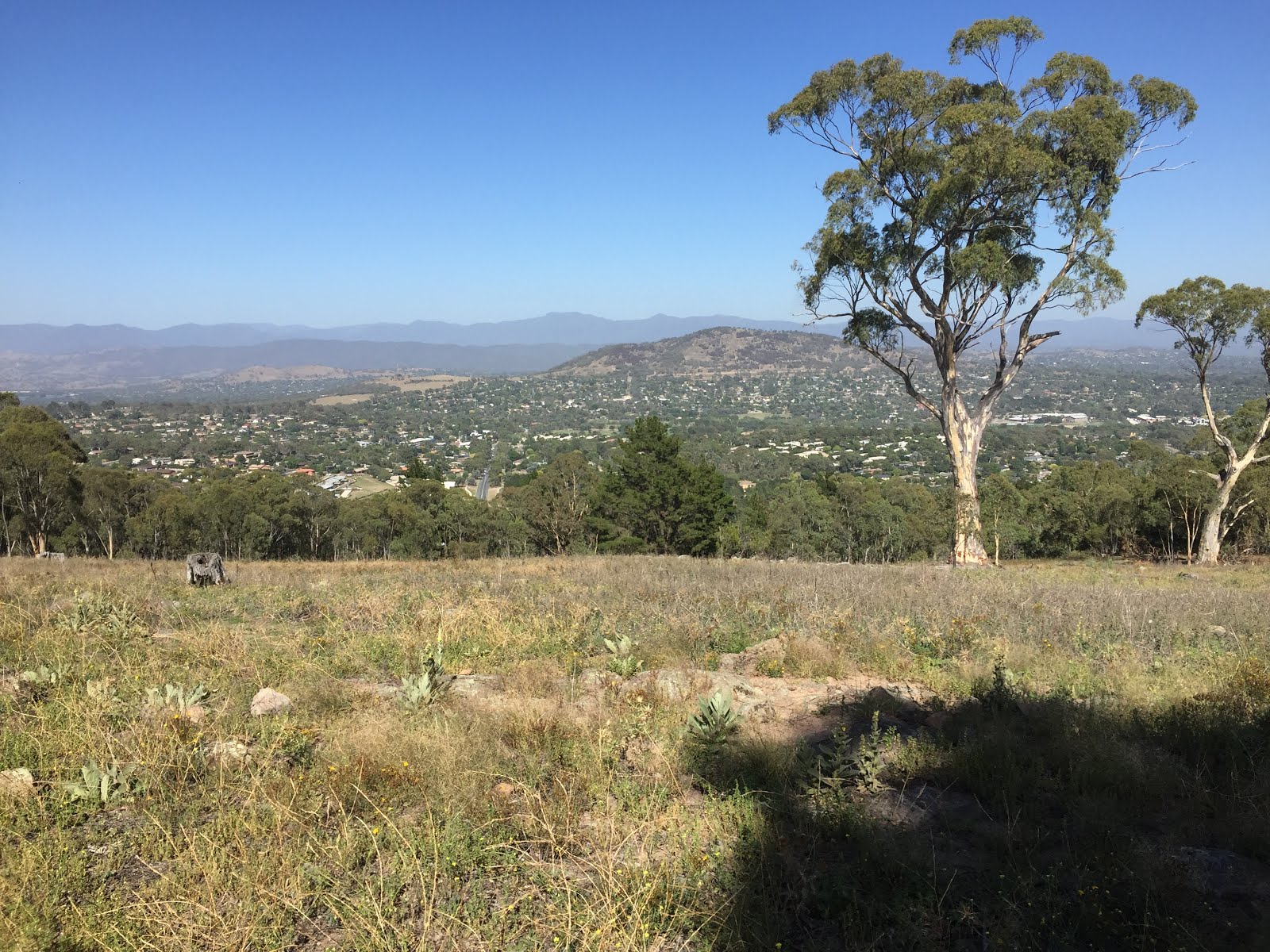
This walk began at the Isaacs Shopping Centre carpark. passing behind the shopping centre we followed the footpath under Julia Flynn Avenue to the edge of the nature reserve. Reaching a management trail we followed it north before starting the fairly steep climb to the top of the ridge. From here there were extensive views towards the Woden Valley.


Continuing along the management trail at the top of the ridge we also had some views of the northern Tuggeranong Valley and the mountains beyond.


Passing a series of transmission towers on top of the ridge we eventually reached our destination, the highest point on the ridge at around 850 meters elevation. The view here was limited, however, by surrounding trees.

From our destination we started the descent back down the ridge to the southwest before heading north again on a management trail. At around map reference 55H FA 92671 82648 (Tuggeranong) we deviated off the management trail to the right, following a very nice walking track running parallel to the management trail. We then followed management trails and suburban streets back to our starting point.
Tuesday, 12 February 2019

Uriarra Forest: Mt McDonald

General Information


Distance:   6.8 kilometers
Total climb:   240 meters
Time taken:   1 hour 40 minutes
Maps:   Cotter Dam 8627-2N 1:25 000
Start point distance by road from Canberra GPO:   26 kilometers
Start point map grid reference:  55H FA 77061 90367
Destination map grid reference:   55H FA 76550 91170
End point:  Same as start

Route

http://maps.six.nsw.gov.au/


Description


This walk began at the small carpark just off Brindabella Road about 2 kilometers north of Cotter Road. From here we followed a neat walking trail uphill until it ended at the Mount McDonald Road which we followed to the Summit of Mount McDonald. From here we had some good 360-degree views, with perhaps the best being towards the Murrumbidgee River near the pumping station...


...and towards Tidbinbilla Reserve.


Leaving Mount McDonald we continued along the road in a generally northwest direction until we came to Crusher Road which we followed south, with some good views of the Cotter Reservoir starting to open up.


Continuing south on Priors Road we eventually met Lookout Road which we followed back to the carpark.

Tuesday, 5 February 2019

Urban Canberra: Parliament House, Red Hill and Embassies

General Information


Distance:   9.5 kilometers
Total climb:   180 meters
Time taken:   2 hours
Maps:   Canberra 8727-3N 1:25 000
Start point distance by road from Canberra GPO:   4 kilometers
Start point map grid reference:  55H FA 92487 91648
Destination map grid reference:   55H FA 92141 88953 (Red Hill)
End point:  Same as start

Route

http://maps.six.nsw.gov.au/


Description


Although this was more of a city walk than a bushwalk I decided it was worth including in this blog. 
The starting point for the walk was the carpark at the Canberra Yacht Club in Mariner Place, Yarralumla. From here we headed via Parliament House to Melbourne Avenue, which we followed to a management road along the base of Red Hill. Picking up a walking track a bit further down the management road we climbed past an electricity station painted to resemble Doctor Who's Tardis towards the lookout at map reference 55H FA 92141 88953. From there we walked back down Red Hill following Hopetoun Circuit past Adelaide Avenue. We then followed Hampton Circuit and Empire Circuit past a number of Embassies and back to the Yacht Club.

Monday, 7 January 2019

Canberra Nature Park: Mt Arawang and Cooleman Ridge

General Information


Distance:   5.5 kilometers
Total climb:   unknown
Time taken:   2 hours
Maps:   Canberra 8727-3N 1:25 000; Tuggeranong 8727-3S 1:25 000
Start point distance by road from Canberra GPO:   18 kilometers
Start point map grid reference:  55H FA 86230 84684
Destination map grid reference:   Mt Arawang 55H FA 85840 84231
                                                     Cooleman Trig 55H FA 84402 85689
End point:  55H FA 83909 86302

Route


http://maps.six.nsw.gov.au/


Description


This walk started on Namatjira Drive, Chapman though to avoid backtracking we had first left another car at the end of Kathner Street. There is a locked gate into the Nature Reserve and a small parking area near this gate. We set off straight up Mt Arawang, which offered views in all directions (apologies for the lack of pictures for this walk). Descending Mt Arawang on the other side we followed management trails in a generally northwest direction, always trying to keep to the more elevated options to avoid unnecessary climbing. Eventually we reached Cooleman Hill on the right and climbed up to the trig for some more views. Continuing down the other side of the Hill we continued on management trails to the car we had left at Kathner Street.

Saturday, 1 December 2018

Murrumbidgee Corridor North of Kambah Pool (1)

General Information


Distance:   9.2 kilometers
Total climb:   unknown
Time taken:   3 hours
Maps:   Tuggeranong 8727-3S 1:25 000
Start point distance by road from Canberra GPO:   19 kilometers
Start point map grid reference:  55H FA 82696 81011
Destination map grid reference:   55H FA 80388 83533 (not reached)
End point:  same as start

Route


http://maps.six.nsw.gov.au/


Description


We started this walk from the Kambah Pool carpark and found the track leading off to the north off Kambah Pool road. The track is very clear and even has distance markers. It starts by heading down into a gully which has to be climbed out again on the other side. before the next gully we changed direction and climbed cross-country to the peak of Forster Hill to take in the view. Coming down Forster Hill on the other side of the gully, we reacquired the walking track and continued on until we had travelled about 5 kilometres. At this point, as our time was limited and I was struggling a bit in the heat, we headed back towards Kambah Pool without getting quite as far as we had intended, following the walking track the entire way back. Just off the track at one point is a rocky outcrop to the west which offers some views over the Murrumbidgee River.

Tuesday, 20 November 2018

Canberra Nature Park: Davidson Hill Trig and Red Hill

General Information


Distance:   8.2 kilometers
Total climb:   300 meters
Time taken:   2 hours
Maps:   Canberra 8627-3N 1:25 000
Start point distance by road from Canberra GPO:   12 kilometers
Start point map grid reference:  55H FA 91628 86904
Destination map grid reference:  Davidson Hill 55H FA 92290 87556
                                                    Red Hill 55H FA 92384 88494
End point:  same as start

Route


http://maps.six.nsw.gov.au/


Description


This walk commenced at The Garran Shopping Centre. The first part of the walk was through suburban Garran Streets to Astley Place, where we were able to access the Red Hill Nature Reserve. Following tracks we ascended Davidson Hill which offered good views of surrounding Canberra.


Continuing on the ridge from Davidson Hill we climbed Red Hill before descending down its western side to the Federal Golf Club. We then did a loop around the Golf Club before returning to Garran Shops via Brereton Street.

Friday, 16 November 2018

Brindabella National Park: Goodradigbee River/Flea Creek Area

General Information


Distance:   9.8 kilometers
Total climb:   570 meters
Time taken:   4 hours 45 minutes
Maps:   Cotter Dam 8627-2N 1:25 000
Start point distance by road from Canberra GPO:   56 kilometers
Start point map grid reference:  55H FA 59838 86629
Destination map grid reference:  exploratory hike - no specific destination
End point:  same as start

Route


http://maps.six.nsw.gov.au/


Description


Our starting point for this exploratory walk was originally going to be the camping area at Flea Creek near its confluence with the Goodradigbee River. This campground is accessed by Gentle Annie Trail off Brindabella Road. Gentle Annie Trail is a very steep and bumpy gravel road, and about halfway down it I had had enough and decided to walk the rest of the way to the campground, and while this added some distance to the walk we were in no particular hurry.
Following Gentle Annie Trail past the Flea Creek campground we continued on to the Goodradigbee River with the intention of following it for some distance if possible. The river at this point is very clear and peaceful, good for swimming and (apparently) fishing.


We first attempted to walk upstream, but were soon thwarted by rocks that we would have had to climb around. Then heading downstream we found it quite scrubby and difficult to negotiate and soon turned back from there too. It became clear that in order to follow the river on the Brindabella National Park side we would have had to move further up the slope, away from the river itself, where it looked like there would be some clearer terrain. Alternatively, the other side of the river seemed to be relatively flat and clear.
Returning to the campground, we started up the Webbs Ridge Trail to Webbs Ridge. This trail is also very steep, gaining 200 meters in the first kilometre of winding road. We had views of the western side of the Brindabella Range, with the cliffs on the southwestern side of Mount Coree prominent.


Eventually climbing above 700 meters elevation, the trail flattens out a bit as it follows Webbs Ridge.


At this stage we decided to head back: a steep descent back down Webbs Ridge Trail and another steep ascent up Gentle Annie Trail back to the car.

Wednesday, 24 October 2018

Tallaganda National Park: Mt Palerang

General Information


Distance:   3.2 kilometers
Total climb:   336 meters
Time taken:   2 hours 10 minutes
Maps:   Bombay 8827-3S 1:25 000
Start point distance by road from Canberra GPO:   60 kilometers
Start point map grid reference:  55H GA 35921 77365
Destination map grid reference:  55H GA 35938 76213
End point:  same as start

Route

http://maps.six.nsw.gov.au/


Description


This walk commenced at the intersection of the Mulloon, Gourock Range and Palerang fire trails in Tallaganda National Park, about 20 kilometers east of Hoskinstown. We had no particular walk in mind except that we wanted to climb Mt Palerang (1264m). We began by walking south along the Palerang Fire Trail, and after only 100 meters walking we came across an unexpected (and unmapped) walking track which seemed to be heading in the direction of Mt Palerang. Naturally we decided to follow this track which climbed quickly up one of Palerang's spurs. When we were nearing the 1200m elevation mark we noticed an indistinct track heading off in the direction of the summit, and after some discussion we decided to follow it rather than the more distinct track that we had been following. This took us up to the narrow ridge at the top of Palerang which we followed south through some moderately thick brush to the relatively impressive Palerang trig.


The views from the top of Palerang are limited by the surrounding bush, but in our case were even more limited by the weather conditions: mist and low cloud. Still, it was a great place to be, with no sound apart from birdsong and some beautiful bush surrounding it.


After lunching on the summit we headed back down, intending to take the spur to the southwest and eventually link up with the Palerang Fire Trail. As sometimes happens (at least to us) a rather cavalier attitude to navigation took us back to the walking track we had started on. Bowing to the inevitable, we decided to follow the track back down to the car.

Although the walk ended up being a lot shorter than we had planned, we decided not to do any more walking. Instead we decided to drive around the Tallaganda National Park and the Tallaganda State Conservation Area fire trials to scout out other walking opportunities. There seem to be plenty of options there, so it is likely that we will be back at some time soon.

Thursday, 4 October 2018

New Zealand: Togariro National Park, Taranaki Falls Track

General Information


Distance:   6.2 kilometers
Total climb:   104 meters
Time taken:   1 hour 30 minutes

Route


Google Maps


Description


This walk starts in Whakapapa village in Tongariro National Park at the end of Ngauruhoe Terrace. This is a loop walk, and for no particular reason we decided to start along the lower track and return by the upper track. It seemed that most people we came across were going the other way, however, so there may have been some local knowledge at play.

The track is wide, easy to follow and very well maintained. It passes through alpine scrub...


...before reaching Wairere Stream, which is more forested terrain.


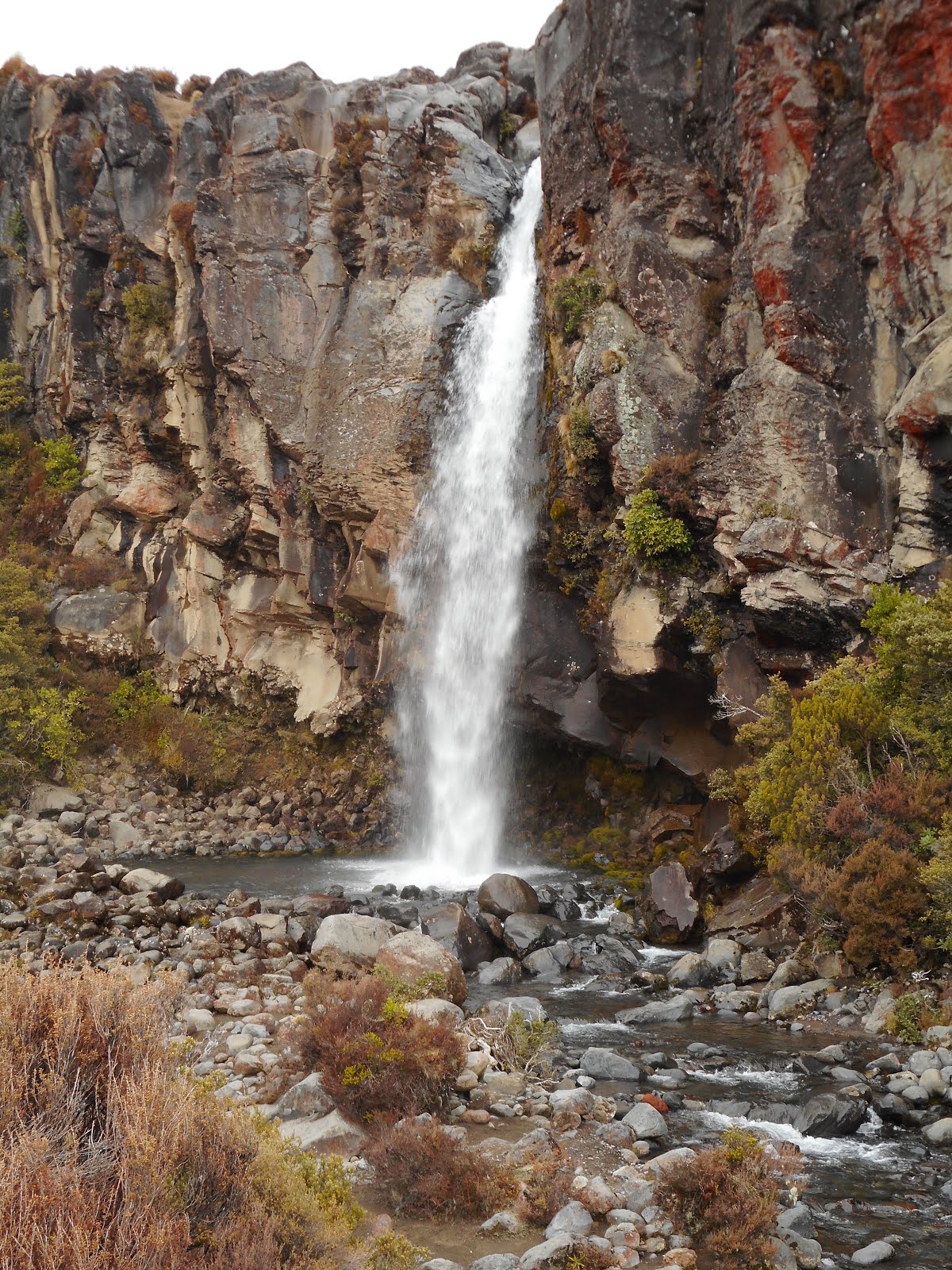
In time we reached the Taranaki Falls.


The trail then took us to the top of the falls before returning to Whakapapa. There were some alpine views along the way, but these were limited by low cloud.

Monday, 1 October 2018

New Zealand: Huka Falls Walkway

General Information


Distance:   6.4 kilometers
Total climb:   45 meters
Time taken:   2 hours

Route


Google Maps


Description


This walk commenced at the day use carpark at the end of County Avenue about 2.8 kilometers from the centre of Taupo. There are two alternative tracks to follow: a walking only track that follows the Waikato River or a slightly longer mixed use walking and cycling track a bit further to the east. We decided to take the shorter, and probably more picturesque riverside track.

We first followed the track down a path through a beautifully lawned area...


...to a thermal pool running into the Waikato River. This pool was full of bathers so we only stayed long enough to have a look.

Continuing on, the track rises above the river, giving some excellent views along the way.


The track itself is wide and perfectly maintained.


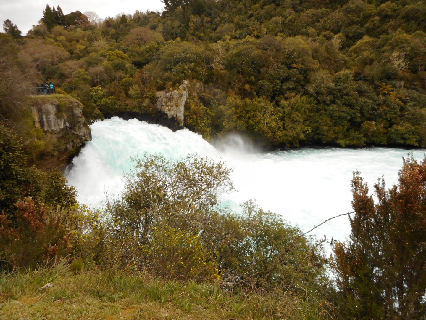
Eventually we arrived at Huka Falls, only to find it packed with sightseers who had taken the easy path over the bridge from the car park on the west side of the river. Nevertheless the canyon and falls were quite spectacular.


While it was open to us to return via the mixed use track, we decided that we would return by the same path.