General Information
Grading: easyDistance: 5.6 kilometers
Total climb: 149 meters
Time taken: 1 hour 25 minutes
Maps: Wolumla 8824-2N 1:25 000
Start point distance by road from Canberra GPO: 254 kilometers
Start point map grid reference: 55H GV 61710 20067
Destination map grid reference: none
End point: Same as start
Route
Description
This walk started at the North Tura Picnic Area at the end of North Tura Road, about 8.5 kilometres drive north of Merimbula. Note that a park use fee of $8 per day (at the time of writing) applies and the only way of paying is to put correct change in an envelope, write your details (so you'll need a pen) and place the envelope in the designated box at the picnic area. There is a viewing platform at the picnic area overlooking Tura Beach.
I chose to do the walk counter-clockwise, so I followed the trail to the north through coastal scrub until I came to Bournda Island.
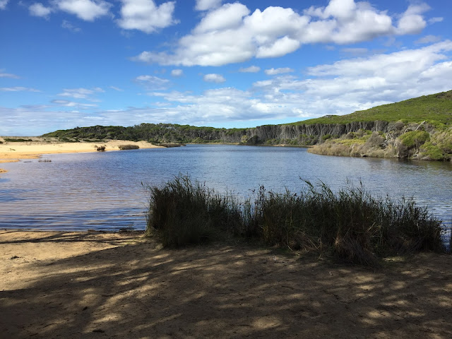
I descended down to the beach and walked up the beach a short distance, then over the rocks and on to Bournda Beach. Continuing north along the beach, and with Bournda Lagoon on my left I turned inland around the northern end of the Lagoon to reacquire the Sandy Creek Walking Track. Some nice views back towards the Lagoon, Sandy Creek and Bournda Island from this section of the track.
The track eventually descends towards Sandy Creek, which it follows for about 1.2 kilometres. At this point it is necessary to cross the Creek, which when I visited was about ankle deep and required crossing in bare feet (although it would have been easy to cross if I had been wearing hiking boots and gaiters). Here is a view of the crossing after I had passed across.
From the Creek the track climbs again. This last section of the track contained a feast of reptiles with a small black snake slithering off in front of me, followed by a goanna taking fright at my approach and climbing up a track-side tree.
After that the rest of the walk was uneventful.


No comments:
Post a Comment