General Information
Distance: 4.3 kilometers
Total climb: 400 meters
Time taken: 5 hours
Map: Caoura 8928-3N; 1:25 000
Guide: link
Start point distance by road from Canberra GPO: 124 kilometers
Start point map grid reference: 56H KG 27160 44914
Destination: loop walk
End point: same as start
Route

http://maps.six.nsw.gov.au/
Description
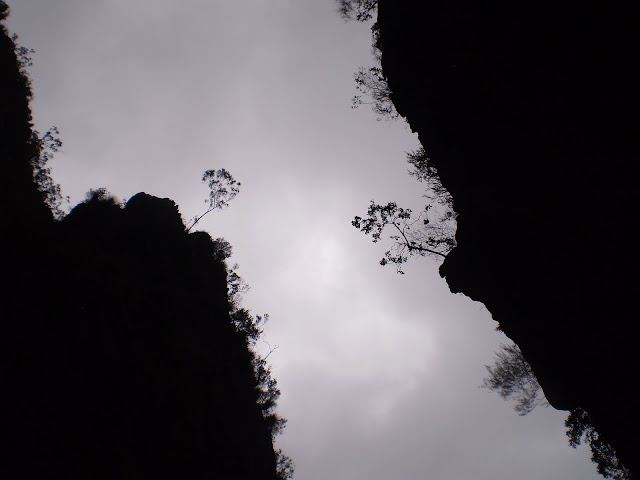
The starting point for this walk was the William Mitchell carpark. From there we followed the Red Track and got our first view of the Slot Canyon we would be walking through.

The descent to the western end of the canyon was very steep, but it didn't take too long to reach the bottom. At the western end of the canyon is a rather nice dry sandy area with high walls all around. This was a good place for a morning tea break.


Continuing eastwards along the canyon the sand gradually gave way to rocks which considerably slowed down our progress. We were required to go over, around or under a tangle of huge boulders.

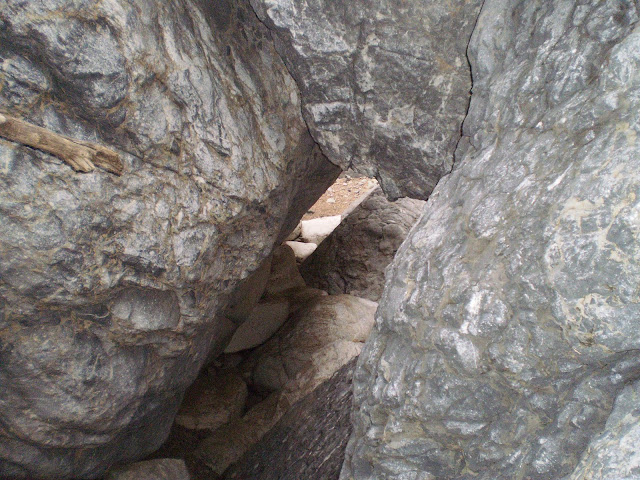
Part way through the rocks Bungonia Creek also made an appearance, requiring us to trudge through the water at some points. Gradually the rocks became smaller and we could walk along Bungonia Creek without too many obstacles in our way. At map grid reference 56H KG 28007 45795 we reached the point where the Red Track combs back up out of the canyon. This is a very steep and difficult climb, with an ascent of 350 metres over a distance of 1 kilometer. Eventually we reached the point where the Red, Green and White Tracks meet, at which point we headed west back towards our starting point. This is a difficult but very rewarding walk.
No comments:
Post a Comment