Tuesday, 28 July 2015

Tidbinbilla Nature Reserve: Fishing Gap

General Information


Distance:  8 kilometers
Total climb:  320 meters
Time taken:  1 hour 50 minutes
Map:  Tidbinbilla 8627-2S 1:25 000
Guide:  link
Start point distance by road from Canberra GPO:  50 kilometers
Start point map grid reference:  55H FA 72303 71966
Destination map grid reference:  55H FA 69893 71016
End Point:  Same as start


Route


http://maps.six.nsw.gov.au/

Description


This walk starts at the Fishing Gap carpark on the Tidbinbilla Ring Road. It follows a pleasant enough management trail up to the southwestern corner of the Tidbinbilla Nature Reserve.


There are not too many views to be seen from the trail, but every now and then something can be glimpsed of surrounding peaks through the trees.


Almost exactly 4 kilometers into the walk you reach Fishing Gap, which is the end of the trail right at the border of Namadgi National Park. There is nothing much to see here, although there used to be a track through to Mount Domain in the north and another to the Cotter River in the west. Both of these were overgrown after the 2003 bushfires.


I had a thought of attempting to climb Mount Domain from here, and headed north into the scrub. After about 100 meters of bashing through dense overgrowth and going over or around many large fallen trees, however, I decided that Mount Domain was going to be too much work and headed back to Fishing Gap, from where I retraced my steps to the carpark. While pleasant enough, the track to Fishing Gap is not particularly spectacular and is only a relatively short walk. It would have been better if I could have continued on to either Mount Domain or Cotter River, but the scrub was to dense in both directions.

Update: In mid-2016 a new walking track was cut from Fishing Gap to Mount Domain.


Monday, 20 July 2015

Namadgi National Park: Yankee Hat Rock Art

General Information


Distance: 6.2 kilometers
Total climb: 146 meters
Time taken: 2 hours
Map: Yaouk 8626-2N 1:25 000
Guide:  link
Start point distance by road from Canberra GPO:  67 kilometers
Start point map grid reference:  55H FA 78506 41194
Destination map grid reference:  55H FA 76721 41823 [approximate]
End Point:  Same as start


Route


http://maps.six.nsw.gov.au/

Description


The Yankee Hat Track begins at the locked gate on the Old Boboyan Road, about 3.3 kilometers southwest of its intersection with Boboyan Road. The first part of the Track passes through a grassy valley surrounded by peaks that were still snow-capped when we walked through.


About 1 kilometer from the start we crossed Bogong Creek using a footbridge, which was handy since there was quite a bit of water in the creek and the banks were boggy.


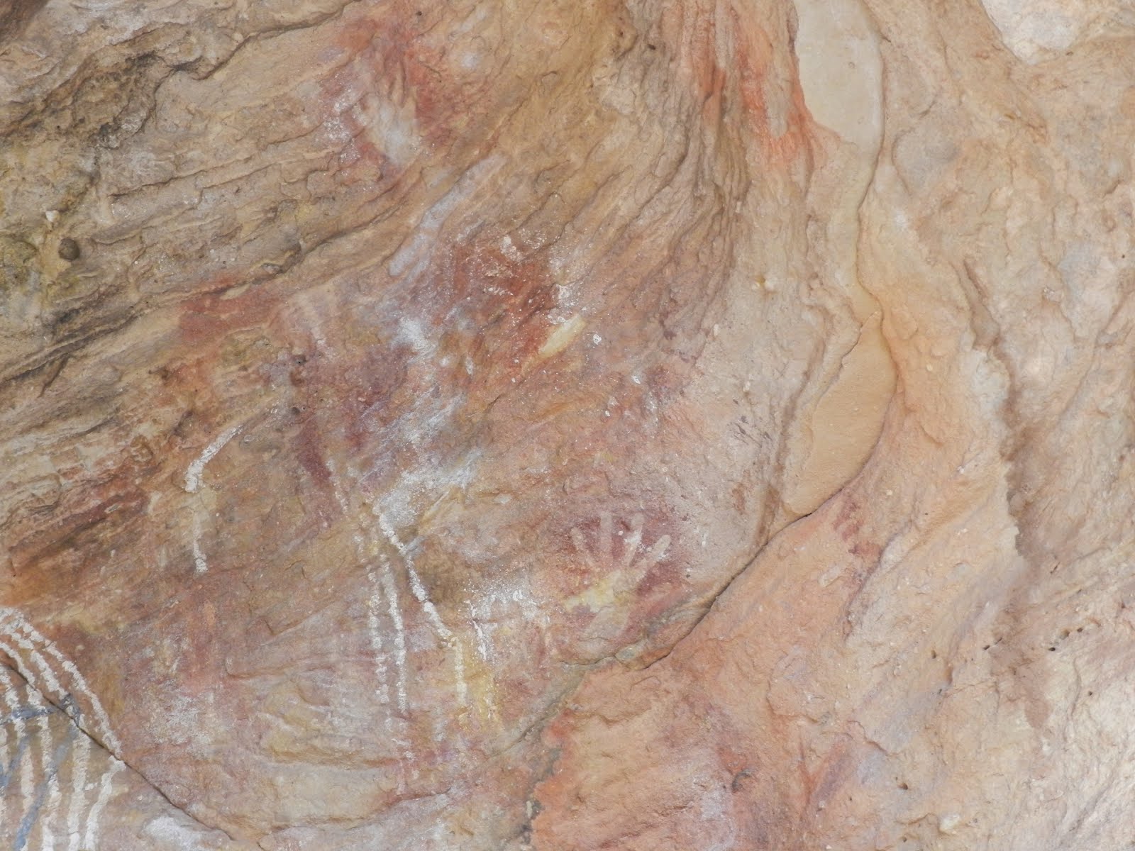
The track finally brought us into the tree line and the granite boulder shelter that contains the rock art, about 3 kilometers from the start point.


Although climbing the nearby Yankee Hat peak (1558 meters) was an option, albeit a very tough one, we decided on this occasion to head back from the rock shelter the way we had come. This is a very rewarding walk, although its remote starting point (45 minutes drive south of Tharwa) is a drawback if time is limited.

Monday, 8 June 2015

Tidbinbilla Nature Reserve: Gibraltar Peak (2)

General Information


Distance: 7 kilometers
Total climb: 354 meters
Time taken: 2 hours
Map: Tidbinbilla 8627-2S 1:25 000
Guide:  link
Start point distance by road from Canberra GPO:  45 kilometers
Start point map grid reference:  55H FA 74987 75469
Destination map grid reference:  55H FA 76766 74314
End Point:  Same as start


Route


http://maps.six.nsw.gov.au/

Description


The starting point for climbing Gibraltar Peak is the Dalsetta carpark off the Tidbinbilla Reserve Road about 1.8 kilometers past the Tidbinbilla Visitors Centre. The walking trail starts across the road and initially heads east through grassland before starting to climb through forest to Eliza Saddle. The track then veers south towards Gibraltar Peak, reaching an intermediate viewing platform at around map grid reference FA 76595 74474. There are some excellent views of the valley from here.


Continuing along the trail we reached the rocky summit of Gibraltar Peak. It is worth doing some careful exploring around the rocks, and there are some more excellent views there.


Rather than retrace our steps, we walked down the Gibraltar Fire Trail to get back to Dalsetta. This fire trail is very steep in places and the sandy surface can be quite slippery.

This is a very good walk that can be completed in just a couple of hours (although the indicative time suggested by the Nature Reserve is 3-4 hours). The views are excellent and the track is clear and well maintained.

Monday, 4 May 2015

Namadgi National Park: Orroral Circuit

General Information


Distance: 16.5 kilometers
Total climb: unknown
Time taken: 4 hours 30 minutes
Maps: Rendezvous Creek 8626-1S 1:25 000; Corin Dam 8626-1N 1:25 000
Guide:  Graeme Barrow, Namadgi & Tidbinbilla Classics: Tough Bushwalks in Canberra's 
                                        High Country (2000), pp. 43-45.
Start point distance by road from Canberra GPO:  61 kilometers
Start point map grid reference:  55H FA 77108 55440 [Rendezvous Creek]
Destination:  Loop walk
End Point:  Same as start


Route


http://maps.six.nsw.gov.au/

Description


The starting point for this walk is the Orroral Tracking Station picnic area, at the end of Orroral Road. From here we made our way to Cotter Hut Road which we followed northwest through grassland and then light forest, steadily climbing the western side of the valley.


At map grid reference 55H FA 74188 57820 Cotter Hut Road turns sharply to the southwest and climbs steeply over a ridge and into and into the valley of Sawpit Creek. The road parallels Prairie Dog Creek and Sawpit Creek until it intersects with the Smokers Trail at map grid reference 55H FA 71228 59043. We turned right on to Smokers Trail and continued to the start of the Orroral Valley Walking track at around map grid reference 55H FA 72557 59947. This led us through some very nice swampy terrain along Sawpit Creek.


This made way for more open grassland as we re-entered Orroral Valley.


Continuing down the Valley we duly arrived back at the start point.

I'm a big fan of the Orroral Valley, and although this was a reasonably long walk I enjoyed it very much. There is a bit of climbing until Sawpit Creek, but after that the track is gradually downhill. Settler remains are strewn through the Valley, and although there's generally not much left of them in this northern part I still think they are worth a look.

Saturday, 2 May 2015

Tidbinbilla Nature Reserve: Pierce Hill and Camels Hump (1)

General Information


Distance:  17.2 kilometers
Total climb:  779 meters
Time taken:  4 hours
Map:  Tidbinbilla 8627-2S, 1:25 000
Guide:  link
Start point distance by road from Canberra GPO:  49 kilometers
Start point map grid reference:  55H FA 71471 74624
Destination map grid reference:  Pierce Hill - 55H FA 72658 80384
                                                    Camels Hump - 55H FA 72016 79083
End point:  same as start

This was the first time that I completed the walk to Camels Hump - later walks were on 27 October 2016 and 26 November 2016.


Route


http://maps.six.nsw.gov.au/

Description


Camels Hump is probably the most distinctive peak in the Tidbinbilla Range. At slightly above 1430 meters elevation it is not the highest peak in the range, but is instantly recognisable by its pointy peak and angular sides.Pierce Hill, a peak at 1364 meters 2 kilometers further north along the Tidbinbilla Range.


There are two alternative starting points for climbing Camels Hump, Greens picnic area and Mountain Creek carpark, but they both link up with the same management trail under the eastern ridge of the Tidbinbilla Range. We chose to start at Mountain Creek carpark since it is slightly shorter in distance and not as much of a climb. From Mountain Creek carpark we followed the walking track past the walkers register until it meets a management trail which we followed to the right. This is where the climb begins, and by the time we met the management trail heading down to Greens, a little under 2 kilometers into the hike, we had climbed about 200 meters in elevation. The track continues past another management trail which heads down towards Nil Desperandum homestead, and about 3 kilometers further on from that trail, and 265 meters higher in elevation, the walking trail to the peak of Camels Hump starts on the left.


On this occasion we walked past the trail to Camels Hump and continued along the Camelback Fire Trail to reach Pierce Hill. We considered taking a detour along the way to Elsies Falls (map grid reference 55H FA 72487 79374), but the steepness of the climb down and the dryness of the creek bed at the Fire Trail turned us off that idea. Eventually we arrived at Pierce Hill trig where we found some good views in several directions.


We retraced our steps to Camels Hump and took the short, but very steep climb up a narrow trail to the summit. This trail is actually quite treacherous and a lot of care needs to be taken. Soon after it begins there are some high rocks, and at this point the trail splits so that you can either climb right over the rocks or around them to the right. I chose to climb over the rocks, but they are quite vertiginous. I needed to focus on the rocks just in front of me to avoid thinking about how far down it was on both sides.


There is a second set of rocks a bit further on where there is again a choice to go up and over or around to the right. Eventually the peak was found.


The views from the peak are a bit obscured by trees, but there are a few spots where you can get a peek through. The best views, particularly towards the rocky Johns Peak, are from the summit trail.


Walking back down the summit track you get a really good idea of how steep it all is.


Although I climbed up and over the rocks on ascent to the summit, I chose to go around them (to the left) on the descent. Back on the management trail I headed back the way I had come. I needed to take care on the last kilometer or so of the trail since its sandy surface and steep decline made footing treacherous. My foot slipped out from under me on a number of occasions, although I managed not to fall. This is a great walk with some spectacular views which can be done in half a day. It isn't an easy walk, but the route is well marked and easy to follow.

Thursday, 16 April 2015

Mutawintji National Park: Homestead Gorge

General information


Distance: 8 kilometers
Total climb: unknown
Time taken: 3 hours
Map:  Nuchea 7335 1:100 000
Guide:  link
Start point distance by road from Canberra GPO:  1,096 kilometers
Start point map grid reference:  54J XL 23083 38129
Destination:  loop walk
End Point:  same as start


Route


http://maps.six.nsw.gov.au/


Description


Mutawintji National Park is about 120 kilometers northeast of Broken Hill. We entered the Park via the Mutawintji Access Road, and about 5 kilometers into the Park we arrived at the (unmanned) visitors centre where we could get the latest information on the Park and take some refreshments after the long drive from Broken Hill. Normally we would have started walking from the picnic area about 2.7 kilometers further on from the visitors centre (map grid reference 54J XL 23933 38987), but due to an access road closure we were obliged to start at the campground about 1 kilometer from the visitor centre, making our walk a few kilometers longer. We followed markers from the campground, initially through open ground.


As we entered the Gorge there were occasional glimpses of the feral goats and some Aboriginal paintings under a rocky overhang (Thaaklatijka).


Following Homestead Creek the Gorge narrowed and became sandy underfoot.


About 2.8 kilometers into the walk we met the Rockholes Loop Walk, a short 1.9 kilometer diversion which required a bit of climbing but included some interesting features above the Gorge, including the rockholes themselves.


Returning to Homestead Creek we continued through the Gorge until we arrived at the rock pool at the end of the track.


Although we could have returned to the start point via the Byngnano Range Walk, one of our group was experiencing problems so we backtracked along the shorter way we had come.

This was an excellent walk through the sort of country I have not had the chance to experience before. The track is easy to follow, although the sandy surface in the Gorge and some climbing in the Rockholes Loop make life interesting. Most of the trail was dry, so take plenty of water. I would have liked to have continued along the Byngnano Range Walk, but it will have to wait for the next time.