General Information
Grading: mediumDistance: 9.9 kilometers
Total climb: 416 meters
Time taken: 3 hours 10 minutes
Maps: Tangmangaroo 8628-1S 1:25 000 and Yass 8728-2N 1:25 000
Start point distance by road from Canberra GPO: 73 kilometers
Start point map grid reference: 55H FB 80613 54409
Destination map grid reference: None
End point: Same as start
Route
Description
The Bango Nature Reserve is about a 12 minutes drive north of Yass. It is accessible to the public only via a 250 meter frontage along Blakney Creek Road South. When travelling north from Yass look for a gate and a NSW National Parks sign on the right - this should be about 13 kilometers from the intersection of Laidlaw and Orion Streets in Yass. There is a small area suitable for roadside parking just near the gate. Unfortunately the gate is locked and there is no way to enter the reserve without climbing over either the gate or the fence.
Our plan was to explore the Nature Reserve by doing a loop around it. We first headed for a peak (55H FB 81576 54242) pretty much due east of our starting point. This was quite an easy climb, with the only obstacle being a fence a few hundred metres in, but there is an unlocked gate that can be used to get through. From this first peak we followed the ridge to Hawkins Trig (55H FB 81824 53582), which dates from 1887.
We followed the fenceline for a while to see what other views presented themselves. At one point we could get a view taking in the nearby Mundoonen Nature Reserve (including Mt Mundoonen) and the distant Brindabella Range. Mt Tennent was clearly discernible about 90 kilometers away.We then left the fenceline and descended a very steep slope down to the southern border of the Reserve before turning back to try and find the old farm track that cuts through the Reserve from the Bango property. We found this track relatively easily, but it was faint and difficult to follow. We passed through some very nice gullies on the western side of the Reserve.
Eventually we found the western fenceline which we followed back to our starting point.
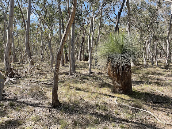
While technically this walk was bush bashing, it was extremely easy walking through light forest and short grass. Although the Reserve is relatively small (441 hectares) it can easily provide three or four hours of excellent walking. There are no clear views from the highest peaks, but there are views all along those parts of the border fenceline that we walked along.


