General Information
The bushwalks of a retired Public Servant who rediscovered the joys of hiking in early 2014 after a forty year hiatus. Most walks are in the immediate surrounds of Canberra, where I live, but there are also walks further afield. I've also included the odd kayaking trip where it was particularly interesting.
Thursday, 15 December 2022
Meryla State Forest: The Top of Bundanoon Gorge
Wednesday, 14 December 2022
Barren Gounds Nature Reserve: Cooks Nose and the Natural Stone Bridge
General Information
Route
Description
Tuesday, 13 December 2022
Gibbergunyah Reserve
General Information
Route
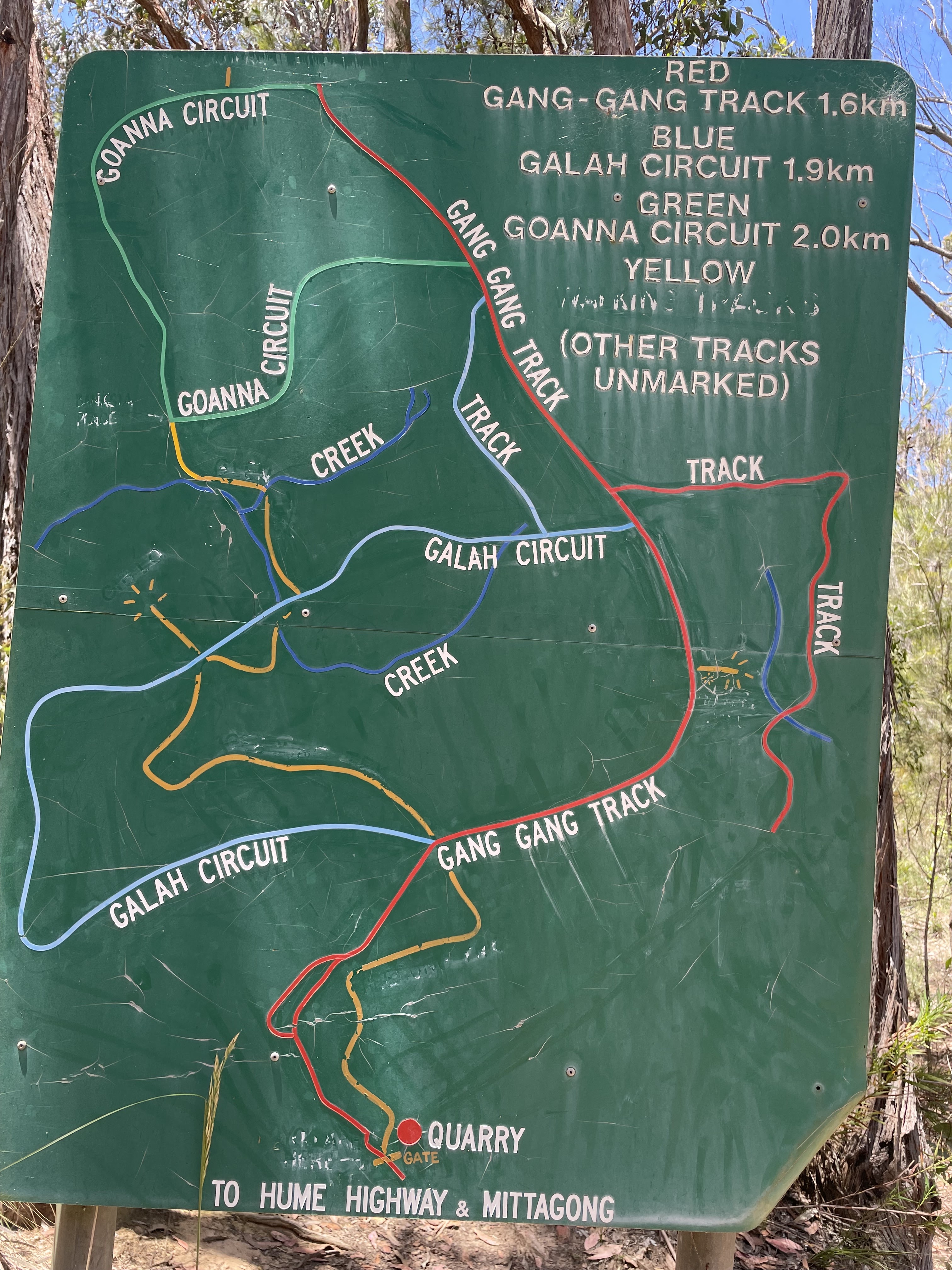
Gibbergunyah is a small reserve that sits between Mittagong and Bowral. It can be accessed from either town, but we started our walk from the Mittagong side. The access point is a locked gate on Howards Way, about 4 kilometers west of the centre of Mittagong. There is a sign here with a map of the walking tracks in the Reserve, and it's a good idea to take a picture of it before setting out. It should be noted that there is traffic noise from the nearby Hume Motorway on the Mittagong side of the Reserve, so this really isn't a walk for people who like the quiet sounds of the bush.
We started up the walking track to the right of the locked gate (shown in yellow on the guide map) and gradually climbed through forest until it met the Gang Gang Track. There were still plenty of wildflowers about, even though it was (notionally) Summer.
Saturday, 28 October 2017
Mount Alexandra Reserve: Forty Foot Falls and Box Vale Mine Walking Track (2)
General Information
Distance: 11.2 kilometers
Total climb: 235 meters
Time taken: 3 hours 05 minutes
Map: Mittagong 8929-2S 1:25 000
Guide: link
Start point distance by road from Canberra GPO: 171 kilometers
Start point map grid reference: 56H KG 62381 86348
Destination map grid reference: Forty Foot Falls - 56H KG 64236 87304
Box Vale Track Tunnel - 56H KG 63867 88724
End point: same as start
Distance: 11.2 kilometers
Route
http://maps.six.nsw.gov.au/
Description
This was the same as the walk completed on 31 August 2017, except that we turned back at the railway tunnel and did not proceed to the lookout.
Thursday, 31 August 2017
Mount Alexandra Reserve: Forty Foot Falls and Box Vale Mine Walking Track (1)
General Information
Distance: 12.8 kilometers
Total climb: 302 meters
Time taken: 4 hours 20 minutes
Map: Mittagong 8929-2S 1:25 000
Guide: link
Start point distance by road from Canberra GPO: 171 kilometers
Start point map grid reference: 56H KG 62381 86348
Destination map grid reference: Forty Foot Falls - 56H KG 64236 87304
Box Vale Track Lookout - 56H KG 63985 88991
End point: same as start
Route
Description


Soon after passing through the first cutting (The Casuarina Cutting) there is a management trail to the right that leads to Forty Foot Falls. After a few hundred meters the trail forks and there is no clear sign of the correct path to follow - presumably it has been removed or vandalised - but the left hand road is the right one to take. About one kilometer further on there is a picnic table on the side of the trail and it is here that the walking track down to Forty Foot Falls begins. The track is very steep, descending about 100 meters in elevation. Much of the track is stepped and there are one or two ladders as well. The track takes you down to the base of the falls, and it is relatively easy to clamber up behind the falls where there is a substantial overhang and a shallow cave - a good place for lunch.


The climb back up to the management trail gave us a good cardio workout, but only took us about 15 minutes. We retraced our steps back to the Box Vale Mine Track and headed roughly north and northeast along more embankments and through more cuttings.

Eventually we reached the most unique aspect of this walk, an old railway tunnel. This is about 84 meters long and quite dark, so a torch is needed to fully appreciate it.


About 400 meters after the tunnel the old railway ends, but from there there is a 600 meter track going down to a lookout over the Nattai River gorge with an excellent view to the northwest.

At the end of the old railway it is also possible to take another track that leads down into the Nattai River gorge and back to Mittagong via Forty Foot Falls. We didn't have time to do this, but have bookmarked it as a possible future walk.