General Information
Grading: easy
Distance: 8.8 kilometers
Total climb: 158 meters
Time taken: 2 hours 20 minutes
Map: Bundanoon 8928-1S 1:25 000
Start point distance by road from Canberra GPO: 163 kilometers
Start point map grid reference: 56H KG 57554 64299
Destination: First Lookouts 56H KG 56930 63203
Second Lookout 56H KG 57586 63136
Third Lookout 56H KG 58602 63645
Fourth Lookout 56H KG 59358 64040
End Point: Same as start
Route
This walk is through a quiet corner of Meryla State Forest near the village of Exeter in the Southern Highlands. The walk used to be around the perimeter of a pine forest, but the pines have now all been harvested, probably after the 2020 bushfire. Unfortunately this means that the left hand side of the track throughout the walk is pretty ugly...
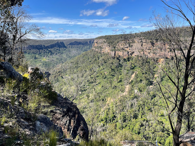
...so it's all about the lookouts over Bundanoon Gorge.
The start of the walk is at the end of Rosedale Road, before the entry to Filbert's Farm. There are “no parking” signs along Rosedale Road, so we had to cross over into the State Forest area; easy to find because there are no fences there. You can pretty much park anywhere, but we decided to find a shady spot off to the left and round a sharp bend.
We followed a counter-clockwise route around the management trail that borders the former pine forest. Along this trail it's just a matter of looking for minor tracks on the right, which invariably led to lookouts. The first lookout was over the Stonequarry Creek Gorge, but the remainder were all over Bundanoon Gorge, which became narrower as we progressed. Plenty of great views from all lookouts, but be aware that there are no protective barriers and it's a long way down...
To return to our starting point we just continued around in a loop around the former pine forest.


No comments:
Post a Comment