Sunday, 31 December 2017

Tinderry Nature Reserve: Tinderry Peak (2)

General Information


Distance:  13.5 kilometers
Total climb:  671 meters
Time taken:  7 hours
Map:  Tinderry 8726-1S, 1:25 000
Start point distance by road from Canberra GPO:  72 kilometers
Starting point map grid reference:  55H GA 06863 43178
Destination map grid reference:  55H GA 05525 47202
End point:  same as start

Route

http://maps.six.nsw.gov.au/

Description


Having previously tried and failed to reach the summit of Tinderry Peak (see blog entry for 28 July 2016), I decided to try a different route this time. Although we were successful in reaching the summit, this is not a route that I would recommend.

We started at the small carpark off Tinderry Road where it meets the Round Flat Fire Trail,15 kilometers east of Michelago. We followed the Round Flat Fire Trail until the point where it turns sharply right. Here we headed through the bush on a northerly bearing headed across Roberts Creek and up a ridge to map reference 55H GA 07428 46813. From here we headed west towards map reference 55H GA 005639 46899. All of this was through dense scrub and the occasional outcrop of large boulders, making progress very difficult and time consuming. When we reached map reference 55H GA 005639 46899, however, it was a relatively easy scramble up the rocks to the summit of Tinderry Peak.


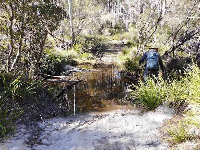
Making our way back down to map reference 55H GA 005639 46899 we decided to head back by following Roberts Creek. This was not a wise move. The Creek itself is choked with undergrowth and rocks so we had to proceed to the south of the Creek through some pretty thick undergrowth and steep slopes falling away to our left. This was treacherous and hard work. It took us three hours to climb up the Peak from the point where we left the track, but it took us two-and-a-half hours to get back to the track, despite it being shorter in distance by a bit under 2 kilometers. Eventually we made it back to the track and followed it to our parked car.

Thursday, 7 December 2017

Uriarra Forest: Mt Blundell and Uriarra Hill

General Information


Distance:  12.5 kilometers
Total climb:  597 meters
Time taken:  3 hours 20 minutes
Map:  Cotter Dam 8627-2N 1:25 000
Start point distance by road from Canberra GPO:  38 kilometers
Start point map grid reference:  55H FA 70480 92980
Destination map grid reference:  Mt Blundell - 55H FA 68318 92812
                                                    Uriarra Hill - 55H FA 69575 91848
End point:  same as start


Route

http://maps.six.nsw.gov.au/


Description

I commenced this walk at the locked gate on Blue Range Road, just before Blue Range Hut. I initially followed Blue Range Road until I reached the trail which intersects with Blue Range Road on the right at 55H FA 69726 93561. Some nice views looking backwards.


I turned off onto this track and after a short time it started to climb steeply.


There were glimpses of good views back towards Canberra.


Eventually I reached the summit of Mt Blundell, but it offered only limited views towards the south, although these opened up a bit as I started to descend, again very steeply, down the other side of the mountain.


I kept following the trail down to Uriarra Hill. Recent forestry operations meant that the views from Uriarra Hill (at least if you mentally blocked out the devastated pine forest in the foreground) were excellent, especially towards the Cotter Reservoir.


Continuing south I then followed the track back north under Uriarra Hill before cutting through a section of the felled pine forest to get back to Blue Range Road, which I followed back to my car.

Saturday, 28 October 2017

Mount Alexandra Reserve: Forty Foot Falls and Box Vale Mine Walking Track (2)

General Information


Distance:  11.2 kilometers
Total climb:  235 meters
Time taken:  3 hours 05 minutes
Map:  Mittagong 8929-2S 1:25 000
Guide:  link
Start point distance by road from Canberra GPO:  171 kilometers
Start point map grid reference:  56H KG 62381 86348
Destination map grid reference:  Forty Foot Falls - 56H KG 64236 87304
                                                    Box Vale Track Tunnel - 56H KG 63867 88724
End point:  same as start

Route


http://maps.six.nsw.gov.au/

Description


This was the same as the walk completed on 31 August 2017, except that we turned back at the railway tunnel and did not proceed to the lookout.

Thursday, 19 October 2017

Canberra Nature Park: Hackett to Mt Majura and Mt Ainslie

General Information


Distance:  8.3 kilometers
Total climb:  472 meters
Time taken:  2 hours 10 minutes
Map:  Canberra 8727-3N 1:25 000
Start point distance by road from Canberra GPO:  6 kilometers
Start point map grid reference:  55H FA 97256 96974
Destination map grid reference:  Mt Majura - 55H FA 98570 98432
End point:  Mt Ainslie - 55H FA 96327 94919


Route

http://maps.six.nsw.gov.au/


Description

Having placed a second car on the top of Mt Ainslie, we made our way to the carpark off Mackenzie Street in Hackett where the walk began. We first made our way up to the summit of Mt Majura via formed trails. Retracing our steps almost to where the walk began, we went bush for a while to take a shortcut through to the nearest formed trail which we followed for a while before heading bush again to climb Mt Ainslie. While this was steep, it was relatively easy going. We reacquired the formed trail near the summit of Mt Ainslie where our walk ended.

Saturday, 7 October 2017

Googong Foreshore: Bradley's Creek Walk to Googong Lookout and Gormans Trig

General Information


Distance:  13.6 kilometers
Total climb:  494 meters
Time taken:  3 hours 30 minutes
Map:  Hoskinstown 8727-2S 1:25 000
Start point distance by road from Canberra GPO:  28 kilometers
Start point map grid reference:  55H GA 4990 78589
Destination map grid reference:  55H GA 36521 91419
End point:  same as start


Route


http://maps.six.nsw.gov.au/


Description

We had intended to start this walk from the downstream picnic area at 55H GA 05221 79019, but when we arrived the gate leading down there was still locked, even though it was well after the posted opening time for the Reserve. We therefore had a longer walk from the locked gate. This wasn't so bad as it afforded a nice view of Googong Dam as we were crossing the Queanbeyan River.

We continued along Bradley's Walk from the picnic area, climbing steadily until we were at the top of the eastern ridge above Googong Reservoir. This was all along a dry and dusty management trail. 


Eventually we reached Gormans Trig, slightly off the track, where we had lunch before heading back. Not much of a view from the trig however.


Returning the same way, we detoured off the track at 55H GA 06193 78638 to check out the lookout at the northern end of the Reservoir. Some great views from there, but inexplicably I failed to take a photograph. A view from further up the trail (and including the lookout itself beyond the trees) will have to do.


Thursday, 21 September 2017

Morton National Park: Budawang Wilderness Area, Corang Peak & Corang Arch

General Information


Distance:  25 kilometers
Total climb:  698 meters
Time taken:  6 hours 50 minutes
Map:  Corang 8927-3N 1:25 000
Start point distance by road from Canberra GPO:  126 kilometers
Start point map grid reference:  56H KF 30328 93194
Destination map grid reference:  Corang Peak - 56H KF 36521 91419
                                                    Corang Arch - 56H KF 37215 92298
End point:  same as start


Route


http://maps.six.nsw.gov.au/


Description


This walk begins at the Wog Wog Campground and follows the Scenic Rim Walking Track. The track first descends first to Wog Wog Creek, a few hundred meters from the Campground. This was the only water source we found along our route, so walkers would be advised to bring plenty of water with them unless continuing on to Canowrie Brook. The track then climbs away from the creek and through forest in a broad semi-circle to the north east before heading south. At around the 4 kilometer mark (map reference 56H KF 32995 93126) the track divides, with one fork heading east towards Goodsell Creek and the other south towards the Corang Plateau. We continued towards the plateau (about one kilometer further on) where some views opened up to the south and southwest.


Once on the plateau the track becomes quite hard and rocky and the vegetation more scrubby. Corang peak can be seen in the distance.


About 8.5 kilometers into the walk (map reference 56H KF 34852 90728) there is a faint track to the right - the Wog Wog Trail which goes down to the Yadboro River via Snedden Pass - which we passed, continuing along the trail to the north of Korra Hill. After passing Korra Hill some views opened up towards Pigeon House and the ocean.


A few hundred meters later (map reference 56H KF 36387 90906) the track divides with the left-hand fork heading straight up to Corang Peak and the right-hand track passing it to the east. We went up the left fork and made the steeply stepped climb up to the Peak where there were extensive and spectacular views in all directions. Corang Arch could also be seen nearby to the north.


We descended via the northern side of Corang Peak (where the two branches of the track come together again) and continued to the edge of the plateau where we could see the Canowrie Creek valley and Profile Rock.


From here we backtracked for a short distance to see Corang Arch up close.


Following the track below Corang Peak we started our return trip.

Thursday, 31 August 2017

Mount Alexandra Reserve: Forty Foot Falls and Box Vale Mine Walking Track (1)

General Information


Distance:  12.8 kilometers
Total climb:  302 meters
Time taken:  4 hours 20 minutes
Map:  Mittagong 8929-2S 1:25 000
Guide:  link
Start point distance by road from Canberra GPO:  171 kilometers
Start point map grid reference:  56H KG 62381 86348
Destination map grid reference:  Forty Foot Falls - 56H KG 64236 87304
                                                    Box Vale Track Lookout - 56H KG 63985 88991
End point:  same as start


Route


http://maps.six.nsw.gov.au/


Description


The Box Vale Mine Track  follows the path of a historic railway line between Mittagong and the defunct Box Vale coal mine. There is also a side-track to Forty Foot falls on Nattai Creek. The trail starts at a picnic area about 250 meters off the Hume Motorway near Welby. Before long the trail conforms to the first of the embankments and cuttings of the old railway line.


Soon after passing through the first cutting (The Casuarina Cutting) there is a management trail to the right that leads to Forty Foot Falls. After a few hundred meters the trail forks and there is no clear sign of the correct path to follow - presumably it has been removed or vandalised - but the left hand road is the right one to take. About one kilometer further on there is a picnic table on the side of the trail and it is here that the walking track down to Forty Foot Falls begins. The track is very steep, descending about 100 meters in elevation. Much of the track is stepped and there are one or two ladders as well. The track takes you down to the base of the falls, and it is relatively easy to clamber up behind the falls where there is a substantial overhang and a shallow cave - a good place for lunch.


The climb back up to the management trail gave us a good cardio workout, but only took us about 15 minutes. We retraced our steps back to the Box Vale Mine Track and headed roughly north and northeast along more embankments and through more cuttings.


Eventually we reached the most unique aspect of this walk, an old railway tunnel. This is about 84 meters long and quite dark, so a torch is needed to fully appreciate it.


About 400 meters after the tunnel the old railway ends, but from there there is a 600 meter track going down to a lookout over the Nattai River gorge with an excellent view to the northwest.


At the end of the old railway it is also possible to take another track that leads down into the Nattai River gorge and back to Mittagong via Forty Foot Falls. We didn't have time to do this, but have bookmarked it as a possible future walk.

Saturday, 12 August 2017

Tidbinbilla Nature Reserve: Mount Domain (2)

General Information


Distance:  12.5 kilometers
Total climb:  735 meters
Time taken:  4 hours 8 minutes
Map:  Tidbinbilla 8627-2S, 1:25 000
Guide:  none available
Start point distance by road from Canberra GPO:  50 kilometers
Start point map grid reference:  55H FA 72311 71964
Destination map grid reference:  55H FA 69661 72739
End point:  same as start


Route


http://maps.six.nsw.gov.au/

Description


This was the same as the hike completed on 13 August 2016.

Saturday, 29 July 2017

Morton National Park: Budawang Wilderness Area, Redgrounds Track

General information


Distance:  28 kilometers
Total climb:  378 meters
Time taken:  6 hours 42 minutes (5 hours 30 minutes moving time)
Map:  Endrick 8927-4S 1:25 000
Guide: none
Start point distance by road from Canberra GPO:  129 kilometers
Start point map grid reference:  56H KG 38115 06920
Destination map grid reference: 56H KG 45030 04485 (but we went further than this)
End point:  same as start


Route

http://maps.six.nsw.gov.au/


Description


This was originally planned as a walk along the Redgrounds Track from the Morton National Park Endrick River entrance (near Nerriga) to where the Track crosses the Endrick River near Quiltys Pass. Since it was a beautiful day and we made the outward hike in better than expected time we went a bit further, following the Endrick River Trail west near Quiltys Pass before heading back the same way. We could have followed the Endrick River Trail all the way back to our car, which would have saved some distance, but this route  leads through a large section of private land. It is possible to navigate through this area without trespassing (see link), but this route does not follow the formed roads and some serious navigation skills and equipment would be required.

The first section of the walk was outside the National Park boundary along a hard and rocky track, all the time trying to keep to the formal route and avoid trespassing on private land. The route is not at all well signposted, however, so it is best to refer to the map. After about 1.8 kilometers we reached our first crossing of the Endrick River: an ankle deep ford which we were able to negotiate without getting too wet. From here the trail heads generally northeast climbing through medium-thick forest until a creek is reached at map reference 56H KG 42066 08324. The trail heads south and then southeast from here, eventually reaching flat and open country that starts to give some views of the surrounding escarpments.


We continued along the Track, crossing Piercy Creek with the forest becoming denser once more. As we approached Quiltys Clearing the Track became more difficult to follow, but with a bit of attention we navigated through without going off-trail. Soon after we arrived at the Endrick River once again, which we were able to easily cross thanks to some rock-hopping.


Having arrived here earlier than expected we had the choice of following the Endrick River Trail south towards The Vines or west towards Round Mountain. We chose the latter, with the idea of reaching a cave in Quiltys Mountain near Blacket Creek. As we followed the Track and saw the terrain, however, we got a better idea of how difficult it would be to reach the cave and agreed that there was probably insufficient time if we were to return to our car before sunset. We discussed whether we could cut back to the Redgrounds Track through the scrub to the north of us, but decided that this would probably take more time than retracing our steps, although we could have knocked about three kilometers off the return journey. The return along the Redgrounds Track allowed us to see everything from the reverse angle and take advantage of the afternoon sun on our views of the escarpments.


While it is long, this is a great one-day walk along a very good trail. 

Saturday, 1 July 2017

Morton National Park: Little Forest Plateau

General information


Distance:  14.5 kilometers
Total climb:  negligible
Time taken:  2.5 hours
Map:  Milton 8927-2N 1:25 000
Guide: Ron Doughton, Bushwalking in the Budawangs (1989), pp. 52-54.
Start point distance by road from Canberra GPO:  223 kilometers
Start point map grid reference:  56H KF 57948 92633
Destination map grid references: Rusden Head 56H KF 54720 91655
                                                     Florance Head 56H KF 57108 90024
End point:  same as start


Route


http://maps.six.nsw.gov.au/


Description


Little Forest Plateau is on the edge of the Budawang Wilderness Area on the eastern edge of Morton National Park near Milton, New South Wales. The bushwalk started at the Little Forest Track carpark, just off Porters Creek Dam Road about 22 kilometers from Milton. The first 500 meters is along a narrow walking track that starts at the carpark and emerges where the Rusden Head Trail meets the Florance Head Trail.


I took the Rusden Head track first. This track is wide and mostly grassy, although there are some boggy patches where it is best to use the decaying plank walkways around them.


There is not much to be seen from this first part of the trail, thanks to the high scrub on both sides, but there was plenty of birdsong compensating somewhat for the lack of a view. As I got closer to Rusden Head, however, the scrub became more shoulder-height and some glimpses of the surrounding area emerged, including a view over the scrub towards Florance Head.


After just a bit under 5 kilometers of walking I came to the edge of the escarpment on Rusden Head where the view opened up considerably: Pigeon House, Talaterang Mountain, Pigeon House Gorge and a glimpse of Pickering Point at the southeastern end of Byangee Mountain.


Resting here for lunch, I then returned up the Rusden Head Trail to the Florance Head Trail. In his 1989 book, Ron Doughton walked through the scrub along the escarpment from Rusden Head to Florance Head, but the density of scrub made this, in my view, inadvisable in 2017. The dangers of walking around escarpments and the fact that I was on my own also contributed to my decision to stay on the trails.

The Florance Head Trail is similar to the Rusden Head Trail, but the surrounding scrub is not as high and some views open up.


At Florance Head itself, there are views towards the ocean and Pigeon House, and The Castle can be glimpsed around the south of Talaterang Mountain.


The walk back to the carpark along the Florance Head Trail was made all the better thanks to some conversation with another lone walker whom I met at Florance Head.

This is an excellent walk with some really rewarding views and the trail is accessible after only a 30 minute drive from Milton. It is unique in my experience of the Budawangs as the hard climbing is all done in the car and the trails themselves are relatively flat.